Ko Yao District
Ko Yao (Thai: เกาะยาว, pronounced [kɔ̀ʔ jāːw]) is a district (amphoe) in Phang Nga Province in Thailand's south.
Ko Yao
เกาะยาว | |
|---|---|
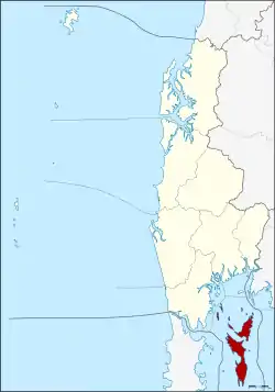 District location in Phang Nga Province | |
| Coordinates: 8°6′42″N 98°35′27″E | |
| Country | Thailand |
| Province | Phang Nga |
| Seat | Ko Yao Noi |
| District established | 1903 |
| Area | |
| • Total | 141.06 km2 (54.46 sq mi) |
| Population (2008) | |
| • Total | 13,155 |
| • Density | 90.3/km2 (234/sq mi) |
| Time zone | UTC+7 (ICT) |
| Postal code | 82160 |
| Geocode | 8202 |
History
The minor district (king amphoe) Ko Yao was established in 1903 as a subordinate of Mueang Phang Nga District. On 1 January 1988 it was upgraded to a full district.[1]
Geography
The district covers several islands of the Ko Yao archipelago in Phang Nga Bay, near the island of Phuket. The two main islands are named Ko Yao Yai and Ko Yao Noi ('big long island' and 'small long island'). The northern tips of the islands are part of Ao Phang Nga National Park.
Religion
Ninety percent of the district's population (2018) of 18,000 are Muslims.[2] The Muslim religion was introduced in the 13th century by Arab traders.
Administration
The district is divided into three sub-districts (tambons), which are further subdivided into 18 villages (mubans). Ko Yao itself has sub-district municipality (thesaban tambon) status, which covers parts of tambon Ko Yao Noi. There are a further three tambon administrative organizations (TAO).
|
 |
References
- พระราชกฤษฎีกาตั้งอำเภอนามน อำเภอพระยืน อำเภอหนองบัวระเหว อำเภอบ้านเหลื่อม อำเภอจะแนะ อำเภอหนองหงส์ อำเภอนาโพธิ์ อำเภอเกาะยาว อำเภอแกดำ อำเภอสระโบสถ์ อำเภอโนนคูณ อำเภอควนโดน อำเภอไชยวาน อำเภอหนองแสง และอำเภอตาลสุม พ.ศ. ๒๕๓๐ (PDF). Royal Gazette (in Thai). 104 (278 ก special): 33–37. 31 December 1987.
- Svasti, Pichaya (3 January 2019). "Going Green". Bangkok Post. Retrieved 3 January 2019.
- "Population statistics 2008". Department of Provincial Administration. Archived from the original on 2 August 2012.
External links
 Ko Yao travel guide from Wikivoyage
- amphoe.com (Thai)
