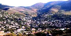
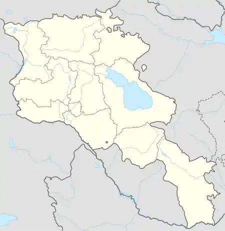
Koghb, Armenia
Koghb (Armenian: Կողբ), is a major village and rural community located in the Tavush Province of Armenia, located near the town of Noyemberyan.
Koghb Կողբ | |
|---|---|
 Koghb | |
 Koghb Կողբ | |
| Coordinates: 41°10′57″N 44°58′33″E | |
| Country | Armenia |
| Marz (Province) | Tavush |
| Elevation | 750 m (2,460 ft) |
| Population (2011) | |
| • Total | 4,420 |
| Time zone | UTC+4 ( ) |
| Website | http://www.koghb.am/ |
Mshkavank also known as Mshakavank, with a restored church of Astvatsatsin, gavit, a 5th-6th-century Tsghakhach church, 6th-century Tvarageghtsi church and cemetery of the 12th-13th centuries are somewhere on the mountain 3–4 km southwest of the town. 1.5 km southeast is the Berdategh cyclopean fort, and also possibly in close proximity is the fort of Gharanots Gol. West of Koghb 10 km are two cyclopean forts, Zikurati and Kozmani, with Bronze Age tomb fields adjacent. 15 km west is the Patashar cyclopean fort. Northwest of Koghb are the ruins of Surb Arakel shrine in the old Arakelots village.
External links
See also
References
- Koghb, Armenia at GEOnet Names Server (as Koghb)
- World Gazeteer: Armenia – World-Gazetteer.com
- Report of the results of the 2001 Armenian Census, Statistical Committee of Armenia
- Kiesling, Brady (2005), Rediscovering Armenia: Guide, Yerevan, Armenia: Matit Graphic Design Studio
- Brady Kiesling, Rediscovering Armenia, p. 117-118; original archived at Archive.org, and current version online on Armeniapedia.org.
Capital: Ijevan | ||
| Urban communities | 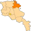 | |
| Rural communities |
| |
| Non-community settlements | ||
| Abandoned settlements | ||
This article is issued from Wikipedia. The text is licensed under Creative Commons - Attribution - Sharealike. Additional terms may apply for the media files.
