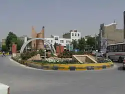
Komijan
Komijan (Persian: كميجان, also Romanized as Komījān and Komeyjān; also known as Khūmajān, Komāzān, Komejān, Komīzān, and Kūmīzān)[2] is a city and capital of Komijan County, Markazi Province, Iran. At the 2006 census, its population was 7,358, in 2,004 families.[3]
Komijan
كميجان | |
|---|---|
City | |
 teacher square | |
 Komijan | |
| Coordinates: 34°43′09″N 49°19′36″E | |
| Country | |
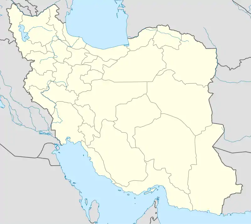
| Province | Markazi |
| County | Komijan |
| Bakhsh | Central |
| Population (2016 Census) | |
| • Total | 8,776 [1] |
| Time zone | UTC+3:30 (IRST) |
| • Summer (DST) | UTC+4:30 (IRDT) |
| Website | Official website Komijan |
District
- GHALEH
The area is considered the highest point of the city and the urban fabric of the old location, which is called the city of Bam.
- OLD GHALEH
The area the neighborhood near the intersection Mahdiyeh Njarlar 16 meters from the street, which is one of the neighborhoods of Old komijan. This place is a mosque called the Masjid Mosque Zaman the old mosque and the Grand Parad Rah is considered that the establishment of local Friday Prayers as well.
- SARAB
- ESSA ABAD
- ANAR
Anar was originally separated from Komijan and was located in its east, but due to its very short distance, it was gradually connected to Komijan through the construction of residential and commercial places and became one of the large neighborhoods of Komijan. The entrance of Komijan city is from Arak side of this neighborhood, which is one of the big and famous neighborhoods of this city. (Azad and Payame Noor Universities, Hospital, Road and Transportation Department, Welfare and Groundwater Department are located in this neighborhood.) This village itself has three neighborhoods called Qala-e-Miandeh-Qala-e-Bala and Ken-e-Icheh and Qala-e-Gol Ahmad. It is called Anar (very bright) because it has many springs such as Tik and Bolagh springs and mills and old and large water aqueducts or because it has active Zoroastrian fire temples. One of the largest tribes is Anari and Mohammad Karim, which can be seen in its population dispersion in the villages of Rastkordan and Qazooq, as well as Rahan (Saqarjuq, Dastjan and Zanjeiran, Kudzar and Aghaziart). Chehrgazi hill is located in the northern part of this large neighborhood. Agricultural lands and good weather make this neighborhood a place for guests to spend the summer, especially in hot summers. It has the most cultivated lands in the city in terms of population and has very fertile soil, so that in the past it was considered one of the most important properties of the Bahadori family (Jafar Khan Bahadori, son of Ibrahim Khan Asem Al-Saltanah Bahadori). Other clans in this neighborhood include Anari, Azimi, Kadivar, Moradi, Alizadeh Bastan and Pezeshki. The Pezeshki family is the founder of modern medicine and Manouchehr Khan Pezeshki is one of the residents of this large old village and the founder of modern education in the city. Most people work in agriculture, and in recent years young people have turned to government jobs. This neighborhood has been extended along the Komijan-Arak road since ancient times
- GHOL ICHE
- ALI GHOLI BAGH
- FARHANGHIAN
- GHOLESTAN
- NAJARLAR
- MASKAN MEHR
- YOKHRE HASAR
- HASSAN ABAD.
Geography
Komijan is 90 kilometres (56 mi) north-weast of Markazi's capital Arak. It has an approximate elevation of 1,550 metres (5,090 ft) above sea level.
Climate
Komijan has a semi-arid climate, characterized with extremely cold winters where the minimum temperature could fall down to −25 °C (−13 °F). On the other hand, summertime in Komijan is relatively hot with temperatures could reach up to 36 °C (97 °F). The annual precipitation averages 250 millimetres (9.8 in).
| Climate data for Komijan | |||||||||||||
|---|---|---|---|---|---|---|---|---|---|---|---|---|---|
| Month | Jan | Feb | Mar | Apr | May | Jun | Jul | Aug | Sep | Oct | Nov | Dec | Year |
| Record high °C (°F) | 9.2 (48.6) |
13.9 (57.0) |
20.6 (69.1) |
26.2 (79.2) |
29.1 (84.4) |
33.1 (91.6) |
38.0 (100.4) |
36.2 (97.2) |
34.0 (93.2) |
27.9 (82.2) |
20.6 (69.1) |
14.0 (57.2) |
38.0 (100.4) |
| Average high °C (°F) | −3 (27) |
−1 (30) |
4 (39) |
13 (55) |
18 (64) |
22 (72) |
26 (79) |
26 (79) |
23 (73) |
16 (61) |
7 (45) |
— | 6 (43) |
| Daily mean °C (°F) | −9 (16) |
−7 (19) |
−1 (30) |
6 (43) |
11 (52) |
15 (59) |
19 (66) |
19 (66) |
15 (59) |
8 (46) |
1 (34) |
−5 (23) |
6 (43) |
| Average low °C (°F) | −14 (7) |
−12 (10) |
−6 (21) |
— | 5 (41) |
8 (46) |
12 (54) |
12 (54) |
7 (45) |
1 (34) |
−3 (27) |
−9 (16) |
32 (90) |
| Record low °C (°F) | −36.0 (−32.8) |
−35.0 (−31.0) |
−30.1 (−22.2) |
−16.0 (3.2) |
−7.6 (18.3) |
−3.6 (25.5) |
1.4 (34.5) |
−1.1 (30.0) |
−4.1 (24.6) |
−14.6 (5.7) |
−23.8 (−10.8) |
−31.2 (−24.2) |
−36.0 (−32.8) |
| Average precipitation mm (inches) | 23.7 (0.93) |
26.7 (1.05) |
28.2 (1.11) |
54.5 (2.15) |
84.6 (3.33) |
73.9 (2.91) |
43.2 (1.70) |
35.7 (1.41) |
26.0 (1.02) |
38.5 (1.52) |
28.2 (1.11) |
22.8 (0.90) |
486 (19.1) |
| Source: Weatherbase[4] | |||||||||||||
Village Life
.jpg.webp)
Although many people live in Komijan, its numbers are decreasing as many leave Komijan to go and live in Tehran or other main cities of Iran. Some of the summer resorts around Komijan are Teraran (darband), Vafs. The Vafs spa is a touristic place around Komijan. Tourists of the villages usually visit them in the summer.[5]
Economy
Komijan produces large amounts of wheat and cotton. It is also well known for its pomegranates and melons. The major product of horticulture and cultivation in the city of Kamijan is grapes and almonds.[6] Komijan Industrial City, the largest industrial city in Iran, is located in Komijan.
Universities
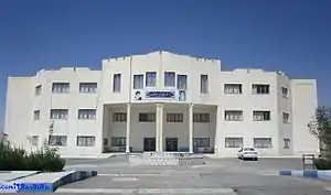
Three universities are situated in Komijan, namely the Komijan branch of the Komijan University, Islamic Azad University of komijan and the Komijan branch of the Payame Noor University. Komijan City is situated in Komijan County.[7]
See also
References
- https://www.amar.org.ir/english
- Komijan can be found at GEOnet Names Server, at this link, by opening the Advanced Search box, entering "-3071918" in the "Unique Feature Id" form, and clicking on "Search Database".
- "Census of the Islamic Republic of Iran, 1385 (2006)". Islamic Republic of Iran. Archived from the original (Excel) on 2011-11-11.
- "Weatherbase: Historical Weather for komijan, iran". Weatherbase. 2011. Retrieved on November 24, 2011.
- komijansarab group
- Cohen, Saul (1998). The Columbia Gazetteer of the World. Columbia University Press. p. 2833.
- komijansarab group
External links
| Wikimedia Commons has media related to Komijan. |
| Capital | 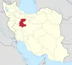 | ||||||||||||||||||||||||
|---|---|---|---|---|---|---|---|---|---|---|---|---|---|---|---|---|---|---|---|---|---|---|---|---|---|
| Counties and cities |
| ||||||||||||||||||||||||
| Sights |
| ||||||||||||||||||||||||
| populated places | |||||||||||||||||||||||||
| Capital | |||||||||||||||||||||
|---|---|---|---|---|---|---|---|---|---|---|---|---|---|---|---|---|---|---|---|---|---|
| Districts |
| ||||||||||||||||||||