Korf, Russia
Korf (Russian: Корф) is a rural locality (a selo) and a port in Olyutorsky District of Koryak Okrug in Kamchatka Krai, Russia, located on a narrow sand spit opposite Tilichiki. Population: 18 (2012 est.);[2] 3,147 (1989 Census).[5]
Korf
Корф | |
|---|---|
Location of Korf 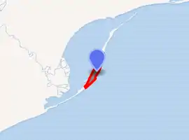
| |
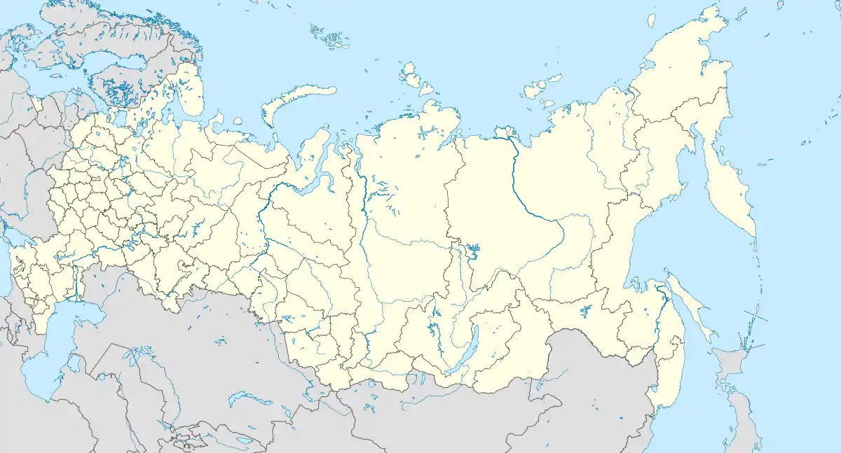 Korf Location of Korf 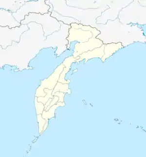 Korf Korf (Kamchatka Krai) | |
| Coordinates: 60°22′N 166°01′E | |
| Country | Russia |
| Federal subject | Kamchatka Krai[1] |
| Administrative district | Olyutorsky District[1] |
| Founded | 1925 |
| Rural locality status since | 1994 |
| Elevation | 3 m (10 ft) |
| Population | |
| • Estimate (2012)[2] | 18 |
| Time zone | UTC+12 (MSK+9 |
| Postal code(s)[4] | 688810, 688811 |
| OKTMO ID | 30827404101 |
History
It was established in 1925 on the coast of the Skrytaya Harbor of the Korfa Bay as a settlement of salmon fishers. In 1994, it was demoted in status from that of an urban-type settlement to rural locality. On April 21, 2006, Korf was destroyed by the 2006 Kamchatka earthquakes. Over eight hundred families were evacuated and the selo was slated to be abandoned. As of 2013, however, Korf has not been officially abolished.[1]
Economy
Korf is connected to Tilichiki by ferry and to other neighboring locations by helicopter service. Platinum and lignite are mined in the district.
Climate
Korf has a subarctic climate (Köppen Dfc), though owing to its maritime location the winters are not so severe as at the same latitude in the interior. For instance, the mean temperature of the coldest month is as much as 15 °C (27 °F) less severe than in Olyokminsk at the same latitude near the Pole of Cold. Precipitation also shows the pronounced maritime influence, with annual averages being typical of Kamchatka and around three or four times those of the interior at the same latitude. The heavier snow cover and milder winter temperatures mean that in spite of the mean temperature of the warmest month not reaching beyond +12.6 °C (54.7 °F), permafrost is only discontinuous. Strong winds, however, limit tree growth severely.
| Climate data for Korf (1929-2012) | |||||||||||||
|---|---|---|---|---|---|---|---|---|---|---|---|---|---|
| Month | Jan | Feb | Mar | Apr | May | Jun | Jul | Aug | Sep | Oct | Nov | Dec | Year |
| Record high °C (°F) | 5.8 (42.4) |
7.2 (45.0) |
4.9 (40.8) |
8.7 (47.7) |
19.5 (67.1) |
26.4 (79.5) |
29.7 (85.5) |
27.1 (80.8) |
18.9 (66.0) |
13.4 (56.1) |
10.1 (50.2) |
7.3 (45.1) |
29.7 (85.5) |
| Average high °C (°F) | −10.2 (13.6) |
−10.3 (13.5) |
−7.9 (17.8) |
−2.8 (27.0) |
4.7 (40.5) |
11.6 (52.9) |
15.5 (59.9) |
15.3 (59.5) |
10.9 (51.6) |
2.2 (36.0) |
−5.6 (21.9) |
−10.1 (13.8) |
1.1 (34.0) |
| Daily mean °C (°F) | −13.7 (7.3) |
−13.8 (7.2) |
−11.5 (11.3) |
−6.4 (20.5) |
1.8 (35.2) |
8.5 (47.3) |
12.6 (54.7) |
12.4 (54.3) |
7.8 (46.0) |
−0.8 (30.6) |
−8.8 (16.2) |
−13.5 (7.7) |
−2.1 (28.2) |
| Average low °C (°F) | −17.3 (0.9) |
−17.3 (0.9) |
−15 (5) |
−9.9 (14.2) |
−1.2 (29.8) |
5.4 (41.7) |
9.6 (49.3) |
9.4 (48.9) |
4.7 (40.5) |
−3.7 (25.3) |
−12 (10) |
−16.9 (1.6) |
−5.4 (22.3) |
| Record low °C (°F) | −40.6 (−41.1) |
−36 (−33) |
−39.5 (−39.1) |
−30.1 (−22.2) |
−18.5 (−1.3) |
−2.3 (27.9) |
2.4 (36.3) |
−0.4 (31.3) |
−6.4 (20.5) |
−20.6 (−5.1) |
−33.1 (−27.6) |
−38.7 (−37.7) |
−40.6 (−41.1) |
| Average precipitation mm (inches) | 59.7 (2.35) |
37.1 (1.46) |
52.3 (2.06) |
62.0 (2.44) |
71.6 (2.82) |
56.4 (2.22) |
100.4 (3.95) |
105.9 (4.17) |
79.3 (3.12) |
75.4 (2.97) |
84.1 (3.31) |
92.0 (3.62) |
876.2 (34.49) |
| Average precipitation days (≥ 0.1 mm) | 11.2 | 9.3 | 9.9 | 9.2 | 9.1 | 10.1 | 12.6 | 13.9 | 11.4 | 11.4 | 10.6 | 10.3 | 129 |
| Mean monthly sunshine hours | 63 | 101 | 175 | 211 | 212 | 209 | 193 | 170 | 149 | 119 | 72 | 44 | 1,718 |
| Source 1: Sistema de Clasificación Bioclimática Mundial (precipitation only)[6] | |||||||||||||
| Source 2: climatebase.ru[7] | |||||||||||||
References
Notes
- Law #46
- Аргументы и Факты. Камчатка. Муниципальное образование «Село Корф» будет упразднено (in Russian)
- "Об исчислении времени". Официальный интернет-портал правовой информации (in Russian). June 3, 2011. Retrieved January 19, 2019.
- Почта России. Информационно-вычислительный центр ОАСУ РПО. (Russian Post). Поиск объектов почтовой связи (Postal Objects Search) (in Russian)
- "Всесоюзная перепись населения 1989 г. Численность наличного населения союзных и автономных республик, автономных областей и округов, краёв, областей, районов, городских поселений и сёл-райцентров" [All Union Population Census of 1989: Present Population of Union and Autonomous Republics, Autonomous Oblasts and Okrugs, Krais, Oblasts, Districts, Urban Settlements, and Villages Serving as District Administrative Centers]. Всесоюзная перепись населения 1989 года [All-Union Population Census of 1989] (in Russian). Институт демографии Национального исследовательского университета: Высшая школа экономики [Institute of Demography at the National Research University: Higher School of Economics]. 1989 – via Demoscope Weekly.
- "RUSSIA - KORF/TILICHIKI" (PDF). Centro de Investigaciones Fitosociológicas. May 2011. Retrieved November 1, 2011. Check date values in:
|year= / |date= mismatch(help) - "Korf, Kamchatka, Russia" (PDF). climatebase.ru. October 2011. Retrieved November 1, 2011. Check date values in:
|year= / |date= mismatch(help)
Sources
- Законодательное Собрание Камчатского края. Закон №46 от 29 апреля 2008 г. «Об административно-территориальном устройстве Камчатского края», в ред. Закона №659 от 30 июля 2015 г. «О внесении изменения в статью 5 Закона Камчатского края "Об административно-территориальном устройстве Камчатского края"». Вступил в силу со дня официального опубликования. Опубликован: "Официальные Ведомости", №65-69, 6 мая 2008 г. (Legislative Assembly of Kamchatka Krai. Law #46 of April 29, 2008 On the Administrative-Territorial Structure of Kamchatka Krai, as amended by the Law #659 of July 30, 2015 On Amending Article 5 of the Law of Kamchatka Krai "On the Administrative-Territorial Structure of Kamchatka Krai". Effective as of the day of the official publication.).
