Kostobobriv
Kostobobriv (Ukrainian: Костобобрів; Russian: Костобобров) is a village in the Semenivka Raion (district) of Chernihiv Oblast (province) in northern Ukraine.
Kostobobriv
Костобобрів | |
|---|---|
Village | |
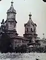
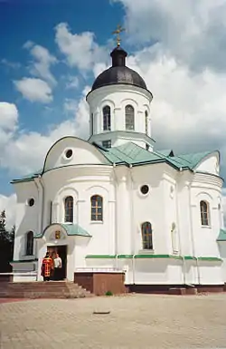 The Saint Daniel's Church | |
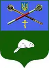 Coat of arms | |
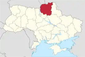 Location of Kostobobriv on the map of Ukraine, with Chernihiv Oblast highlighted (pink). | |
| Coordinates: 52°14′10″N 32°56′40″E | |
| Country | Ukraine |
| Oblast | Chernihiv Oblast |
| Raion | Semenivka Raion |
| Founded | 1200 |
| Government | |
| • Mayor | Lubov Ruban |
| Area | |
| • Total | 263 km2 (102 sq mi) |
| Elevation | 176 m (577 ft) |
| Population | |
| • Total | 10,000 |
| • Density | 31,179/km2 (80,750/sq mi) |
| Postal code | 15443 |
| Website | s. Kostobobriv Chernihivska oblast, Semenivka raion Verkhovna Rada website |
Description
The village is located on Kosta River, a left tributary of Revna 5 km (3.1 mi) south from the Russia–Ukraine border.
Kostobobriv was first founded in 1200. It is located near the Ugli Railroad Station, the second railroad station in the entire district.
- Foto

Mazepa family in Kostobobriv
- Mazepa family in Kostobobriv
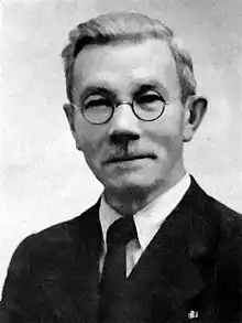

 Mykola Mazepa.[1]
See also
References
External links
- Verkhovna Rada website-s. Kostobobriv Chernihivska oblast, Semenivka raion
- Mazepa family
 Media related to Category:Kostobobrovo at Wikimedia Commons
| Raions | |||||
|---|---|---|---|---|---|
| Hromadas | |||||
| Cities |
| ||||
| |||||
This article is issued from Wikipedia. The text is licensed under Creative Commons - Attribution - Sharealike. Additional terms may apply for the media files.