Kotyli
Kotyli (Greek: Κοτύλη, Turkish: Kozluca, Bulgarian: Козлуджа, Kozluđa) is a former community in the Xanthi regional unit, East Macedonia and Thrace, Greece. Since the 2011 local government reform it is part of the municipality Myki, of which it is a municipal unit.[2] The municipal unit has an area of 79.119 km2.[3] Population 2,158 (2011). The community consists of the settlements Kotyli, Aimoni, Dimari and Pachni.
Kotyli
Κοτύλη | |
|---|---|
 Kotyli Location within the regional unit 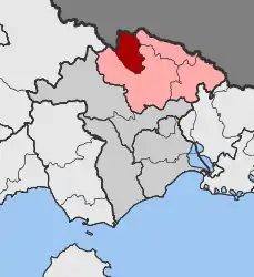 | |
| Coordinates: 41°20′N 24°53′E | |
| Country | Greece |
| Administrative region | East Macedonia and Thrace |
| Regional unit | Xanthi |
| Municipality | Myki |
| • Municipal unit | 79.1 km2 (30.5 sq mi) |
| Elevation | 708 m (2,323 ft) |
| Population (2011)[1] | |
| • Municipal unit | 2,158 |
| • Municipal unit density | 27/km2 (71/sq mi) |
| Time zone | UTC+2 (EET) |
| • Summer (DST) | UTC+3 (EEST) |
| Vehicle registration | AH |
References
- "Απογραφή Πληθυσμού - Κατοικιών 2011. ΜΟΝΙΜΟΣ Πληθυσμός" (in Greek). Hellenic Statistical Authority.
- Kallikratis law Greece Ministry of Interior (in Greek)
- "Population & housing census 2001 (incl. area and average elevation)" (PDF) (in Greek). National Statistical Service of Greece. Archived from the original (PDF) on 2015-09-21.
This article is issued from Wikipedia. The text is licensed under Creative Commons - Attribution - Sharealike. Additional terms may apply for the media files.