Kranuan District
Kranuan (Thai: กระนวน, pronounced [krā.nūa̯n]) is a district (amphoe) of Khon Kaen Province, northeastern Thailand.
Kranuan
กระนวน | |
|---|---|
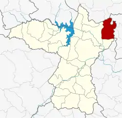 District location in Khon Kaen Province | |
| Coordinates: 16°42′22″N 103°4′44″E | |
| Country | Thailand |
| Province | Khon Kaen |
| Area | |
| • Total | 322.017 km2 (124.331 sq mi) |
| Population (2005) | |
| • Total | 77,531 |
| • Density | 240.8/km2 (624/sq mi) |
| Time zone | UTC+7 (ICT) |
| Postal code | 40170 |
| Geocode | 4009 |
History
The minor district (king amphoe) Kranuan was established on 1 January 1948 by splitting it from Nam Phong District. It was upgraded to a full district on 22 July 1958.
Geography
Neighboring districts are (from the south clockwise): Sam Sung and Nam Phong of Khon Kaen Province; Non Sa-at and Kumphawapi of Udon Thani Province; Tha Khantho, Nong Kung Si, and Huai Mek of Kalasin Province; and Chuen Chom of Maha Sarakham Province.
Administration
The district is divided into nine subdistricts (tambons), which are further subdivided into 81 villages (mubans). Nong Ko is a township (thesaban tambon) which covers parts of tambon Nong Ko. There are a further nine tambon administrative organizations (TAO).
| No. | Name | Thai name | Villages | Pop. | |
|---|---|---|---|---|---|
| 1. | Nong Ko | หนองโก | 19 | 21,252 | |
| 2. | Nong Kung Yai | หนองกุงใหญ่ | 13 | 10,315 | |
| 3. | Huai Chot | ห้วยโจด | 11 | 6,370 | |
| 4. | Huai Yang | ห้วยยาง | 8 | 6,037 | |
| 5. | Ban Fang | บ้านฝาง | 11 | 7,831 | |
| 6. | Dun Sat | ดูนสาด | 11 | 8,038 | |
| 7. | Nong No | หนองโน | 7 | 6,180 | |
| 8. | Nam Om | น้ำอ้อม | 8 | 4,763 | |
| 9. | Hua Na Kham | หัวนาคำ | 10 | 6,745 |