Huai Mek District
Huai Mek (Thai: ห้วยเม็ก, pronounced [hûa̯j mék]) is a district (amphoe) in the western part of Kalasin Province, northeastern Thailand.
Huai Mek
ห้วยเม็ก | |
|---|---|
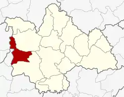 District location in Kalasin Province | |
| Coordinates: 16°35′24″N 103°14′8″E | |
| Country | Thailand |
| Province | Kalasin |
| Area | |
| • Total | 291.01 km2 (112.36 sq mi) |
| Population (2005) | |
| • Total | 49,716 |
| • Density | 170.8/km2 (442/sq mi) |
| Time zone | UTC+7 (ICT) |
| Postal code | 46240 |
| Geocode | 4608 |
Geography
Neighboring districts are (from the northeast clockwise): Nong Kung Si and Yang Talat of Kalasin Province; Chuen Chom of Maha Sarakham Province; and Kranuan of Khon Kaen Province.
History
The minor district (king amphoe) was created on 1 November 1970, when the three tambons, Huai Mek, Kut Don, and Bueng Na Riang were split off from Yang Talat District.[1] It was upgraded to a full district on 12 April 1977.[2]
Administration
The district is divided into nine sub-districts (tambons), which are further subdivided into 81 villages (mubans). There are two townships (thesaban tambons): Huai Mek and Kham Yai each cover parts of the same-named tambon. There are a further nine tambon administrative organizations (TAO).
| No. | Name | Thai name | Villages | Pop. | |
|---|---|---|---|---|---|
| 1. | Huai Mek | ห้วยเม็ก | 12 | 9,094 | |
| 2. | Kham Yai | คำใหญ่ | 12 | 7,306 | |
| 3. | Kut Don | กุดโดน | 13 | 8,369 | |
| 4. | Bueng Na Riang | บึงนาเรียง | 7 | 3,955 | |
| 5. | Hua Hin | หัวหิน | 8 | 4,344 | |
| 6. | Phimun | พิมูล | 7 | 4,149 | |
| 7. | Kham Mueat Kaeo | คำเหมือดแก้ว | 9 | 5,788 | |
| 8. | Non Sa-at | โนนสะอาด | 7 | 4,091 | |
| 9. | Sai Thong | ทรายทอง | 6 | 2,620 |
References
- ประกาศกระทรวงมหาดไทย เรื่อง แบ่งท้องที่ตั้งเป็นกิ่งอำเภอ กิ่งอำเภอห้วยเม็ก (PDF). Royal Gazette (in Thai). 87 (101 ง special): 6. 1 November 1970.
- พระราชกฤษฎีกาตั้งอำเภอปลายพระยา อำเภอห้วยเม็ก อำเภอละแม อำเภอแม่จริม อำเภอหนองกี่ อำเภอโคกปีบ อำเภอเกาะพะงัน อำเภอสนม อำเภอโซ่พิสัย อำเภอโนนสะอาด และอำเภอนาจะหลวย พ.ศ. ๒๕๒๐ (PDF). Royal Gazette (in Thai). 94 (31 ก): 326–330. 12 April 1977.