Krishnayapalem
Krishnayapalem is a neighbourhood of Amaravati, the state capital of the Indian state of Andhra Pradesh.[4] It is a denotification as gram panchayat in Mangalagiri mandal of Guntur district.[2]
Krishnayapalem | |
|---|---|
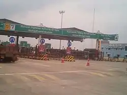 Kaza toll plaza | |
.svg.png.webp) Krishnayapalem Location in Andhra Pradesh, India | |
| Coordinates: 16.29217°N 80.33243°E | |
| Country | India |
| State | Andhra Pradesh |
| District | Guntur |
| Mandal | Mangalagiri |
| Government | |
| • Type | Panchayati raj |
| • Body | Krishnayapalem gram panchayat |
| Area | |
| • Total | 634 ha (1,567 acres) |
| Population (2011)[3] | |
| • Total | 1,560 |
| • Density | 250/km2 (640/sq mi) |
| Languages | |
| • Official | Telugu |
| Time zone | UTC+5:30 (IST) |
| PIN | 522503 |
| Area code(s) | +91–8645 |
| Vehicle registration | AP |
Geography
Krishnayapalem is situated to the southwest of the mandal headquarters, Mangalagiri,[5] at 16.29217°N 80.33243°E. It is spread over an area of 634 ha (1,570 acres).[2]
Demographics
As of 2011 Census of India, the town had a population of 1,560, of which males are 724, females are 836 and the population under 6 years of age are 146. The average literacy rate stands at 69.52 percent.[2]
Government and politics
Krishnayapalem gram panchayat is the local self-government of the village.[1] It is divided into wards and each ward is represented by a ward member.[6] In 2013, the then sarpanch of the gram panchayat was awarded Nirmala Grama Puraskaram.[7] The village forms a part of Andhra Pradesh Capital Region and is under the jurisdiction of APCRDA.[8]
Education
As per the school information report for the academic year 2018–19, the village has a total of 2 Zilla Parishad/MPP schools.[9]
Transport
Krishnayapalem is located on Vijayawada – Amaravati and Amaravati – Thulluru – Mangalagiri route. APSRTC run buses offers transport services in the route.
See also
References
- "Gram Panchayat Identification Codes" (PDF). Saakshar Bharat Mission. National Informatics Centre. p. 107. Archived from the original (PDF) on 18 August 2017. Retrieved 7 May 2019.
- "District Census Hand Book : Guntur (Part B)" (PDF). Census of India. Directorate of Census Operations, Andhra Pradesh. 2011. pp. 14, 270. Retrieved 10 June 2019.
- "Population". Census of India. Registrar General and Census Commissioner of India. Retrieved 8 May 2019.
- "New Andhra capital Amaravati to compete for Smart City tag". The New Indian Express. 25 May 2016. Retrieved 6 June 2016.
- "District Census Handbook : Guntur (Part A)" (PDF). Census of India. Directorate of Census Operations, Andhra Pradesh. 2011. pp. 5, 364–365. Retrieved 5 June 2019.
- Seetharam, Mukkavilli (1 January 1990). Citizen Participation in Rural Development. Mittal Publications. p. 34. ISBN 9788170992271.
- "2 Terms for Sarpanch Proposed to Centre". The New Indian Express. Visakhapatnam. 23 August 2015. Retrieved 10 April 2016.
- "Declaration of A.P. Capital Region" (PDF). Andhra Pradesh Capital Region Development Authority. Municipal Administration and Urban Development Department, Andhra Pradesh. 30 December 2014. p. 4. Archived from the original (PDF) on 11 May 2019. Retrieved 14 May 2019.
- "School Information". Commissionerate of School Education. Government of Andhra Pradesh. Retrieved 7 May 2019.