Krivoklát, Ilava District
Krivoklát (Hungarian: Széppatak) is a village and municipality in Ilava District in the Trenčín Region of north-western Slovakia.
Krivoklát | |
|---|---|
Municipality | |
 | |
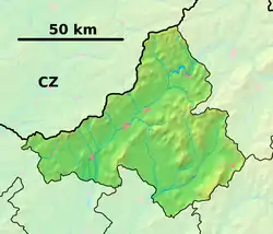 Krivoklát Location of Krivoklát in the Trenčín Region  Krivoklát Krivoklát (Slovakia) | |
| Coordinates: 49°03′N 18°10′E | |
| Country | |
| Region | Trenčín |
| District | Ilava |
| First mentioned | 1439 |
| Area | |
| • Total | 10.668 km2 (4.119 sq mi) |
| Elevation | 252 m (827 ft) |
| Population | |
| • Total | 288 |
| • Density | 27/km2 (70/sq mi) |
| Postal code | 018 52 (pošta Pruské) |
| Area code(s) | 421-42 |
| Car plate | IL |
History
In historical records the village was first mentioned in 1439.
Geography
The municipality lies at an altitude of 252 metres and covers an area of 10.668 km². It has a population of about 288 people.
This article is issued from Wikipedia. The text is licensed under Creative Commons - Attribution - Sharealike. Additional terms may apply for the media files.