Kryve Ozero
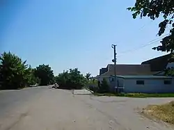
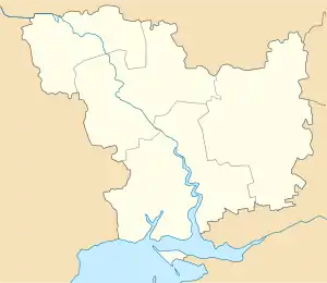
Kryve Ozero (Ukrainian: Криве Озеро, Russian: Кривое Озеро) is an urban-type settlement in the northwest of Mykolaiv Oblast, Ukraine. It serves as the administrative center of Kryve Ozero Raion. Population: 7,482 (2020 est.)[1]
Kryve Ozero
Криве Озеро | |
|---|---|
Urban-type settlement | |
 | |
 Kryve Ozero | |
| Coordinates: 47°56′43″N 30°21′10″E | |
| Country | Ukraine |
| Oblast | Mykolaiv Oblast |
| Raion | Kryve Ozero Raion |
| Population (2020) | |
| • Total | 7,482[1] |
| Time zone | UTC+2 (EET) |
| • Summer (DST) | UTC+3 (EEST) |
The settlement is located on the banks of the Kodyma River, a right tributary of the Southern Buh.
History
Kryve Ozero was founded in 1762.[2][3]
In the 1920s, Kryve Ozero belonged to Odessa Governorate. In 1923, uyezds in Ukrainian Soviet Socialist Republic were abolished, and the governorates were divided into okruhas. In 1923, Kryve Ozero Raion with the administrative center in Kryve Ozero was established. It belonged to Pervomaisk Okruha.[2] In 1925, the governorates were abolished, and okruhas were directly subordinated to Ukrainian SSR. In 1930, okruhas were abolished, and on 27 February 1932, Odessa Oblast was established, and Kryve Ozero was included into Odessa Oblast. In February 1954, Kryve Ozero Raion was transferred to Mykolaiv Oblast.[4] In 1976, Kryve Ozero was granted urban-type settlement status.[5]
Economy
Transportation
The closest railway station is in Liubashivka 14 kilometres (8.7 mi) to the south. It has connections to Pervomaisk and Podilsk.[5]
Notable residents
- Israel Wachser (1892-1919), Russian-Jewish writer of short stories and children's literature
References
- "Чисельність наявного населення України (Actual population of Ukraine)" (PDF) (in Ukrainian). State Statistics Service of Ukraine. Retrieved 30 September 2020.
- Ирина Калиниченко; Алена Викторова (23 April 2011). "На Кривоозерщине говорят "НЕТ" безработице" (in Russian). Ridne Prybuzzhia. Retrieved 8 March 2016.
- "Ханские слободы" (in Russian). Николаевская область. Электронная историческая энциклопедия. Retrieved 8 March 2016.
- "Районы Николаевской области" (in Russian). Николаевская область. Электронная историческая энциклопедия. Retrieved 6 March 2016.
- Украинская ССР - Административно-территориальное деление на 1 января 1979 года. Kiev: Ukrainian Soviet Encyclopedia. 1979.
| Raions | |||||
|---|---|---|---|---|---|
| Hromadas | |||||
| Cities |
| ||||
| |||||