KwaMhlanga
KwaMhlanga is a fast growing town in the Mpumalanga province of South Africa. It is the spiritual home of the Ndebele tribe that settled here in the early 18th century.
KwaMhlanga | |
|---|---|
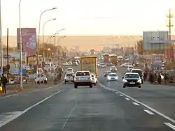 KwaMhlanga Crossroads | |
 KwaMhlanga  KwaMhlanga | |
| Coordinates: 25.432°S 28.708°E | |
| Country | South Africa |
| Province | Mpumalanga |
| District | Nkangala |
| Municipality | Thembisile Hani |
| Area | |
| • Total | 6.92 km2 (2.67 sq mi) |
| Elevation | 1,325 m (4,347 ft) |
| Population (2011)[1] | |
| • Total | 7,123 |
| • Density | 1,000/km2 (2,700/sq mi) |
| Racial makeup (2011) | |
| • Black African | 99.0% |
| • Coloured | 0.4% |
| • Indian/Asian | 0.4% |
| • White | 0.2% |
| First languages (2011) | |
| • S. Ndebele | 50.0% |
| • Northern Sotho | 19.7% |
| • Zulu | 10.9% |
| • Sotho | 5.4% |
| • Other | 14.1% |
| Time zone | UTC+2 (SAST) |
| Postal code (street) | 1022 |
| PO box | 1022 |
| Area code | 013 |
KwaMhlanga is 73KMs or an hour from the country’s capital, Pretoria (Tshwane).
This town developed into the administrative centre for the local government, and now houses the government administration for the North Western Region of the Mpumalanga Province.
To the north of KwaMhlanga, on the R568 near the village of Klipfontein, is located the Manala Royal Kraal; the Ndzundza Mabhoko Royal Kraal is situated further north at Weltevreden. By special arrangement, both of these kraals can be visited by small parties.
See also
References
- "Main Place KwaMhlanga". Census 2011.
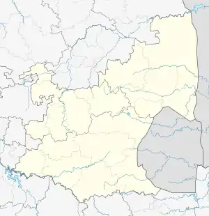
Municipalities and communities of Nkangala District Municipality, Mpumalanga | ||
|---|---|---|
District seat: Middelburg | ||
| Emalahleni | .svg.png.webp) Nkangala District within South Africa | |
| Steve Tshwete | ||
| Emakhazeni | ||
| Thembisile | ||
| Dr JS Moroka | ||
| Victor Khanye | ||
This article is issued from Wikipedia. The text is licensed under Creative Commons - Attribution - Sharealike. Additional terms may apply for the media files.
