Kyazanga
Kyazanga is a town council in the Lwengo District of the Central Region of Uganda.[2]
Kyazanga | |
|---|---|
 Kyazanga Map of Uganda showing the location of Kyazanga | |
| Coordinates: 00°23′11″S 31°19′07″E | |
| Country | |
| Region | Central Region of Uganda |
| District | Lwengo District |
| Elevation | 1,300 m (4,300 ft) |
| Population (2014 Census) | |
| • Total | 15,531[1] |
| Time zone | UTC+3 (EAT) |
Location
Kyazanga is approximately 48 kilometres (30 mi), by road, west of Masaka on the all-weather highway between Masaka and Mbarara.[3] The coordinates of the town are 0°23'11.0"S, 31°19'07.0"E (Latitude:-0.386389; Longitude:31.318611).[4]
Climate
The Köppen-Geiger climate classification system classifies its climate as tropical wet and dry (As).[5][6]
| Climate data for Kyazanga (altitude: 1300m) | |||||||||||||
|---|---|---|---|---|---|---|---|---|---|---|---|---|---|
| Month | Jan | Feb | Mar | Apr | May | Jun | Jul | Aug | Sep | Oct | Nov | Dec | Year |
| Average high °C (°F) | 27.5 (81.5) |
27.6 (81.7) |
27.1 (80.8) |
26.1 (79.0) |
25.6 (78.1) |
26.1 (79.0) |
26.3 (79.3) |
26.3 (79.3) |
26.6 (79.9) |
26.4 (79.5) |
26 (79) |
26.4 (79.5) |
26.5 (79.7) |
| Daily mean °C (°F) | 21.2 (70.2) |
21.4 (70.5) |
21.3 (70.3) |
20.8 (69.4) |
20.3 (68.5) |
20.1 (68.2) |
19.9 (67.8) |
20.1 (68.2) |
20.6 (69.1) |
20.7 (69.3) |
20.6 (69.1) |
20.6 (69.1) |
20.6 (69.1) |
| Average low °C (°F) | 14.9 (58.8) |
15.2 (59.4) |
15.5 (59.9) |
15.6 (60.1) |
15.1 (59.2) |
14.1 (57.4) |
13.5 (56.3) |
14 (57) |
14.6 (58.3) |
15.1 (59.2) |
15.3 (59.5) |
14.8 (58.6) |
14.8 (58.6) |
| Average precipitation mm (inches) | 48 (1.9) |
52 (2.0) |
97 (3.8) |
124 (4.9) |
90 (3.5) |
20 (0.8) |
18 (0.7) |
49 (1.9) |
81 (3.2) |
93 (3.7) |
106 (4.2) |
69 (2.7) |
847 (33.3) |
| Source: Climate-Data.org[5] | |||||||||||||
| Climate data for Kyazanga (altitude: 1241m) | |||||||||||||
|---|---|---|---|---|---|---|---|---|---|---|---|---|---|
| Month | Jan | Feb | Mar | Apr | May | Jun | Jul | Aug | Sep | Oct | Nov | Dec | Year |
| Average high °C (°F) | 27.7 (81.9) |
27.9 (82.2) |
27.4 (81.3) |
26.5 (79.7) |
26 (79) |
26.4 (79.5) |
26.7 (80.1) |
26.7 (80.1) |
26.9 (80.4) |
26.8 (80.2) |
26.3 (79.3) |
26.7 (80.1) |
26.8 (80.3) |
| Daily mean °C (°F) | 21.3 (70.3) |
21.6 (70.9) |
21.5 (70.7) |
21.2 (70.2) |
20.6 (69.1) |
20.3 (68.5) |
20.2 (68.4) |
20.4 (68.7) |
20.8 (69.4) |
21.1 (70.0) |
20.9 (69.6) |
20.9 (69.6) |
20.9 (69.6) |
| Average low °C (°F) | 15 (59) |
15.4 (59.7) |
15.7 (60.3) |
15.9 (60.6) |
15.3 (59.5) |
14.3 (57.7) |
13.7 (56.7) |
14.2 (57.6) |
14.8 (58.6) |
15.4 (59.7) |
15.6 (60.1) |
15.1 (59.2) |
15.0 (59.1) |
| Average precipitation mm (inches) | 48 (1.9) |
53 (2.1) |
96 (3.8) |
123 (4.8) |
89 (3.5) |
19 (0.7) |
18 (0.7) |
48 (1.9) |
81 (3.2) |
92 (3.6) |
105 (4.1) |
68 (2.7) |
840 (33) |
| Source: Climate-Data.org[6] | |||||||||||||
Population
The 2014 national population census put he population of Kyazanga at 15,531.[1]
Points of interest
The following additional points of interest lie within the town limits or near its edges:
- offices of Kyazanga Town Council
- Kyazanga central market
- Masaka-Mbarara Highway, passing through the center of the town, in an east to west direction.
References
- UBOS, . (27 August 2014). "The Population of The Regions of the Republic of Uganda And All Cities And Towns of More Than 15,000 Inhabitants". Citypopulation.de Quoting Uganda Bureau of Statistics (UBOS). Retrieved 26 February 2015.CS1 maint: numeric names: authors list (link)
- Cyprian Musoke, and Joyce Namutebi (1 September 2009). "Members of Parliament Warn On New Town Councils". New Vision (Kampala). Archived from the original on 4 September 2009. Retrieved 26 February 2015.
- "Road Distance Between Masaka And Kyazanga With Map". Globefeed.com. Retrieved 26 February 2015.
- Google (13 July 2015). "Location of Kyazanga At Google Maps" (Map). Google Maps. Google. Retrieved 13 July 2015.
- "Climate: Kyazanga (altitude: 1300m) - Climate graph, Temperature graph, Climate table". Climate-Data.org. Retrieved 2013-12-07.
- "Climate: Kyazanga (altitude: 1241m) - Climate graph, Temperature graph, Climate table". Climate-Data.org. Retrieved 2013-12-07.
External links
Capital: Lwengo | ||
| Towns and villages | 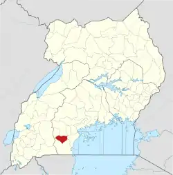 | |
| Economy |
| |
| Transport |
| |
| Health |
| |
This article is issued from Wikipedia. The text is licensed under Creative Commons - Attribution - Sharealike. Additional terms may apply for the media files.