Kyra, Cyprus
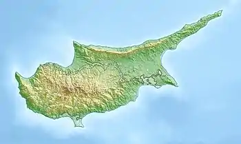
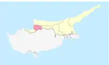
Kyra (Greek: Κυρά; Turkish: Mevlevi) is a village located in the Nicosia District of Cyprus, 6 km east of Morphou. De facto, it is under the control of Northern Cyprus.
Kyra
| |
|---|---|
 Kyra | |
| Coordinates: 35°12′09″N 33°03′28″E | |
| Country (de jure) | |
| • District | Nicosia District |
| Country (de facto) | |
| • District | Güzelyurt District |
| Population (2011)[2] | |
| • Total | 386 |
| Time zone | UTC+2 (EET) |
| • Summer (DST) | UTC+3 (EEST) |
Originally inhabited by Greek Cypriots, since the Turkish invasion in 1974, the village has been solely inhabited by Turks.[3] The Church of Panagia is used by the Turkish army as a depot.
References
- In 1983, the Turkish Republic of Northern Cyprus unilaterally declared independence from the Republic of Cyprus. The de facto state is not recognised by any UN state except Turkey.
- "KKTC 2011 Nüfus ve Konut Sayımı" [TRNC 2011 Population and Housing Census] (PDF). TRNC State Planning Organization. 6 August 2013. p. 22. Archived from the original (PDF) on 6 November 2013.
- https://docs.google.com/viewer?a=v&q=cache:HFPwLt8LC_AJ:www.unhchr.ch/Huridocda/Huridoca.nsf/0/f4f30ed4b0ee47f5c1256af4003755db/%24FILE/G0115564.pdf+Fterycha&hl=en&gl=uk&pid=bl&srcid=ADGEESjJWaRiEGn3eIn6YUUnIhuA6FmNv2q_uUpAFejCqfJngD6TmPkNyTFZ7lACAEWg4f823_M1QrgWdPN6j2kJZo7iVpwusSqFxL2I-1ee2GXe8hCBkxduvWQHg1kpf_FmdB2_WCFC&sig=AHIEtbQ8XjiXdelgW7MpJxFm8XIM5DM69Q
This article is issued from Wikipedia. The text is licensed under Creative Commons - Attribution - Sharealike. Additional terms may apply for the media files.

