Kyrgyz Ala-Too Range
The Kyrgyz Ala-Too (Kyrgyz: Кыргыз Ала-Тоосу, Kırgız Ala-Toosü, [kərˈɣəs ɑlɑˈtoːsu]; Kazakh: Қырғыз Алатауы, Qyrǵyz Alataýy) also known as Kyrgyz Alatau, Kyrgyz Range, and Alexander Range (until 1933) is a large range in the North Tien-Shan. It stretches for a total length of 454 km from the west-end of Issyk-Kul to the town Taraz in Kazakhstan. It runs in the east-west direction, separating Chuy Valley from Kochkor Valley, Suusamyr Valley, and Talas Valley. Talas Ala-Too Range adjoins the Kyrgyz Ala-Too in vicinity of Töö Ashuu Pass. The western part of Kyrgyz Ala-Too serves as a natural border between Kyrgyzstan and Kazakhstan.[1]
| Kyrgyz Ala-Too | |
|---|---|
| Alexander Range (until 1933) | |
 | |
| Highest point | |
| Peak | Semenov-Tian-Shansky Peak |
| Elevation | 4,895 m (16,060 ft) |
| Dimensions | |
| Length | 454 km (282 mi) E-W |
| Width | 40 km (25 mi) N-S |
| Naming | |
| Native name | Кыргыз Ала-Тоосу |
| Geography | |
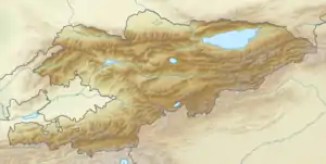 | |
| Countries | Kyrgyzstan and Kazakhstan |
| Province | Chuy Province |
| Range coordinates | 42°30′N 74°35′E |
| Geology | |
| Type of rock | Meganticline |
Parts of the range are contained within Ala Archa National Park, a popular alpine recreation area.
Notable Peaks
- Semenov-Tian-Shansky Peak (4895m)
- Korona Peak (4860m)
- Free Korea Peak (4740m)
- Vladimir Putin Peak (4446m)
References
- Чүй облусу:Энциклопедия [Encyclopedia of Chuy Oblast] (in Kyrgyz and Russian). Bishkek: Chief Editorial Board of Kyrgyz Encyclopedia. 1994. p. 718. ISBN 5-89750-083-5.
This article is issued from Wikipedia. The text is licensed under Creative Commons - Attribution - Sharealike. Additional terms may apply for the media files.
