L'Ange-Gardien, Capitale-Nationale, Quebec
L'Ange-Gardien is a municipality in the Capitale-Nationale region of Quebec, Canada. It is part of La Côte-de-Beaupré Regional County Municipality.
L'Ange-Gardien | |
|---|---|
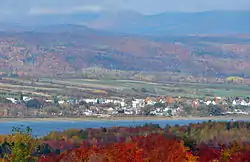 L'Ange-Gardien as seen from Île d'Orléans | |
_Quebec_location_diagram.png.webp) Location within La Côte-de-Beaupré RCM | |
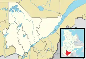 L'Ange-Gardien Location in central Quebec | |
| Coordinates: 46°55′N 71°06′W[1] | |
| Country | Canada |
| Province | Quebec |
| Region | Capitale-Nationale |
| RCM | La Côte-de-Beaupré |
| Constituted | July 1, 1855 |
| Government | |
| • Mayor | Pierre Lefrançois |
| • Federal riding | Beauport—Côte-de-Beaupré—Île d'Orléans—Charlevoix |
| • Prov. riding | Charlevoix–Côte-de-Beaupré |
| Area | |
| • Total | 53.59 km2 (20.69 sq mi) |
| • Land | 52.64 km2 (20.32 sq mi) |
| Population | |
| • Total | 3,695 |
| • Density | 68.9/km2 (178/sq mi) |
| • Pop 2011–2016 | |
| • Dwellings | 1,625 |
| Time zone | UTC−5 (EST) |
| • Summer (DST) | UTC−4 (EDT) |
| Postal code(s) | G0A 2K0 |
| Area code(s) | 418 and 581 |
| Highways | |
| Website | www |
L'Ange-Gardien changed status from parish municipality to ordinary municipality on May 17, 2007.[1]
Demographics
Population trend:[4]
- Population in 2011: 3634 (2006 to 2011 population change: 20.8%)
- Population in 2006: 3008
- Population in 2001: 2815
- Population in 1996: 2841
- Population in 1991: 2819
Private dwellings occupied by usual residents: 1,459 (total dwellings: 1,534)
Mother tongue:
- English as first language: 1.7%
- French as first language: 97.5%
- English and French as first language: 0%
- Other as first language: 0.8%
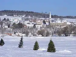
L'Ange-Gardien in winter as seen from the frozen Saint Lawrence River.
See also
References
- Reference number 397361 of the Commission de toponymie du Québec (in French)
- Geographic code 21040 in the official Répertoire des municipalités (in French)
- "(Code 2421040) Census Profile". 2016 census. Statistics Canada. 2017.
- Statistics Canada: 1996, 2001, 2006, 2011 census
External links
![]() Media related to L'Ange-Gardien, Capitale-Nationale, Quebec at Wikimedia Commons
Media related to L'Ange-Gardien, Capitale-Nationale, Quebec at Wikimedia Commons
Adjacent Municipal Subdivisions | |
|---|---|
| Cities & towns | |
|---|---|
| Municipalities | |
| Parishes | |
| Unorganized territories | |
| |
This article is issued from Wikipedia. The text is licensed under Creative Commons - Attribution - Sharealike. Additional terms may apply for the media files.
