Laa River
The Laa River is a river in Sulawesi, Indonesia, about 1700 km northeast of the capital Jakarta.[1]
| Laa River Sungai Laa, Salo Laa, Sungai La, Salo La | |
|---|---|
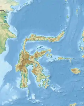 Location of river mouth  Laa River (Indonesia) | |
| Location | |
| Country | Indonesia |
| Province | Central Sulawesi |
Hydrology
The Laa River empties into the Gulf of Mori. The Ta Pamona live along the river as well as the To Mori, which settled on the lower section of the river.[1]
Geography
The river flows in the eastern area of Sulawesi with predominantly tropical rainforest climate (designated as Af in the Köppen-Geiger climate classification).[2] The annual average temperature in the area is 23 °C. The warmest month is February, when the average temperature is around 26 °C, and the coldest is July, at 21 °C.[3] The average annual rainfall is 4154 mm. The wettest month is April, with an average of 522 mm rainfall, and the driest is October, with 94 mm rainfall.[4]
| Laa River | ||||||||||||||||||||||||||||||||||||||||||||||||||||||||||||
|---|---|---|---|---|---|---|---|---|---|---|---|---|---|---|---|---|---|---|---|---|---|---|---|---|---|---|---|---|---|---|---|---|---|---|---|---|---|---|---|---|---|---|---|---|---|---|---|---|---|---|---|---|---|---|---|---|---|---|---|---|
| Climate chart (explanation) | ||||||||||||||||||||||||||||||||||||||||||||||||||||||||||||
| ||||||||||||||||||||||||||||||||||||||||||||||||||||||||||||
| ||||||||||||||||||||||||||||||||||||||||||||||||||||||||||||
References
- Colonial 'reformation' in the Highlands of Central Sulawesi, Indonesia, 1892-1995 by Albert Schrauwers University of Toronto Press, 2000 page65
- Peel, M C; Finlayson, B L; McMahon, T A (2007). "Updated world map of the Köppen-Geiger climate classification". Hydrology and Earth System Sciences. 11: 1633–1644. doi:10.5194/hess-11-1633-2007. Retrieved 30 January 2016.
- "NASA Earth Observations Data Set Index". NASA. 30 January 2016.
- "NASA Earth Observations: Rainfall (1 month - TRMM)". NASA/Tropical Rainfall Monitoring Mission. 30 January 2016.
This article is issued from Wikipedia. The text is licensed under Creative Commons - Attribution - Sharealike. Additional terms may apply for the media files.