Lac Vieux Desert Indian Reservation
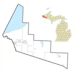
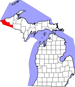
Lac Vieux Desert Indian Reservation is an Indian reservation located in Watersmeet Township of southeastern Gogebic County, in the western part of Michigan's Upper Peninsula. It is the landbase for the Lac Vieux Desert Band of Lake Superior Chippewa. The reservation has a total land area of 328.04 acres (1.3275 km2), split into two sections in eastern Watersmeet Township.
Lac Vieux Desert Indian Reservation | |
|---|---|
 Location within Gogebic County | |
 Lac Vieux Desert Location within the state of Michigan | |
| Coordinates: 46°16′10″N 89°10′40″W | |
| Country | United States |
| State | Michigan |
| County | Gogebic |
| Established | 1988 |
| Government | |
| • Type | Tribal Council |
| • Chairman | James Williams, Jr. |
| Area | |
| • Total | 0.51 sq mi (1.3 km2) |
| • Land | 0.51 sq mi (1.3 km2) |
| • Water | 0.0 sq mi (0 km2) |
| Population (2000) | |
| • Total | 135 |
| • Density | 256.9/sq mi (99.2/km2) |
| Time zone | UTC-6 (Central (CST)) |
| • Summer (DST) | UTC-5 (CDT) |
| ZIP code(s) | 49969 (Watersmeet) |
| Area code(s) | 906 |
| Website | Official website |
The 2000 census reported a total population of 135 residents. Most of the population lived in the 232.78-acre (0.9420 km2) northern section in the unincorporated community of Watersmeet, near the junction of US routes 45 (US 45) and 2. Some 26 persons lived in the 95.26-acre (385,500 m2) southern section, which is located on the north shore of Lac Vieux Desert, on the Michigan-Wisconsin border.
References
- Lac Vieux Desert Reservation, Michigan, United States Census Bureau
