Laersdrif
Laersdrif (formerly Delagersdrift) is a small settlement in Elias Motsoaledi Local Municipality in the Limpopo province of South Africa. It is situated on the Laersdrifspruit, a tributary of the upper Steelpoort River, 27 km southwest of Roossenekal, 72 km northeast of Middelburg and 11 km north east of Stoffberg.
Laersdrif | |
|---|---|
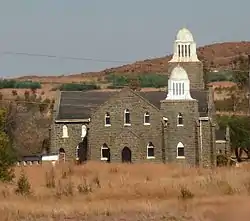 NG stone church at Laersdrif | |
 Laersdrif  Laersdrif | |
| Coordinates: 25.366°S 29.857°E | |
| Country | South Africa |
| Province | Limpopo |
| District | Sekhukhune |
| Municipality | Elias Motsoaledi |
| Established | 1907 |
| Area | |
| • Total | 4.06 km2 (1.57 sq mi) |
| Elevation | 1,474 m (4,836 ft) |
| Population (2011)[1] | |
| • Total | 2,218 |
| • Density | 550/km2 (1,400/sq mi) |
| Racial makeup (2011) | |
| • Black African | 96.1% |
| • Coloured | 0.9% |
| • Indian/Asian | 0.5% |
| • White | 2.6% |
| First languages (2011) | |
| • Northern Sotho | 49.1% |
| • S. Ndebele | 38.0% |
| • Zulu | 4.7% |
| • Afrikaans | 3.6% |
| • Other | 4.6% |
| Time zone | UTC+2 (SAST) |
| Postal code (street) | 1065 |
| PO box | 1065 |
| Area code | 013 |
It was founded in 1907 on the farms Swartkoppies and De Lagersdrift, and proclaimed a township in July 1953. It takes its name from the latter farm, which in turn was named after a ford (Afrikaans: drif, Dutch: drift) at which a Boer commando laagered during the Mapoch War of 1882; a laager is laer in Afrikaans.[2]
References
- "Main Place Laersdrif". Census 2011.
- Raper, Peter E. (1987). Dictionary of Southern African Place Names. Internet Archive. p. 269. Retrieved 28 August 2013.
Municipalities and communities of Sekhukhune District Municipality | ||
|---|---|---|
District seat: Groblersdal | ||
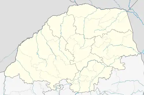
| Elias Motsoaledi | .svg.png.webp) Sekhukhune District within South Africa | |
| Ephraim Mogale | ||
| Fetakgomo/Tubatse | ||
| Makhuduthamaga | ||
This article is issued from Wikipedia. The text is licensed under Creative Commons - Attribution - Sharealike. Additional terms may apply for the media files.