Lagan (Sweden)
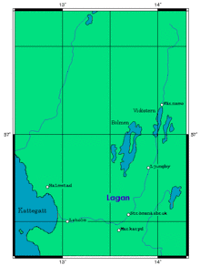
The Lagan is one of four main westcoast rivers in south-western Sweden besides Göta älv. It is with 244 kilometers one of the longest rivers in southern Sweden.
| Lagan | |
|---|---|
 Lagan and Hamneda Church in October 2010 | |
 | |
| Location | |
| Country | Sweden |
| Physical characteristics | |
| Source | Tahesjön |
| • location | Jönköping Municipality, Sweden |
| Mouth | Laholmsbukten, Kattegat |
• coordinates | 56°32′55″N 12°56′50″E |
• elevation | 0 m (0 ft) |
| Length | 244 km (152 mi)[1] |
| Basin size | 6,451.8 km2 (2,491.1 sq mi)[2] |
| Discharge | |
| • average | 82 m3/s (2,900 cu ft/s)[1] |
It starts in Tahesjön near Taberg in the municipality of Jönköping, flows through Vaggeryd, Värnamo and Ljungby and ends in the town of Mellbystrand in the municipality of Laholm. More specifically, it ends in the Bay of Laholm, a part of the strait of Kattegat.
People have been following the river from the coastal areas since the Viking Age and settling in its vicinity. Along Lagan was a trading route, the so-called Lagastigen, which is now part of the road E4.
The straight middle and upper course of Lagan follows a branch of the Protogine Zone —a zone of crustal weakness in western Sweden.[3]
See also
References
- "Lagan". Nationalencyklopedin (in Swedish). Retrieved 11 July 2010. (subscription required)
- "Län och huvudavrinningsområden i Sverige" (PDF) (in Swedish). Swedish Meteorological and Hydrological Institute. Retrieved 10 July 2010.
- Andréasson, Per-Gunnar; Rodhe, Agnes (1992). The Protogine Zone. Geology and mobility during the last 1.5 Ga (PDF) (Report). SKB technical report.
