Lake City, Arkansas
Lake City is a city[3] in Craighead County, Arkansas, United States, along the St. Francis River. The population was 2,082 as of the 2010 census.[4] It is included in the Jonesboro, Arkansas Metropolitan Statistical Area. It serves as a second county seat, serving the Eastern District of Craighead County (Jonesboro serves the Western District).
Lake City, Arkansas | |
|---|---|
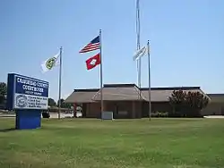 Craighead County Courthouse, Eastern District in Lake City | |
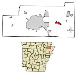 Location of Lake City in Craighead County, Arkansas. | |
| Coordinates: 35°49′4″N 90°26′24″W | |
| Country | |
| State | |
| County | |
| Area | |
| • Total | 3.18 sq mi (8.23 km2) |
| • Land | 3.15 sq mi (8.15 km2) |
| • Water | 0.03 sq mi (0.08 km2) |
| Elevation | 226 ft (69 m) |
| Population (2010) | |
| • Total | 2,082 |
| • Estimate (2019)[2] | 2,650 |
| • Density | 842.34/sq mi (325.21/km2) |
| Time zone | UTC−06:00 (Central (CST)) |
| • Summer (DST) | UTC−05:00 (CDT) |
| ZIP Code | 72437 |
| Area code(s) | 870 |
| FIPS code | 05-37780 |
| GNIS feature ID | 0077429 |
| Website | http://lakecityar.com/ |
Geography
Lake City is located in eastern Craighead County at 35°49′4″N 90°26′24″W (35.817866, -90.439927),[5] along the west bank of the St. Francis River. It is 16 miles (26 km) east of downtown Jonesboro.
According to the United States Census Bureau, the town has a total area of 3.1 square miles (7.9 km2), of which 3.0 square miles (7.8 km2) is land and 0.04 square miles (0.1 km2), or 1.35%, is water.[4]
List of highways
Notable facts
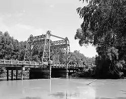
Lake City has the only lift bridge in the world that has been raised once in its construction. In order to construct a four-lane highway, a new bridge was constructed in 2002 and the lift bridge was moved to a location just south of the new bridge where it remains as a landmark.
Demographics
| Historical population | |||
|---|---|---|---|
| Census | Pop. | %± | |
| 1900 | 434 | — | |
| 1910 | 448 | 3.2% | |
| 1920 | 635 | 41.7% | |
| 1930 | 760 | 19.7% | |
| 1940 | 786 | 3.4% | |
| 1950 | 783 | −0.4% | |
| 1960 | 850 | 8.6% | |
| 1970 | 948 | 11.5% | |
| 1980 | 1,842 | 94.3% | |
| 1990 | 1,833 | −0.5% | |
| 2000 | 1,956 | 6.7% | |
| 2010 | 2,082 | 6.4% | |
| 2019 (est.) | 2,650 | [2] | 27.3% |
| U.S. Decennial Census[6] | |||
As of the census[7] of 2000, there were 1,956 people, 731 households, and 546 families residing in the town. The population density was 881.9 inhabitants per square mile (340.2/km2). There were 776 housing units at an average density of 349.9 per square mile (135.0/km2). The racial makeup of the town was 98.67% White, 0.05% Black or African American, 0.36% Native American, 0.05% Asian, 0.26% from other races, and 0.61% from two or more races. 1.02% of the population were Hispanic or Latino of any race.
There were 731 households, out of which 37.3% had children under the age of 18 living with them, 55.8% were married couples living together, 15.2% had a female householder with no husband present, and 25.3% were non-families. 23.0% of all households were made up of individuals, and 12.3% had someone living alone who was 65 years of age or older. The average household size was 2.57 and the average family size was 3.00.
In the town the population was spread out, with 27.0% under the age of 18, 8.4% from 18 to 24, 27.8% from 25 to 44, 20.7% from 45 to 64, and 16.1% who were 65 years of age or older. The median age was 35 years. For every 100 females, there were 94.4 males. For every 100 females age 18 and over, there were 84.4 males.
The median income for a household in the town was $30,844, and the median income for a family was $33,477. Males had a median income of $27,798 versus $19,205 for females. The per capita income for the town was $14,126. About 11.4% of families and 14.6% of the population were below the poverty line, including 21.1% of those under age 18 and 9.1% of those age 65 or over.
Education
Lake City is part of the Riverside School District, formed as a result of consolidation with the Lake City School District with that of nearby Caraway on July 1, 1985.[8] The Riverside High School mascot and athletic teams are known as "the Rebels". There are two elementary schools associated with the school: one is located in Lake City and the other in Caraway.
References
| Wikimedia Commons has media related to Lake City, Arkansas. |
- "2019 U.S. Gazetteer Files". United States Census Bureau. Retrieved June 30, 2020.
- "Population and Housing Unit Estimates". United States Census Bureau. May 24, 2020. Retrieved May 27, 2020.
- Local.Arkansas.gov - Lake City, retrieved September 3, 2012
- "Geographic Identifiers: 2010 Demographic Profile Data (G001): Lake City city, Arkansas". U.S. Census Bureau, American Factfinder. Archived from the original on February 12, 2020. Retrieved June 18, 2014.
- "US Gazetteer files: 2010, 2000, and 1990". United States Census Bureau. 2011-02-12. Retrieved 2011-04-23.
- "Census of Population and Housing". Census.gov. Retrieved June 4, 2015.
- "U.S. Census website". United States Census Bureau. Retrieved 2008-01-31.
- "ConsolidationAnnex_from_1983.xls." Arkansas Department of Education. Retrieved on October 13, 2017.
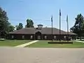
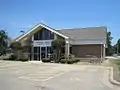
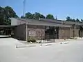
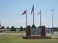
Gallery


Municipalities and communities of Craighead County, Arkansas, United States | ||
|---|---|---|
| Cities | 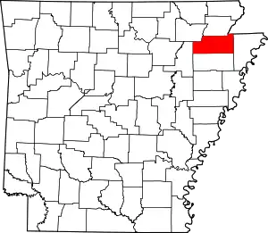 Map of Arkansas highlighting Craighead County | |
| Towns | ||
| Unincorporated communities |
| |
| Ghost town | ||
| ||
