Lake Wylie
Lake Wylie is a reservoir, or man-made lake in the U.S. states of both South Carolina and North Carolina. The lake has a surface area of 13,400 acres (54.2 km2)[1] (20.9 mi2) (5420 ha) and features 325 miles (523 km)[2] of shore line.
| Lake Wylie | |
|---|---|
 Lake Wylie in the autumn | |
 Lake Wylie  Lake Wylie | |
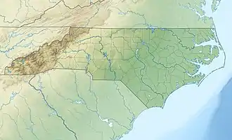
| Location | York County, South Carolina / Gaston / Mecklenburg counties, North Carolina, US |
| Coordinates | 35°5′8.9″N 81°3′30.9″W |
| Lake type | Reservoir |
| Primary inflows | Catawba River |
| Basin countries | United States |
| Surface area | 20.9 mi2 (54.2 km2) |
| Max. depth | 25 m (82 ft) |
| Shore length1 | 325 mi (523 km) |
| Islands | many |
| Settlements | Charlotte, North Carolina Lake Wylie, South Carolina Steele Creek, North Carolina Tega Cay, South Carolina India Hook, South Carolina |
| 1 Shore length is not a well-defined measure. | |
History
The man-made lake was first formed when the Catawba Power Company built the Catawba Dam and Power Plant near India Hook, South Carolina in 1904.[3] This dam impounded the Catawba River and created Lake Catawba, which was utilized to create hydro-electric power. In 1905, the Catawba Power Company became part of the Southern Power Company.[1]
In 1924, the Southern Power Company raised the level of the dam and built the new Catawba Hydroelectric Station to replace the original. This facility opened in August 1925, increasing the surface area of Lake Catawba from 668 acres (2.70 km2) to 13,400 acres (54.2 km2). The Southern Power Company was merged with Duke Power Company in 1927.[1]
In October 1960, the power station was renamed the Wylie Hydroelectric Station, and the lake was renamed Lake Wylie in honor of W. Gil Wylie, one of the founders of the original Catawba Power Company that had created the lake and become Duke Power.[1]
Other information

Lake Wylie's location on both the South Carolina and North Carolina borders makes it a common recreational destination for residents of nearby cities including Charlotte, Fort Mill, and Rock Hill. Duke Power manages six public boat access areas on the lake. There are also two towns that are located on Lake Wylie, including Tega Cay and Lake Wylie.
Lake Wylie is one of 11 lakes on the Catawba River and is the oldest lake in the Catawba River basin, with water being moved around each lake on the chain system through Duke Power. The lake has a surface area of approximately 13,443 acres (54.361 km2) with 325 miles (523 km) of shoreline, and stretches from the Mountain Island Dam, south of Mountain Island Lake in North Carolina to the Wylie Dam on the south end of the lake. The average depth of the lake is just over 20 feet.
The Catawba Nuclear Generating Station is located on the south-western part of the lake, and draws its cooling water from the lake. Allen Steam Station located on the northern part of the lake (west of Charlotte) also draws its cooling water from the lake.
The South Fork River and Catawba River confluence is now submerged under Lake Wylie near the North Carolina/South Carolina state line.
See also
- Lake Wylie, South Carolina
- Catawba Nuclear Generating Station
- Buster Boyd Bridge
- List of lakes in South Carolina
References
| Wikimedia Commons has media related to Lake Wylie. |
- "Wylie Hydroelectric Station Celebrates 75 Years Of Service: A Little History Gets A Chance To Shine" (Press release). Duke Power. 2000-08-09. Archived from the original on 2007-09-27. Retrieved 2007-08-13.
- "Lake Wylie". The Official Tourism Site of South Carolina. South Carolina Department of Parks, Recreation & Tourism. Archived from the original on 2007-09-27. Retrieved 2007-08-16.
- "History of York County". Excerpted from "Historical Properties of York County, South Carolina". York County Historical Commission. Retrieved 2007-08-16.
External links
- Boat Rentals on Lake Wylie Lake Wylie Boat Rentals
