Leadville North, Colorado
Leadville North is an unincorporated community and a census-designated place (CDP) located in Lake County, Colorado, United States. The population of the Leadville North CDP was 1,794 at the United States Census 2010.[4] Lake County governs the unincorporated community. The Leadville post office (Zip Code 80461) serves the area.[3]
Leadville North, Colorado | |
|---|---|
 A grocery store in Leadville North. | |
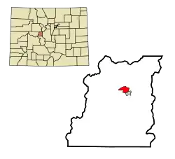 Location of the Leadville North CDP in Lake County, Colorado. | |
| Country | |
| State | |
| County | Lake County |
| Government | |
| • Type | unincorporated community |
| Area | |
| • Total | 2.449 sq mi (6.343 km2) |
| • Land | 2.449 sq mi (6.343 km2) |
| • Water | 0.000 sq mi (0.000 km2) |
| Elevation | 9,990 ft (3,045 m) |
| Population (2010) | |
| • Total | 1,794 |
| • Density | 733/sq mi (283/km2) |
| Time zone | UTC-7 (MST) |
| • Summer (DST) | UTC-6 (MDT) |
| ZIP Code[3] | Leadville 80461 |
| Area code(s) | 719 |
| GNIS feature[1] | Leadville North CDP |
Geography
Leadville North is bordered to the south by the City of Leadville, the county seat.
U.S. Route 24 forms the eastern edge of the community. The highway leads north 31 miles (50 km) over the Continental Divide to Interstate 70 at Minturn, and it runs south through Leadville 35 miles (56 km) to Buena Vista. Colorado State Highway 91 has its southern terminus in Leadville North and leads north-northeast 22 miles (35 km) to Interstate 70 at Copper Mountain.
The Leadville North CDP has an area of 1,567 acres (6.343 km2), all land.[2]
Demographics
The United States Census Bureau initially defined the Leadville North CDP for the 1970 United States Census.
| Year | Pop. | ±% |
|---|---|---|
| 1970 | 1,717 | — |
| 1980 | 1,851 | +7.8% |
| 1990 | 1,757 | −5.1% |
| 2000 | 1,942 | +10.5% |
| 2010 | 1,794 | −7.6% |
| 2020 | — | |
| Source: United States Census Bureau | ||
See also
- Outline of Colorado
- State of Colorado
- Colorado cities and towns
- Colorado counties
- Colorado metropolitan areas
References
- "U.S. Board on Geographic Names: Domestic Names". United States Geological Survey. Retrieved December 23, 2020.
- "State of Colorado Census Designated Places - BAS20 - Data as of January 1, 2020". United States Census Bureau. Retrieved December 23, 2020.
- "Zip Code 80461 Map and Profile". zipdatamaps.com. 2020. Retrieved December 23, 2020.
- "2010: DEC Summary File 1". United States Census Bureau. Retrieved December 23, 2020.
External links
- Leadville, Colorado
- Leadville @ Colorado.com
- Leadville @ UncoverColorado.com
- Leadville Lake County Chamber of Commerce
- Lake County website
Municipalities and communities of Lake County, Colorado, United States | ||
|---|---|---|
| City | 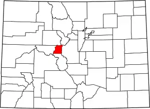 Map of Colorado highlighting Lake County | |
| CDPs | ||
| Ghost towns | ||
| ||
