Leoti, Kansas
Leoti, pronounced "Lee-OH-Ti." is a city in and the county seat of Wichita County, Kansas, United States.[6] As of the 2010 census, the city population was 1,534.[7]
Leoti, Kansas | |
|---|---|
City and County seat | |
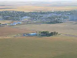 Aerial view of Leoti (2005) | |
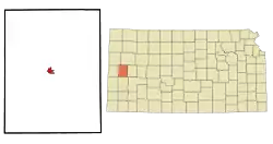 Location within Wichita County and Kansas | |
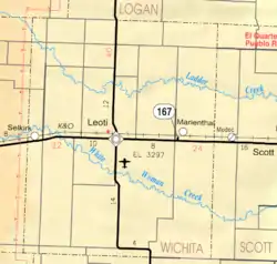 KDOT map of Wichita County (legend) | |
| Coordinates: 38°29′3″N 101°21′28″W | |
| Country | United States |
| State | Kansas |
| County | Wichita |
| Founded | 1885 |
| Incorporated | 1887 |
| Area | |
| • Total | 1.32 sq mi (3.41 km2) |
| • Land | 1.32 sq mi (3.41 km2) |
| • Water | 0.00 sq mi (0.00 km2) |
| Elevation | 3,301 ft (1,006 m) |
| Population | |
| • Total | 1,534 |
| • Estimate (2019)[3] | 1,448 |
| • Density | 1,100.30/sq mi (424.86/km2) |
| Time zone | UTC-6 (CST) |
| • Summer (DST) | UTC-5 (CDT) |
| ZIP code | 67861 |
| Area code | 620 |
| FIPS code | 20-39550 [4] |
| GNIS ID | 0471498 [5] |
| Website | leotikansas.org |
History
Leoti was founded in 1885[8] by a company of men from Garden City, Kansas. Two years later, in 1887, it was involved in the bloodiest county seat fight in the history of the American West. The shoot-out was on February 27, 1887, when men—some would say hired gunmen—from Leoti, went to the neighboring, rival town of Coronado and left several people dead and wounded.[9][10] A small town called Farmer City which was located between Coronado and Leoti, was hoped by some to become the county seat—which would end the fighting. Leoti later won the right to become the county seat and now the two other towns consist mainly of farmland.
The origin of the name Leoti is disputed: one tradition says the name is an Indian term for "prairie flower"; another says the community was named for settler Leoti Kibbee; a third says it was named for Leoti Gray, the daughter of a town founder.[11]
Geography
Leoti is located at 38°29′3″N 101°21′28″W (38.484073, -101.357639).[12] According to the United States Census Bureau, the city has a total area of 1.31 square miles (3.39 km2), all land.[13]
Climate
According to the Köppen Climate Classification system, Leoti has a semi-arid climate, abbreviated "BSk" on climate maps.[14]
Demographics
| Historical population | |||
|---|---|---|---|
| Census | Pop. | %± | |
| 1890 | 341 | — | |
| 1900 | 151 | −55.7% | |
| 1910 | 288 | 90.7% | |
| 1920 | 392 | 36.1% | |
| 1930 | 618 | 57.7% | |
| 1940 | 816 | 32.0% | |
| 1950 | 1,250 | 53.2% | |
| 1960 | 1,401 | 12.1% | |
| 1970 | 1,916 | 36.8% | |
| 1980 | 1,869 | −2.5% | |
| 1990 | 1,738 | −7.0% | |
| 2000 | 1,598 | −8.1% | |
| 2010 | 1,534 | −4.0% | |
| 2019 (est.) | 1,448 | [3] | −5.6% |
| U.S. Decennial Census | |||
2010 census
As of the census[2] of 2010, there were 1,534 people, 607 households, and 419 families residing in the city. The population density was 1,171.0 inhabitants per square mile (452.1/km2). There were 708 housing units at an average density of 540.5 per square mile (208.7/km2). The racial makeup of the city was 85.8% White, 0.7% African American, 0.6% Native American, 0.1% Asian, 10.8% from other races, and 2.1% from two or more races. Hispanic or Latino of any race were 31.6% of the population.
There were 607 households, of which 35.4% had children under the age of 18 living with them, 55.7% were married couples living together, 8.2% had a female householder with no husband present, 5.1% had a male householder with no wife present, and 31.0% were non-families. 28.5% of all households were made up of individuals, and 14% had someone living alone who was 65 years of age or older. The average household size was 2.48 and the average family size was 3.05.
The median age in the city was 37.4 years. 29.1% of residents were under the age of 18; 5% were between the ages of 18 and 24; 24.6% were from 25 to 44; 23.6% were from 45 to 64; and 17.7% were 65 years of age or older. The gender makeup of the city was 49.7% male and 50.3% female.
2000 census
As of the census[4] of 2000, there were 1,598 people, 634 households, and 452 families residing in the city. The population density was 1,213.3 people per square mile (467.4/km2). There were 726 housing units at an average density of 551.2 per square mile (212.4/km2). The racial makeup of the city was 81.35% White, 0.06% African American, 0.50% Native American, 0.06% Asian, 15.33% from other races, and 2.69% from two or more races. Hispanic or Latino of any race were 26.03% of the population.
There were 634 households, out of which 34.1% had children under the age of 18 living with them, 59.5% were married couples living together, 7.3% had a female householder with no husband present, and 28.7% were non-families. 27.6% of all households were made up of individuals, and 13.1% had someone living alone who was 65 years of age or older. The average household size was 2.48 and the average family size was 3.02.
In the city, the population was spread out, with 27.7% under the age of 18, 7.9% from 18 to 24, 25.0% from 25 to 44, 21.0% from 45 to 64, and 18.5% who were 65 years of age or older. The median age was 36 years. For every 100 females, there were 98.3 males. For every 100 females age 18 and over, there were 96.9 males.
The median income for a household in the city was $32,596, and the median income for a family was $41,484. Males had a median income of $27,235 versus $17,986 for females. The per capita income for the city was $16,550. About 8.8% of families and 12.0% of the population were below the poverty line, including 16.8% of those under age 18 and 6.0% of those age 65 or over.
Education
Leoti is home to USD 467 Wichita County Schools. The Wichita County High School mascot is Wichita County Indians.[15]
Prior to school unification, Leoti High School also used the Indians mascot.[16]
Notable people
- Ben Diggins, baseball player.
- Steve Tasker, American football player (retired), sportscaster.
References
- "2019 U.S. Gazetteer Files". United States Census Bureau. Retrieved July 24, 2020.
- "U.S. Census website". United States Census Bureau. Retrieved 2012-07-06.
- "Population and Housing Unit Estimates". United States Census Bureau. May 24, 2020. Retrieved May 27, 2020.
- "U.S. Census website". United States Census Bureau. Retrieved 2008-01-31.
- "US Board on Geographic Names". United States Geological Survey. 2007-10-25. Retrieved 2008-01-31.
- "Find a County". National Association of Counties. Retrieved 2011-06-07.
- "2010 City Population and Housing Occupancy Status". U.S. Census Bureau. Retrieved March 27, 2011.
- Kansas State Historical Society (1916). Biennial Report of the Board of Directors of the Kansas State Historical Society. Kansas State Printing Plant. pp. 313.
- "8 Wonders of Wichita County". Wichita County, KS: Wichita County. Retrieved September 24, 2019.
- "County Seat History of Wichita County, Kansas". Retrieved September 24, 2019.
- "Profile for Leoti, Kansas". ePodunk. Retrieved 28 June 2014.
- "US Gazetteer files: 2010, 2000, and 1990". United States Census Bureau. 2011-02-12. Retrieved 2011-04-23.
- "US Gazetteer files 2010". United States Census Bureau. Archived from the original on 2012-07-02. Retrieved 2012-07-06.
- Climate Summary for Leoti, Kansas
- "#467". USD 467. Retrieved 5 January 2017.
- "Leoti 46 Lacrosse 44", Great Bend Tribune, 4 December 1966, p.5.
Further reading
External links
| Wikimedia Commons has media related to Leoti, Kansas. |
- City
- County
- Education
- Maps
- Leoti City Map, KDOT
Municipalities and communities of Wichita County, Kansas, United States | ||
|---|---|---|
| City | 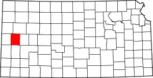 Map of Kansas highlighting Wichita County | |
| Unincorporated communities | ||
| Ghost towns | ||
| Footnotes | †This populated place is designated a Census-Designated Place (CDP) by the United States Census Bureau | |
| ||