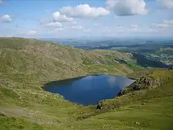
Levers Water
Levers Water is a small lake in the English Lake District. It is located at the head of the Coppermines Valley, above Coniston village. To its south-west is Raven Tor, a spur of Brim Fell, and to its north-west are Little How Crags and Great How Crags, on the eastern side of the north–south ridge leading to Swirl How.
| Levers Water | |
|---|---|
 | |
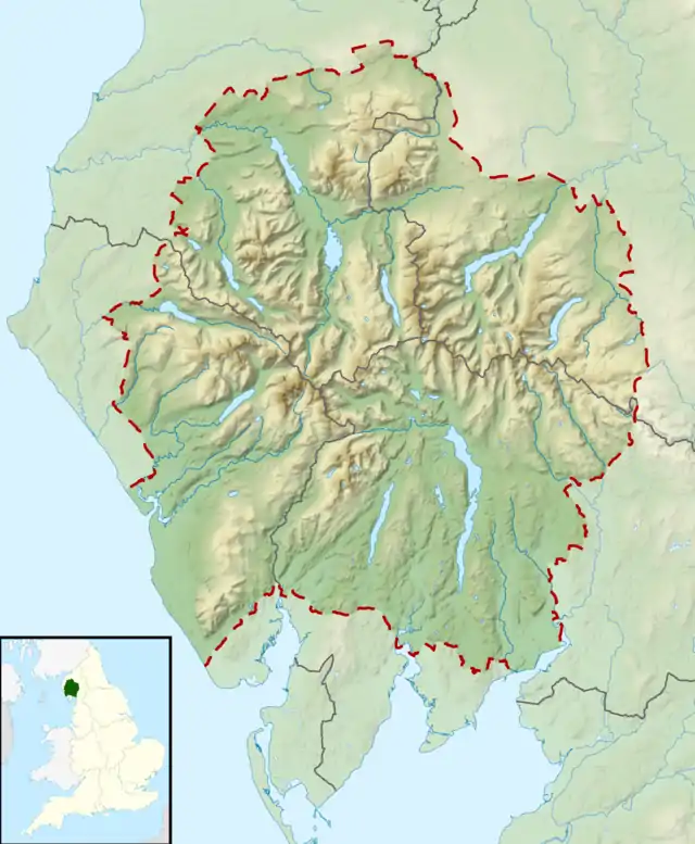 Levers Water Location in the Lake District National Park 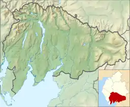 Levers Water Location in South Lakeland, Cumbria | |
| Location | Lake District |
| Coordinates | 54.384°N 3.111°W |
| Primary inflows | Swirl Hawse Beck, Cove Beck |
| Primary outflows | Levers Water Beck |
| Basin countries | United Kingdom |
| Surface area | 14 hectares (35 acres) |
| Average depth | 7.9 m (26 ft) |
| Water volume | 1,071,870 m3 (37,853,000 cu ft) |
| Surface elevation | 413 metres (1,355 ft) |
| References | [1] |
A dam built in 1717 enlarged the existing tarn to provide water for the mines and for the village below.[2]
A public footpath on its north-east side connects the Coppermines Valley to Swirl Hawse, while to its south-west, a path leads up Gill Cove to Levers Hawse on the main ridge of the Coniston Fells.
References
- "UK Lakes Detail - Levers Water". Centre for Ecology and Hydrology. Archived from the original on 2016-06-11. Retrieved 2017-02-12.
- "Levers Water". Retrieved 2017-02-12.
This article is issued from Wikipedia. The text is licensed under Creative Commons - Attribution - Sharealike. Additional terms may apply for the media files.