Liberty Township, Howard County, Indiana
Liberty Township is one of eleven townships in Howard County, Indiana, United States. As of the 2010 census, its population was 4,862 and it contained 2,042 housing units.[2] Liberty Township hosts the Howard County fair each year in July in Greentown, which is the second biggest town in Howard County, and third biggest in the Kokomo Metropolitan Area after only Kokomo, and Tipton.
Liberty Township | |
|---|---|
 The Hy-Red Gasoline Station, a historic site in Liberty Township | |
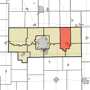 Location in Howard County | |
| Coordinates: 40°29′59″N 85°58′51″W | |
| Country | United States |
| State | Indiana |
| County | Howard |
| Government | |
| • Type | Indiana township |
| Area | |
| • Total | 31.77 sq mi (82.3 km2) |
| • Land | 31.53 sq mi (81.7 km2) |
| • Water | 0.24 sq mi (0.6 km2) 0.76% |
| Elevation | 853 ft (260 m) |
| Population (2010) | |
| • Total | 4,862 |
| • Estimate (2012[1]) | 4,870 |
| • Density | 154.2/sq mi (59.5/km2) |
| GNIS feature ID | 0453557 |
History
Liberty Township was founded in 1858.[3]
Geography
| Historical population | |||
|---|---|---|---|
| Census | Pop. | %± | |
| 2000 | 5,032 | — | |
| 2010 | 4,862 | −3.4% | |
| 2012 (est.) | 4,870 | 0.2% | |
| U.S. Census[4] | |||
According to the 2010 census, the township has a total area of 31.77 square miles (82.3 km2), of which 31.53 square miles (81.7 km2) (or 99.24%) is land and 0.24 square miles (0.62 km2) (or 0.76%) is water.[2]
Cities and towns
Adjacent townships
- Harrison Township, Miami County (north)
- Jackson Township, Miami County (northeast)
- Jackson Township (east)
- Union Township (southeast)
- Taylor Township (southwest)
- Howard Township (west)
- Clay Township, Miami County (northwest)
Cemeteries
The township contains five cemeteries: Freeman, Greenlawn, Hochstedler, Mast and Shrock. Lamb Cemetery, Lindley Cemetery
Libraries
- Greentown Main Public Library, in Eastern Junior & Senior High School
- Greentown Children's Public Library, in Eastern Elementary School
- Kokomo-Howard County Public Library Main Branch (in Kokomo, but serves Liberty Township outside of Greentown)
- Kokomo-Howard County Public Library South Branch (in Kokomo, but serves Liberty Township outside of Greentown)
Schools
- Eastern-Howard Elementary School
- Eastern Junior & Senior High School
Business
- Subway, in Greentown
- Crave Crepes, in Greentown
- Hucks Gas Station, in Greentown
- Smart Mart/Citgo Gas, in Greentown
- Family Dollar, in Greentown
- Kellys Ice Cream, in Greentown
- Walnut Street Bistro, in Greentown
- Blondie's Cookies Headquarters, in Greentown
- King Chef, in Greentown
- Haley's II Family Dining, in Greentown
- Ford, in Greentown
- Bank, in Greentown
Medical
References
- "Liberty Township, Howard County, Indiana". Geographic Names Information System. United States Geological Survey. Retrieved 2009-09-24.
- United States Census Bureau cartographic boundary files
- "Population Estimates". United States Census Bureau. Archived from the original on June 17, 2013. Retrieved 2013-06-25.
- "Population, Housing Units, Area, and Density: 2010 - County -- County Subdivision and Place -- 2010 Census Summary File 1". United States Census. Archived from the original on 2020-02-12. Retrieved 2013-05-10.
- "Howard County's Townships and Their Early Settlements and Towns". Kokomo-Howard County Public Library. Archived from the original on 22 December 2013. Retrieved 2 June 2014.
- "US Census Data". US Government Census Agency. Archived from the original on 8 October 2014. Retrieved 26 February 2014.
External links
Municipalities and communities of Howard County, Indiana, United States | ||
|---|---|---|
| City | Map of Indiana highlighting Howard County | |
| Towns | ||
| Townships | ||
| Other unincorporated communities | ||
| ||