Lipa pri Frankolovem
Lipa pri Frankolovem (pronounced [ˈliːpa pɾi fɾaŋkɔˈloːʋɛm]) is a settlement in the Municipality of Vojnik in eastern Slovenia. It lies in the hills north of Frankolovo off the main road from Vojnik to Slovenske Konjice. The area is part of the traditional region of Styria and is now included in the Savinja Statistical Region.[2]
Lipa pri Frankolovem | |
|---|---|
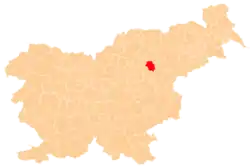
 Lipa pri Frankolovem Location in Slovenia | |
| Coordinates: 46°20′56.47″N 15°18′51.48″E | |
| Country | |
| Traditional region | Styria |
| Statistical region | Savinja |
| Municipality | Vojnik |
| Area | |
| • Total | 2.69 km2 (1.04 sq mi) |
| Elevation | 535.7 m (1,757.5 ft) |
| Population (2002) | |
| • Total | 157 |
| [1] | |
Name
The name of the settlement was changed from Lipa to Lipa pri Frankolovem in 1953.[3]
References
- Statistical Office of the Republic of Slovenia
- Vojnik municipal site
- Spremembe naselij 1948–95. 1996. Database. Ljubljana: Geografski inštitut ZRC SAZU, DZS.
External links
| Settlements | Administrative centre: Vojnik
|  |
|---|---|---|
| Landmarks |
| |
| Notable people | ||
This article is issued from Wikipedia. The text is licensed under Creative Commons - Attribution - Sharealike. Additional terms may apply for the media files.