List of Missouri conservation areas – Northwest region
The Northwest administrative region of the Missouri Department of Conservation encompasses Andrew, Atchison, Buchanan, Caldwell, Carroll, Chariton, Clinton, Daviess, DeKalb, Gentry, Grundy, Harrison, Holt, Linn, Livingston, and Mercer counties. The regional conservation office is in St. Joseph.
| Conservation Area | Description | Size | County | Location | |
|---|---|---|---|---|---|
| Agency Access | This is a forest area on the Platte River. | 1.6 acres | 0.65 ha | Buchanan | 39°38′37.70″N 94°43′34.76″W |
| Agency Conservation Area | This is a forest area on the Platte River. | 93 acres | 38 ha | Buchanan | 39°37′47.18″N 94°43′52.94″W |
| Bagley (Peter and John) Woods Conservation Area | This is an old-growth oak-hickory forest, a stand of state-endangered northern pin oaks and a small stream. | 21 acres | 8.5 ha | Mercer | 40°34′20.07″N 93°41′14.70″W |
| Belcher Branch Lake Conservation Area | This tract is mostly cropland and old fields with some forest and grassland. | 395 acres | 160 ha | Buchanan | 39°35′3.45″N 94°43′56.16″W |
| Bilby Ranch Lake Conservation Area | This area contains grassland, cropland, old fields, and some forest. Facilities/features: boat ramp, fishing dock, fish cleaning station, Bilby Ranch Lake (110 acres), and many small fishing ponds. | 5,089 acres | 2,059 ha | Nodaway | 40°21′17.29″N 95°9′4.96″W |
| Blue Jay Trail Access | This forest area offers access to Crooked River. | 33 acres | 13 ha | Ray | 39°27′49.65″N 94°6′0.94″W |
| Bluffwoods Conservation Area | Bluffwoods and Goodell Annex overlook the Missouri River floodplain just south of St. Joseph. Both areas are mostly forested with scattered open grasslands. The Bluffwoods area has numerous service roads and several established trails for hiking. The Fore | 2,247 acres | 909 ha | Buchanan | 39°37′44.09″N 94°56′31.70″W |
| Bluffwoods CA - Goodell Memorial Annex | Bluffwoods/Goodell is mostly forest. | 58 acres | 23 ha | Buchanan | 39°39′47.52″N 94°54′45.12″W |
| Bonanza Conservation Area | This area contains forest, old fields, cropland, and grassland. Facilities/features: primitive camping, fishable ponds, numerous fishless ponds, and 4 permanent streams (Crabapple Creek, Shoal Creek, Brush Creek, and Log Creek). | 1,863 acres | 754 ha | Caldwell | 39°37′36.68″N 93°58′21.48″W |
| Bosworth Access | This area contains old fields and forest and offers access to the Grand River. | 12 acres | 4.9 ha | Carroll | 39°28′24.58″N 93°15′50.50″W |
| Brickyard Hill Conservation Area | The area is mostly forest with significant tracts of old fields and grassland. | 2,296 acres | 929 ha | Atchison | 40°28′23.75″N 95°34′22.97″W |
| Bridgewater Access | This area offers access to the 102 River. | 11 acres | 4.5 ha | Nodaway | 40°14′33.30″N 94°50′8.96″W |
| Bristle Ridge Access | This area offers access to the Long Branch of the Platte River. | 1.4 acres | 0.57 ha | Nodaway | 40°10′13.98″N 94°44′52.65″W |
| Brown (Bob) Conservation Area | This area contains more than 1,000 acres (4.0 km2) of wetlands along with cropland, old fields, grassland, and forest. | 3,361 acres | 1,360 ha | Holt | 39°57′32.52″N 95°14′6.63″W |
| Brown (Tom) Access | This area is mostly old fields with some timber and offers access to the Missouri River. | 9 acres | 3.6 ha | Andrew | 39°54′11.89″N 94°58′2.70″W |
| Brunswick Access | Facilities/features: boat ramp, picnic area, pavilion, and a permanent stream (Grand River). | 1.8 acres | 0.73 ha | Chariton | 39°25′19.73″N 93°7′55.07″W |
| Bunch Hollow Conservation Area | This area contains more than 1,300 acres (5.3 km2) of forest along with old fields, grassland, savanna and cropland. | 3,302 acres | 1,336 ha | Carroll | 39°35′11.91″N 93°35′49.37″W |
| Burton Bridge Access | This area is mostly old fields. It offers access to the Platte River. | 18 acres | 7.3 ha | Buchanan | 39°34′52.65″N 94°43′2.07″W |
| Chillicothe (Coval Gann -) Access | There is a boat ramp. | 8 acres | 3.2 ha | Livingston | 39°45′12.34″N 93°33′16.44″W |
| Chloe Lowry Marsh Natural Area | This area includes 40 acres (160,000 m2) of freshwater marsh and 15 acres (61,000 m2) of wet-mesic prairie. Chloe Lowry Marsh is 1 of the highest quality natural marshes in the state containing 6 Missouri species of conservation concern. | 113 acres | 46 ha | Mercer | 40°26′3.73″N 93°36′37.42″W |
| Christie (James D) Conservation Area | The areas contain forest, cropland, old fields, and grassland. There are fishable ponds on Christie CA. | 174 acres | 70 ha | Andrew | 40°3′49.08″N 94°47′56.85″W |
| Corning Conservation Area | This area is located in the Missouri River floodplain and contains a mix of young forest, cropland, grassland, wetlands, and idle crop fields. | 1,958 acres | 792 ha | Atchison, Holt | 40°15′8.61″N 95°29′19.82″W |
| Crooked River Conservation Area | This area contains old fields, forest, cropland, grassland, and wetlands. | 1,411 acres | 571 ha | Ray | 39°24′28.81″N 94°3′24.69″W |
| Crusader's Access | This area offers access to the Weldon Fork of the North Grand River. | 3 acres | 1.2 ha | Grundy | 40°14′37.78″N 93°35′57.61″W |
| Dalton Bottoms Access | This old-fields area provides access to the Missouri River and the Chariton River via the Missouri River. | 54 acres | 22 ha | Chariton | 39°18′57.15″N 92°57′45.78″W |
| Davis (The Eva N) Memorial Conservation Area | The areas contain forest, cropland, old fields, and grassland. There are fishable ponds on Christie CA. | 30 acres | 12 ha | Andrew | 40°4′4.98″N 94°48′9.65″W |
| Denton (Andy) Access | This access is a mix of forest, cropland, and old field habitat with access to the Grand River. | 123 acres | 50 ha | Gentry | 40°5′47.04″N 94°20′54.09″W |
| Deroin Bend Conservation Area | This area is primarily old fields, forest, and wetlands. Facilities/features: primitive camping, Missouri river Chute, and a permanent stream (Missouri River). | 1,213 acres | 491 ha | Holt | 40°16′0.28″N 95°32′29.89″W |
| DuPree (Arthur) Memorial Conservation Area | Mostly forest with some old fields. | 215 acres | 87 ha | Buchanan | 39°46′57.48″N 94°52′51.02″W |
| Elam Bend Conservation Area | This area is a mixture of forest, old field, and cropland habitat. The area features a boat ramp with access to the Grand River, a firearms shooting range, primitive camping, and a disabled accessible privy. | 1,497 acres | 606 ha | Gentry | 40°5′2.78″N 94°15′26.07″W |
| Elrod Mill Access | This area is mostly forest with some cropland and old fields. | 59 acres | 24 ha | Andrew | 40°0′0.95″N 94°41′40.56″W |
| Floyd (Nannie B) Memorial Conservation Area | This is a forest area. | 19 acres | 7.7 ha | Chariton | 39°39′33.59″N 93°3′16.01″W |
| Fountain Grove Conservation Area | This area contains large wetlands and forest tracts in addition to cropland, grassland, and old fields. Facilities/features: boat ramps, picnic areas, and waterfowl blinds. In addition, there are 3 major bodies of water: Che-Ru Lake, Bittern Marsh, and Jo | 7,486 acres | 3,029 ha | Linn, Livingston | 39°42′7.98″N 93°17′17.05″W |
| Foxglove Conservation Area | This area is mostly prairie with some forest. | 56 acres | 23 ha | Ray | 39°23′28.76″N 94°7′8.75″W |
| Gallatin Conservation Area | This area contains forest, grassland, old fields, cropland, wetlands, and savanna. | 682 acres | 276 ha | Daviess | 39°50′38.16″N 93°55′14.05″W |
| Grand Trace Conservation Area | This area is a mixture of forest, old field, savanna, and grassland habitat. The area features primitive camping and 2 fishable ponds. | 1,522 acres | 616 ha | Harrison | 40°19′25.74″N 94°6′23.69″W |
| Green Access | This area offers access to the Grand River. | 5 acres | 2.0 ha | Daviess | 40°1′28.16″N 94°7′32.37″W |
| Hadorn Bridge Access | The area contains cropland with forest, old fields, and grassland. | 102 acres | 41 ha | Andrew | 40°0′48.11″N 94°47′55.01″W |
| Happy Holler Lake Conservation Area | The area contains old fields, grassland, cropland, and forest. | 2,286 acres | 925 ha | Andrew | 39°59′6.99″N 94°46′9.78″W |
| Hardin Conservation Area | This area is primarily forested and contains a 40-acre (160,000 m2) blue hole created by the flood of 1993. | 242 acres | 98 ha | Ray | 39°15′3.76″N 93°50′31.60″W |
| Hartell (Ronald and Maude) Conservation Area | This area contains forest, pasture, and grassland. | 113 acres | 46 ha | Clinton | 39°36′13.87″N 94°23′53.98″W |
| Helton (The Wayne) Memorial WA | This area contains old fields, forest, cropland, prairie, and 2 small wetlands. The area features 1 designated camping area (primitive) and the 30-acre (120,000 m2) Helton Prairie Natural Area, which features unique wildflower displays from mid-May until early July. | 2,567 acres | 1,039 ha | Harrison | 40°14′17.82″N 93°48′17.99″W |
| Holmes Bend Access | This area contains forest, old fields, and grassland. It offers access to the Grand River. | 83 acres | 34 ha | Daviess | 39°53′34.62″N 93°55′34.53″W |
| Honey Creek Conservation Area | The area is about 1/2 forest and also contains old fields, cropland and grassland. | 1,437 acres | 582 ha | Andrew | 39°57′12.14″N 94°58′51.79″W |
| Hoot Owl Bend Access | Facilities/features: primitive camping, a permanent stream (Missouri River), and no boat ramp. | 7 acres | 2.8 ha | Atchison | 40°18′54.03″N 95°37′4.71″W |
| James Bridge Access | This forest area offers access to the Crooked River. | 20 acres | 8.1 ha | Ray | 39°22′14.83″N 94°2′32.77″W |
| Jamesport Lake | This area contains forest, old fields, and grassland. | 142 acres | 57 ha | Daviess | 40°0′1.93″N 93°50′29.24″W |
| Jentell Brees Access | The area consists primarily of old fields and grassland. It offers access to the Missouri River. | 31 acres | 13 ha | Buchanan | 39°41′28.71″N 94°57′48.09″W |
| Keever Bridge Access | This area offers access to the Platte River. | 7 acres | 2.8 ha | Nodaway | 40°25′43.05″N 94°38′5.98″W |
| Kendzora (Anthony and Beatrice) Conservation Area | This area provides a variety of habitats for many fish and wildlife species. The area includes 100 acres (0.40 km2) of cropland that is seasonally flooded, providing both upland game and waterfowl habitats. A 35-acre (140,000 m2) fishing lake and approximately 1-mile (1.6 km) of the Plat | 789 acres | 319 ha | Platte, Buchanan | 39°31′38.10″N 94°38′54.12″W |
| King Lake Conservation Area | This area contains grassland, old fields, cropland, and some forest and wetlands. | 1,292 acres | 523 ha | DeKalb, Gentry | 40°1′41.98″N 94°26′4.07″W |
| Kneib (Wilfrid V and Anna C) Memorial Conservation Area | This area is primarily forest with some old fields and prairies. | 35 acres | 14 ha | Buchanan | 39°43′2.91″N 94°56′1.49″W |
| Lake Paho Conservation Area | This area contains old fields, forest, cropland, prairie, and grassland. Facilities/features: boat ramps, boat dock, improved camping, hatchery, picnic areas, fishing jetty, numerous fishable ponds, and Lake Paho. Hatchery tours are available on request. | 2,359 acres | 955 ha | Mercer | 40°24′58.49″N 93°39′43.19″W |
| Langdon Bend Access | This area is primarily forest. | 11 acres | 4.5 ha | Atchison | 40°20′23.91″N 95°37′16.55″W |
| Lathrop Bridge Access | The area is mostly old fields and grassland. | 27 acres | 11 ha | Clinton | 39°33′59.61″N 94°24′32.33″W |
| Lewis Mill Access | This area offers access to the Little Chariton River. | 8 acres | 3.2 ha | Chariton | 39°15′26.01″N 92°51′44.34″W |
| Limpp Lake | This area offers a 29-acre (120,000 m2) lake with boat ramp and privy, forest, and old field habitat. | 69 acres | 28 ha | Gentry | 40°3′40.25″N 94°32′4.80″W |
| Little Compton Lake Conservation Area | This area consists of old fields and grassland along with some forest. | 344 acres | 139 ha | Carroll | 39°32′25.23″N 93°16′41.77″W |
| Little Tarkio Prairie | This area is mostly grassland with some forest and a 15-acre (61,000 m2) prairie. Primitive camping is allowed. | 127 acres | 51 ha | Holt | 40°12′16.07″N 95°19′13.28″W |
| Logan (Caroline Sheridan) Memorial WA | This area is mostly forest with some old fields. | 41 acres | 17 ha | Buchanan | 39°49′7.55″N 94°52′12.50″W |
| Lotts Creek Conservation Area | This area is completely wooded with 1 parking lot. | 19 acres | 7.7 ha | Harrison | 40°31′44.97″N 94°11′26.78″W |
| Lower Hamburg Bend Conservation Area | This area is mostly young cottonwood forest with some cropland, old fields, grasslands, and a Missouri River Chute. | 2,100 acres | 850 ha | Atchison | 40°32′45.35″N 95°45′13.98″W |
| MO Western State University Skeet Range | Open to the public 2:00-6:00 April 1 - October 30. Closed major holidays. | 12 acres | 4.9 ha | Buchanan | 39°45′40.51″N 94°47′38.85″W |
| Maitland Access | This area provides foot access to the Nodaway River. | 0.7 acres | 0.28 ha | Holt | 40°12′8.35″N 95°4′11.50″W |
| McCormack (Jamerson C) Conservation Area | This area contains forest, grassland, old fields, and savanna. | 225 acres | 91 ha | Holt | 40°3′5.27″N 95°14′13.61″W |
| McKinny Conservation Area | This area contains forest, wetlands, cropland, and old fields. | 112 acres | 45 ha | Carroll | 39°22′14.95″N 93°14′14.71″W |
| Midway Access | This area offers access to the 102 River. | 1.0 acre | 0.40 ha | Andrew | 40°6′48.48″N 94°50′14.07″W |
| Mockingbird Hill Access | Travel .5-mile (8.0 km) west of Trenton on Hwy 6, then north on SW 30th Avenue. After approximately .25-mile (40 km), SW 30th Avenue becomes NW 30th street. Continue another .5-mile (8.0 km) to NW 3rd Street/Crowder Street. Travel .25-mile (40 km) east on NW 3rd Street/Crowder Street a | 84 acres | 34 ha | Grundy | 40°4′42.09″N 93°38′30.50″W |
| Monkey Mountain Conservation Area | This area has 800 acres (3.2 km2) of mostly forested bluffs above the Missouri River and 780 acres (3.2 km2) of Missouri River floodplain. This area also has stream frontage along the Missouri and Nodaway Rivers. | 1,624 acres | 657 ha | Holt | 39°55′3.71″N 95°0′24.22″W |
| Morton Bridge Access | This old fields and forest area offers access to the Crooked River. | 21 acres | 8.5 ha | Ray | 39°17′45.24″N 93°53′32.21″W |
| Mussel Fork Conservation Area | This area contains cropland, old fields, grassland, and woodlands. Area includes 3 fishable ponds and a permanent stream (Mussel Fork Creek). | 2,449 acres | 991 ha | Linn, Macon | 39°43′28.15″N 92°51′43.97″W |
| Newman Memorial Access | This area offers access to the Grand River. | 9 acres | 3.6 ha | Daviess | 39°52′28.42″N 93°50′15.55″W |
| Nishnabotna Conservation Area | This area is divided into 2 separate tracts. The south tract is mostly forested and the north tract is a mix of cropland, idle fields and grasslands. | 2,321 acres | 939 ha | Atchison | 40°28′19.26″N 95°40′14.54″W |
| Nodaway County Lake | This area is about 1/3 grassland and also contains old fields, forest, cropland, and savanna. | 317 acres | 128 ha | Nodaway | 40°25′49.92″N 94°51′24.54″W |
| Nodaway Island Access | The access contains forest and pasture. | 7 acres | 2.8 ha | Andrew | 39°54′10.69″N 94°57′7.78″W |
| Nodaway Valley Conservation Area | The area is mostly cropland with significant wetland acreage. There are smaller tracts of forest and old fields. | 3,912 acres | 1,583 ha | Andrew, Holt | 40°4′34.26″N 95°3′29.03″W |
| Pawnee Prairie Natural Area | This prairie natural area is a remnant of the once-vast tallgrass prairie that covered much of northwest Missouri. Prairie restoration efforts are on-going. Several bird species of conservation concern can be seen on the area during spring and summer. | 472 acres | 191 ha | Harrison | 40°31′19.90″N 94°8′50.98″W |
| Payne Landing Access | This area offers access to the Missouri River. | 4 acres | 1.6 ha | Holt | 39°54′29.13″N 95°9′44.07″W |
| Pigeon Hill Conservation Area | This area is mostly forest with cropland and old fields. | 460 acres | 190 ha | Buchanan | 39°39′47.89″N 94°46′45.95″W |
| Pigg's Landing Access | This grassland area offers access to the Fishing River. | 17 acres | 6.9 ha | Ray | 39°13′15.99″N 94°9′16.36″W |
| Poosey Conservation Area | This area contains forests, grasslands, croplands, prairie/savanna and old field habitats. Numerous upland game species are present in addition to fishing opportunities and an extensive trail system. This area has been designated an Audubon Society Import | 5,793 acres | 2,344 ha | Livingston | 39°55′22.06″N 93°41′51.63″W |
| Possum Walk Access | This forest area offers access to the Nodaway River. | 8 acres | 3.2 ha | Nodaway | 40°30′33.62″N 95°4′7.80″W |
| Punkin Center Access | This is a forest, wetlands, and old fields area along the Thompson River. | 71 acres | 29 ha | Livingston | 39°56′20.30″N 93°37′0.22″W |
| Ray County Lake | This area is mostly grassland. Facilities/features: boat ramp, picnic area, fishing jetty, and Ray County Community Lake (25 acres). | 166 acres | 67 ha | Ray | 39°18′48.93″N 93°59′50.48″W |
| Riverbreaks Conservation Area | This area is more than 1/2 forest with grassland, old fields, cropland, and prairie. Facilities/features: primitive camping, 3 fishing ponds, single projectile firearms range, and 3 permanent streams (Whales Creek, Schlotz Branch, and Forbes Creek). | 2,276 acres | 921 ha | Holt | 39°56′7.05″N 95°7′53.64″W |
| Rochester Falls Access | The land is mainly pasture. | 12 acres | 4.9 ha | Andrew | 39°54′33.66″N 94°41′33.68″W |
| Rock Quarry Access | The area is mostly old fields and pasture. | 9 acres | 3.6 ha | Andrew | 39°53′13.60″N 94°46′48.63″W |
| Rush Bottoms Conservation Area | This area is mostly open land and contains a mix of cropland, idle fields, grassland, and some small tracts of forest. This area has approximately 2.5 miles (4.0 km) of Missouri River frontage and 1 fishing pond. | 767 acres | 310 ha | Holt | 40°4′46.16″N 95°24′13.45″W |
| Savage Access | This mostly forest area offers access to the Grand River. | 13 acres | 5.3 ha | Daviess | 40°2′58.10″N 94°12′38.33″W |
| Saxton Access | This area offers access to the Platte River. | 7 acres | 2.8 ha | Buchanan | 39°43′9.69″N 94°42′15.09″W |
| Schifferdecker (W L) Memorial Conservation Area | This area contains old fields, cropland, 2 wetland units, grassland, and some forest. | 235 acres | 95 ha | Carroll | 39°22′26.16″N 93°40′18.36″W |
| Seat (Emmett and Leah) Memorial Conservation Area | This area is a mixture of old field, grasslands, cropland, and woodland habitats. The area features primitive camping, an archery range, 16 fishable ponds (totalling 13 acres), and a permanent stream (Little Muddy Creek). The area is managed primarily for | 3,483 acres | 1,410 ha | Worth, Gentry | 40°24′8.50″N 94°14′25.43″W |
| Sheridan Access | This area offers access to the Platte River. | 1.7 acres | 0.69 ha | Worth | 40°31′4.97″N 94°35′59.86″W |
| Sowards Ford Access | This area offers access to the East Fork of the Grand River. Primitive camping with gravel pads and picnic tables is available. | 58 acres | 23 ha | Worth | 40°23′26.31″N 94°19′14.20″W |
| St Joseph (French Bottom Access) | It offers access to the Missouri River. There is a boat ramp. | 1.9 acres | 0.77 ha | Buchanan | 39°46′51.89″N 94°52′31.91″W |
| Star School Hill Prairie Conservation Area | This area provides a variety of habitats for a number of rare and endangered plants and animals. | 292 acres | 118 ha | Atchison | 40°33′28.87″N 95°37′36.34″W |
| Sterling Price Lake | This area contains forest and grassland. This lake was renovated in 1978. | 84 acres | 34 ha | Chariton | 39°23′59.83″N 92°50′19.04″W |
| Sumner Access | Facilities/features: boat ramp, parking lot, and a permanent stream (Grand River). | 3 acres | 1.2 ha | Chariton | 39°38′25.30″N 93°16′19.86″W |
| Sunbridge Hills Conservation Area | This area is mostly forest with some old fields. Facilities/features: permanent stream (Missouri River). | 200 acres | 81 ha | Buchanan | 39°48′40.79″N 94°52′19.36″W |
| Tarkio Prairie Conservation Area | This area contains a 57-acre (230,000 m2) natural area featuring diverse prairie flora on glacial till soil. | 633 acres | 256 ha | Atchison | 40°30′5.06″N 95°12′54.42″W |
| Thurnau (H F) Conservation Area | This area is a mix of forest, old field, cropland and wetland. | 1,761 acres | 713 ha | Holt | 40°10′26.32″N 95°26′46.49″W |
| VanDyke (Russell B, Hazel S and Arnold L) Conservation Area | This area is half timber and half open fields. | 320 acres | 130 ha | Mercer | 40°24′45.87″N 93°24′15.69″W |
| Wabash Crossing Access | This mostly grassland area offers access to the Grand River. | 12 acres | 4.9 ha | Daviess | 39°55′36.59″N 93°56′46.05″W |
| Wagner (Frank E) Conservation Area | This area contains forest, old fields, and grassland. | 133 acres | 54 ha | Ray | 39°23′12.06″N 93°53′47.58″W |
| Watson Access | Facilities/features: boat ramp and permanent stream (Nishnabotna River). | 5 acres | 2.0 ha | Atchison | 40°29′57.04″N 95°40′37.48″W |
| Wolf Creek Bend Conservation Area | Wolf Creek Bend is a mix of cropland and idle cropland with some small tracts of timber along the Missouri River. | 982 acres | 397 ha | Holt | 39°54′51.73″N 95°11′19.90″W |
| Worth County Lake | This area consists of a 20-acre (81,000 m2) lake with a boat ramp, privy, and 37 acres (150,000 m2) of old field and prairie habitat. | 53 acres | 21 ha | Worth | 40°24′7.97″N 94°31′26.31″W |
| Worthwine Island Conservation Area | The area is primarily forest and old fields. Facilities/features: primitive camping and permanent stream (Missouri River). | 636 acres | 257 ha | Andrew | 39°51′39.74″N 94°55′57.49″W |
| Yellow Creek Conservation Area | This is a Designated natural area consisting of lowland hardwood forest. | 593 acres | 240 ha | Chariton | 39°34′38.95″N 93°13′16.19″W |
| Youngdahl (Mark) Urban Conservation Area | Three loop hiking trails, 2 of which are disabled accessible - asphalt surface - the 3rd is gravel surface and not disabled accessible. The area consists of 80 acres (320,000 m2) of openland and several acres of planted trees. 2 picnic pavilions with picnic tables and | 96 acres | 39 ha | Buchanan | 39°45′59.13″N 94°48′38.51″W |
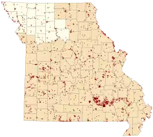
Map of Missouri conservation areas with the Northwest region highlighted
Notes
- Acreage and counties from MDCLand GIS file
- Names, descriptions, and locations from Conservation Atlas Online GIS file
Lotts Creek Conservation Area was sold to private individuals in 2018. It is not open to the public.
References
- "MDCland" (shapefile). Missouri Department of Conservation. 2007-01-01.
- "Google Earth File". Conservation Atlas Online. Missouri Department of Conservation. 2007-06-18. Archived from the original on 2010-08-12.
This article is issued from Wikipedia. The text is licensed under Creative Commons - Attribution - Sharealike. Additional terms may apply for the media files.