List of crossings of the Lower Passaic River
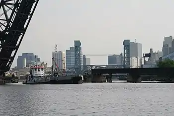
The Lower Passaic River in New Jersey is the section of the Passaic River below the Great Falls which flows over the Dundee Dam to the river mouth at Newark Bay in the northeastern part of the state. Its midpoint generally delineates the Essex-Hudson and Passaic-Bergen county lines. Numerous spans, mostly moveable bridges, have been built over of the lower reaches of the river, which is tidally influenced to the dam at about mile point (MP) 17.4 and channelized to about MP 17. Once one of the most heavily used waterways in the Port of New York and New Jersey, it remains partially navigable for commercial marine traffic. While requests have significantly diminished since the mid-late 20th century, the bridge at MP 11.7 and those downstream from it are required by federal regulations to open with advance notice, with the exception of the first at MP 1.8, which is manned and opens on demand.

Early fixed crossings included turnpikes, sometimes built as plank roads. Wood, and later, metal bridges were constructed by competing railroads to access railyards, carfloat operations, passenger terminals, and ferries on the Hudson Waterfront. Rail lines led to further industrialization, urbanization-suburbanization, and the construction of vehicular bridges and streetcar lines. The advent of automobile age in the early and mid 20th century saw the building of highway bridges.
The Acquackanonk Bridge was dismantled in 1776 as George Washington retreated from Fort Lee. Another with the same name at the crossing was lost to flooding in 1903. The first railroad swing bridge in the United States was built in 1833. Numerous bridges have been demolished or fallen into disuse, while others have had their swing spans removed, replaced or immobilized. The first new bridge to be built since 2002, the Passaic River Crossing, opened in 2014.[1]
Crossings
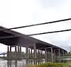


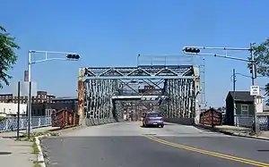
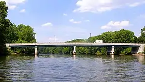
.jpg.webp)
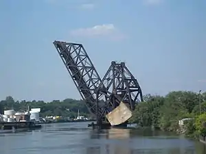
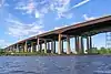
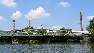
.tiff.png.webp)
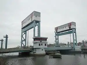

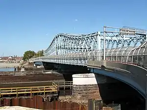
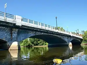
.tiff.png.webp)


Abbreviations
- CNJ=Central Railroad of New Jersey
- CSXT=CSX Transportation
- DL&W=Delaware, Lackawanna and Western Railroad
- Erie=Erie Railroad
- H&M=Hudson and Manhattan Railroad
- NRHP=National Register of Historic Places
- NJDOT=New Jersey Department of Transportation
- NJRHP=New Jersey Register of Historic Places
- NJT=New Jersey Transit
- NYS&W=New York, Susquehanna and Western Railway
- NS=Norfolk Southern Railway
- PATH=Port Authority Trans-Hudson
- PRR=Pennsylvania Railroad
- PS=Public Service Railway
See also
Notes
- Grant, Meghan. "Expanded Route 3 bridge reopened". Retrieved December 8, 2016.
- "New Jersey Coverage Map". Bridgehunter. Retrieved December 10, 2016.
- "CNJ - PD Draw". Retrieved December 8, 2016.
- "An Unusual Bridge-Moving Operation", Popular Mechanics Magazine, Hearst Magazines, p. 26, July 1912, retrieved August 8, 2012
- "Portway-Passaic River Crossing" (PDF). FY 2010-2011 Studies and Development. NJDOT. Retrieved August 8, 2012.
This project will study Doremus Avenue, Passaic River Crossing and Central Avenue over Route 1&9T as one project because of their connectivity. The areas of the project service industrial and commercial facilities in a section of Newark and the southern section of Kearny. The purpose of the proposed improvement is to create a connection with NJ Turnpike at Interchange 15E and Route 1&9T, and/or another variation of the two. The improved section will serve to improve access to/from trucking distribution facilities along Doremus Avenue and the NJ Turnpike and will help reduce truck traffic on Route 1&9T. It will range from replacing the existing Route 1&9T bridge to providing dual bridge structures. The reconfiguration of Central Avenue/Route 1&9T interchange may provide four 12-foot travel lanes and two 12-foot shoulders to improve flow and safety. The proposed geometry will primarily follow the existing alignment except at the interchange. Sidewalks could be provided within the proposed berm. A rail crossing on the same facility will also be investigated as part of this project.
- "Lower Passaic River Restoration Project Commercial Navigation Analysis 2nd revision" (PDF). United States Army Corps of Engineers. July 2, 2010. Retrieved August 5, 2012.
The abutments of a formerly utilized railroad freight bridge (Central Railroad of NJ) lie at approximately RM 1.2. These abutments limit channel width to 145 feet. However, NJDOT is currently investigating the feasibility of a new Lower Passaic River Bridge within the existing alignment of the former railroad freight bridge. If construction of the new bridge was to move forward, the derelict structure at RM 1.2 would be removed and would be replaced with a structure designed with adequate horizontal and vertical clearance for typical vessel traffic on the Lower Passaic River
- "Interim Bridge Report" (PDF). NJDOT. August 9, 2007. Retrieved December 1, 2016.
- "National Bridge Inventory NJ2015". Federal Highway Administration. 2015. Retrieved January 10, 2017.
- "Passaic River Bridge". Retrieved December 8, 2016.
- "To Close Road, Open New Span". The New York Times. January 23, 1941. Retrieved December 8, 2016.
- "U.S. Route 1-9 Truck straight line diagram" (PDF). NJDOT. Retrieved December 21, 2016.
- Federal Highway Administration (2012). "NBI Structure Number: 0901150". National Bridge Inventory. Federal Highway Administration.
- Federal Highway Administration (2012). "NBI Structure Number: 0704150". National Bridge Inventory. Federal Highway Administration.
- "CRCX - Point No Point Bridge". Retrieved December 8, 2016.
- Staff. "Route 700 Straight Line Diagram" (PDF). NJDOT. Retrieved March 25, 2016.
- "Jackson Street Bridge". Retrieved December 8, 2016.
- "Civil Engineering Feat Old Bridge Removed and New One Substituted in 18 1/2 Minutes Crosses the Passaic" (PDF), The New York Times, July 24, 1899, retrieved August 25, 2012
- "Bridge Street Bridge". Retrieved December 8, 2016.
- "NJT - Newark Draw". Retrieved December 8, 2016.
- "Stickel Bridge -". Retrieved December 8, 2016.
- "Clay Street Bridge". Retrieved December 8, 2016.
- "Erie - NX Bridge". Retrieved December 8, 2016.
- "NJT - WR Draw". Retrieved December 8, 2016.
- "Belleville Turnpike Bridge". Retrieved December 8, 2016.
- "Avondale Bridge". Retrieved December 8, 2016.
- "NJT - Lyndhurst Draw". Retrieved December 8, 2016.
- "Route 3 straight line diagram" (PDF). NJDOT. Retrieved December 21, 2016.
- "Masonry and Metal: The Historic Bridges of Bergen County, New Jersey" (PDF). Richard Grubb and Associates. 2008. Archived from the original (PDF) on July 10, 2012. Retrieved May 18, 2017.
- "Passaic River Bridge". Retrieved December 8, 2016.
- "EL - Passaic River Bridge". Retrieved December 8, 2016.
- Bianculli, Anthony J. (2001). Trains and Technology: The American Railroad in the Nineteenth Century. 4. University of Delaware Press. ISBN 9780874138030.
The first railroad drawbridge in the United States was built by the Paterson and Hudson River Railroad across the Passaic River in New Jersey in 1832
- https://timesmachine.nytimes.com/timesmachine/1934/11/18/95497819.pdf
- Brydon, Norman F. (December 2006). "Passaic County's Covered Bridges (Extracted frcm Of Time, Ftre and the River:The Story of New Jersey's Covered Bridges)" (PDF). Vol. 6. The Fassaie County Historical Society by Norman F. Brydon). Archived from the original (PDF) on June 24, 2016. Retrieved February 9, 2017. Cite magazine requires
|magazine=(help) - "Gregory Avenue Bridge". Retrieved December 8, 2016.
- "Masonry and Metal The Historic Bridges of Bergen County, New Jersey" (PDF). Richard Grubb and Associates. 2008. Archived from the original (PDF) on July 10, 2012. Retrieved August 21, 2012.
- Scott, William W. How Washington's Retreat Became Stabilized at Passaic Passaic County Historical Publication September 1, 1931 Archived December 19, 2015, at the Wayback Machine
- "Passaic, New Jersey Revolutionary War Sites - Passaic Historic Sites". revolutionarywarnewjersey.com. Retrieved September 28, 2015.
- "Full text of "Washington and his army at Acquackanonk : an incident of the retreat of 'seventy-six"". archive.org. Retrieved September 28, 2015.
- http://bridgehunter.com/nj/passaic/1600004/
- https://bridgehunter.com/nj/bergen/passaic-river/
- https://timesmachine.nytimes.com/timesmachine/1885/07/10/103630028.pdf
- "Monroe Street Bridge". Retrieved December 8, 2016.
- http://www.bridgesnyc.com/tag/monroe-street/
- "THE BRIDGE TORN DOWN; THE ERIE'S PROPERTY DESTROYED BY ITS RIVAL'S WORKMEN. FIVE HUNDRED HUNGARIANS PLUNGE INTO THE CANAL AFTER THE FLOATING TIMBER--A COMPROMISE.", The New York Times, July 11, 1885
- "Archived copy". Archived from the original on January 5, 2017. Retrieved January 5, 2017.CS1 maint: archived copy as title (link)
Sources
- "Lower Passaic River Restoration Project Commercial Navigation Analysis" (PDF). (2nd Revision). United States Army Corps of Engineers. July 2, 2010. Retrieved August 20, 2012.
- "Historic Bridge Survey (1991-1994)". NJDOT. 2001. Retrieved August 21, 2012.
- "New Jersey and National Registers of Historic Places". NJ DEP - State Historic Preservation Office. Retrieved August 21, 2012.
- "Masonry and Metal The Historic Bridges of Bergen County, New Jersey" (PDF). Richard Grubb and Associates. 2008. Archived from the original (PDF) on July 10, 2012. Retrieved August 21, 2012.
- "33 CFR 117.739 - Passaic River". Code of Federal Regulations. Coast Guard, Department of Homeland Security. Archived from the original on August 12, 2014. Retrieved August 21, 2012.
updated to July 1, 2010
- "Section 117.739 - Passaic River" (PDF). Code of Federal Regulations Title 33 - Navigation and Navigable Waters Volume: 1. Government Publishing Office. July 1, 2002. Retrieved August 21, 2012.
- Report of the Assembly Committee Appointed to Inquire into the Condition of the Bridges over the Passaic and Hackensack Rivers in the Counties of Union, Essex, Hudson (Report). Trenton: New Jersey Assembly. 1865.
- "Bridges over the Passaic River". Passaic River Basin. Retrieved August 21, 2012.
- "Drawbridge Schedules". NJDOT. April 12, 2012. Retrieved August 21, 2012.
- "Bridgehunter: Passaic River". Retrieved August 21, 2012.
- "Bridgesnyc". Retrieved August 21, 2012.
- "FAQS about Recreational Boating on the Lower Passaic River". Passaic River Boat Club. Retrieved August 25, 2012.
- Jag9889. "Passaic River Bridges". Flickr. Retrieved August 25, 2012.
- "National Bridge Inventory Database". Retrieved August 21, 2012.
- "Passaic River, New Jersey" (PDF). Report of Channel Conditions 100 to 400 Feet Wide (ER 1130-2-306). US Army Corps of Engineers. September 14, 2010. Retrieved November 11, 2012.
- "Route 3 Passaic River Crossing". NJDOT. August 11, 2011. Retrieved August 25, 2012.
- "Acquakanonk Bridge". Revolutionary War in New Jersey. Retrieved August 8, 2012.
- Olsen, Kevin K. (2008), A Great Conveniency A Maritime History of the Passaic River, Hackensack River, and Newark Bay, American History Imprints, ISBN 9780975366776
- DeLeuw, Cather and Company Engineering Science, Inc. (prepared for NJ Transit and NJDPA) (1991). Historic Railroad Bridge Survey (Report).CS1 maint: multiple names: authors list (link)
- Survey, U. S. Coast and Geodetic (May 8, 1918). "United States Coast Pilot: Atlantic Coast, Section B, Cape Cod to Sandy Hook". U.S. Government Printing Office – via Google Books.
External links
Ensslin, John C. (September 30, 2012), Many Bergen County bridges nearing end of lifespan, retrieved October 3, 2012
- "Passaic River". BridgesNYC. Retrieved December 8, 2016.
- "Bridges On The Passaic". www.urbanindustrialimaging. Retrieved December 8, 2016.