List of hills of the Schönbuch
This list of hills of the Schönbuch contains an almost complete selection of the hills, high points and spurs or subpeaks of the Schönbuch, a forest region in the south German Keuper Uplands, and of the Schönbuch Nature Park within the German state of Baden-Württemberg.
The table below is organised in order of height in metres above sea level (NHN), but some of the columns are sortable by clicking on the symbol in the respective header.
The abbreviations used in the table are explained below.
| Hill or high point | Height (m)[1] |
Location | Counties * |
Part of (see Remarks) * |
|---|---|---|---|---|
| Bromberg | 582.6 | In the centre of the Schönbuch between Entringen and Altdorf | BB | Hermitage Former chapel, Schonwald Diebsteig, Wagner military cemetery (on the Gr. Goldersbach stream) |
| Stellberg | 580.3[2] | on the western edge of the Schönbuch 3.5 km northeast of Herrenberg | BB | Recultivated rubbish and soil tip, former quarry |
| Steingart | 566.1 | In the centre of the Schönbuch between Entringen and Weil | TÜ | |
| Kapf | 566.0 | North-northwest of Mönchberg | BB | |
| Grafenberg | 560.9 | North of Kayh | BB | Grafenberg NR (23.9 ha; 480–560 m; 19 August 1969) |
| Kirnberg | 558.9 | Northwestern spur of the Bromberg | BB | |
| Rötelberg | 555.5 | Part of the Rohrauer Köpfe southeast of Rohrau | BB | |
| Schönbuchspitz | 546.1 | North-northeast of Entringen | TÜ | Schönbuch-Westhang/Ammerbuch NR (459.0 ha; 360–540 m; 15 November 2000) (with the Pfaffenkopf in front to the south) |
| Burgberg Breitenholz | 543.1 | East-northeast of Breitenholz | TÜ | Müneck Castle, Schönbuch-Westhang/Ammerbuch NR (459.0 ha; 360–540 m; 15 November 2000) |
| Falkenkopf | 532.2 | Southwestern spur of the Bromberg | BB | |
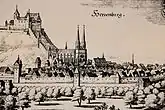
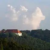
| Palace ofberg Herrenberg | 522.8 | In Herrenberg | BB | Herrenberg Palace |
| Palace ofberg Rohrau | 520 | Part of the Rohrauer Köpfe, western spur of the Rötelberg, south of Rohrau | BB | lost castle of Rohrau |
| Hornkopf | 515.2 | North of Hagelloch | TÜ | |
| Schlossberg Entringen | 509.9 | East of Entringen | TÜ | Palace of Hohenentringen, Schönbuch-Westhang/Ammerbuch NR (459.0 ha; 360–540 m; 15 November 2000) |
| Eichenfirst | 502.0 | In the centre of the Schönbuch between Dettenhausen and Pfrondorf | RT, TÜ | Schaich Valley NR (205.9 ha; 320–360 m; 23 February 1995), Eisenbachhain NR (8.3 ha; 470–490 m; 23 August 1937) |
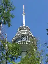
| Betzenberg | 499.5 | South-southwest of Glashütte | BB, ES | Waldenbuch Transmission Tower, Celtic quadrangular schanze, Schaich valley NR (205.9 ha; 320–360 m; 23 February 1995), Betzenberg Forest Educational Trail |
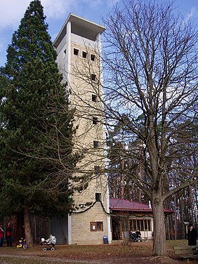
| Steinenberg (Tübingen) | 492.0 | On the northwestern perimeter of Tübingen | TÜ | Steinenberg Tower (OT) |
| Günzberg | 490.5 | West-southwest of Dettenhausen | <!—in the county to the west --> BB | |
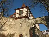
| Kapellenberg (Wurmlinger Berg) | 475 | Southwest of Tübingen, east of Hirschau | TÜ | St. Remigius Chapel (Wurmlingen Chapel) |
| Spitzberg | 474.4 | Southwest of Tübingen, northeast of Hirschau | TÜ | Former castle of Ödenburg, Hirschauer Berg NR (22.2 ha; 375–470 m; 30 July 1980), Spitzberg - Ödenburg NR (9.9 ha; 280–427 m; 22 October 1990) (Spitzberg is south of the Schönbuch) |
| Uhlberg | 469.6 | Between Plattenhardt and Neuenhaus | ES | Uhlberg Tower (OT) |
| Kirnberg | 464.6 | east of Bebenhausen | TÜ | Geological trail |
| Schlossberg Unterjesingen | 456.8 | North of Unterjesingen | TÜ | Roseck Palace, Schönbuch-Westhang/Ammerbuch NR (459.0 ha; 360–540 m; 15 November 2000) |
| Schaichberg | 456.0 | Northwest of Häslach | ES, RT | Schaichberg Tower (WT), Schaich Valley NR (205.9 ha; 320–360 m; 23 February 1995), Sulzeiche NR (1.9 ha; 445–455 m; 16 November 1981) |
| Österberg | 437.9 | In Tübingen | TÜ | Österberg Tower (former OT) |
| Dürrenberg | 433.1 | Southwest of Rübgarten | RT | |
| Keßlerhau (local name) | 417.2 | West of Waldenbuch | BB | Neuweiler Viehweide NR (13.5 ha; 370–417.2 m; 3 January 1984) |
| Steinenberg (Aichtal) | 383.1 | Between Neuenhaus and Aich | ES | Aich Viaduct |
Abbreviations and key
The abbreviations used in the table (alphabetically sorted) mean:
|
Counties:
|
Other:
|
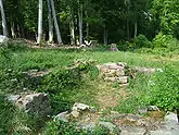
The Part of column usually gives details of the local nature reserve, which is almost never on the hilltop, but on its sides or at its foot. The area in hectares, height in metres (m) above Normalhöhennull (NHN) and the date of foundation are given.
References
- Map services of the Federal Agency for Nature Conservation
- Measurement undertaken by the Landratsamt Böblingen over 5 control survey points in 2016