List of historic places in Regional Municipality of Niagara
This is a list of historic places in Regional Municipality of Niagara, Ontario, containing heritage sites listed on the Canadian Register of Historic Places (CRHP), all of which are designated as historic places either locally, provincially, territorially, nationally, or by more than one level of government.
List of historic places
| Name | Address | Coordinates | IDF | IDP | IDM | Image | |
|---|---|---|---|---|---|---|---|
| 36 Concession Road | 36 Concession, Fort Erie, ON | 42°53′58″N 78°55′31″W | 16358 |  | |||
| 202 Dufferin Street | 202 Dufferin Street, Fort Erie, ON | 42°55′50″N 78°55′09″W | 15922 | | |||
| Fort Erie National Historic Site of Canada | 350 Lakeshore Road, Fort Erie, ON | 42°53′36″N 78°55′26″W | 12103 | 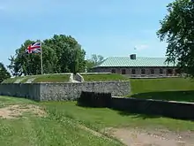 | |||
| Frenchman's Creek National Historic Site of Canada | Niagara River Parkway, Fort Erie, ON | 42°55′35″N 78°56′32″W | 13036 | 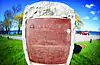 | |||
| The Kraft House | 3347 Bowen, Fort Erie, ON | 42°56′00″N 79°02′33″W | 16344 | | |||
| Point Abino Light Tower National Historic Site of Canada | Point Abino Road, Fort Erie (Crystal Beach), ON | 42°50′08″N 79°05′43″WPoint Abino Light Tower National Historic Site of Canada) | 12102 | 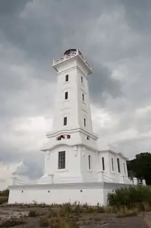 | |||
| Ridgeway Battlefield National Historic Site of Canada | Garrison Road (Highway 3), Fort Erie, ON | 42°54′14″N 79°02′31″W | 16025 | 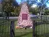 | |||
| Smith-Geddes House | 390 Main Street West, Grimsby, ON | 43°11′43″N 79°36′04″W | 10572 | | |||
| Alexander-Robinson House | 3289 St. Paul Avenue, Niagara Falls, ON | 43°08′38″N 79°06′04″W | 9748 | | |||
| Bampfield Hall | 4761 Zimmerman Avenue, Niagara Falls, ON | 43°06′18″N 79°03′44″W | 9865 | 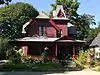 More images | |||
| Battle of Chippawa National Historic Site of Canada | south of the town of Chippawa on the west side of the Niagara River Parkway, Niagara Falls, ON | 43°03′10″N 79°01′27″W | 12972 | 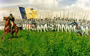 More images | |||
| Battle of Lundy's Lane National Historic Site of Canada | Four-block area of town; marker in Drummond Hill Cemetery, Niagara Falls, ON | 43°05′21″N 79°05′45″W | 12081 | 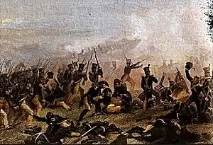 More images | |||
| Buchner House | 6172 Buchner Place, Niagara Falls, ON | 43°05′19″N 79°05′51″W | 9749 | | |||
| Chippawa Town Hall | 8196 Cummington Square, Niagara Falls, ON | 43°03′34″N 79°03′02″W | 9750 | 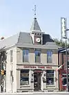 More images | |||
| Church Residence | 3000 Portage Road, Niagara Falls, ON | 43°07′49″N 79°05′51″W | 9752 | | |||
| Copper Beech Tree | 6110 Lundy's Lane, Niagara Falls, ON | 43°05′23″N 79°05′45″W | 9753 | | |||
| Cummington Square | 8191 Cummington, Niagara Falls, ON | 43°03′34″N 79°03′02″W | 9754 | 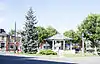 More images | |||
| Danner-Sherk House | 12549 Niagara River Parkway, Niagara Falls, ON | 43°00′01″N 79°01′44″W | 9755 | | |||
| Doran-Marshall Residence | 4851 River Road, Niagara Falls, ON | 43°06′14″N 79°03′44″W | 9757 | 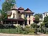 More images | |||
| Egerton Morden House | 6145 Corwin Avenue, Niagara Falls, ON | 43°05′02″N 79°06′30″W | 9759 | | |||
| First Bampfield House | 4325 Bampfield Street, Niagara Falls, ON | 43°06′06″N 79°03′51″W | 9760 | 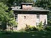 More images | |||
| Fralick's Tavern | 6137 Lundy's Lane, Niagara Falls, ON | 43°05′23″N 79°05′47″W | 9761 | .JPG.webp) More images | |||
| Glenview Mansion | 4223 Terrace, Niagara Falls, ON | 43°06′44″N 79°03′49″W | 9762 | | |||
| Holy Trinity Church | 7820 Portage Road, Niagara Falls, ON | 43°03′45″N 79°03′26″W | 9763 | | |||
| J. Ingles House | 6151 Culp Street, Niagara Falls, ON | 43°05′10″N 79°05′47″W | 9774 | | |||
| John Thomson Jr. House | 4891 Portage Road, Niagara Falls, ON | 43°06′13″N 79°05′35″W | 9775 | | |||
| Laura Secord House | 3800 Bridgewater Street, Niagara Falls, ON | 43°03′31″N 79°03′08″W | 9866 | 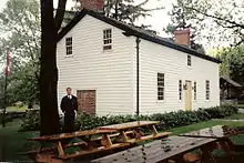 | |||
| Lyon's Creek Church | 7906 Schisler Road, Niagara Falls, ON | 43°00′12″N 79°07′39″W | 9776 | | |||
| Mitchell Cottage | 3360 St. Patrick Avenue, Niagara Falls, ON | 43°07′47″N 79°06′06″W | 9777 | | |||
| Nathaniel Dett Chapel | 5674 Peer, Niagara Falls, ON | 43°05′16″N 79°05′18″W | 9778 |  | |||
| Navy Island National Historic Site of Canada | Niagara Parkway, Niagara Falls, ON | 43°03′23″N 79°00′42″W | 16122 | ||||
| Niagara Falls Armoury | 5049 Victoria Avenue, Niagara Falls, ON | 43°06′04″N 79°04′26″W | 4347 | 9870 | 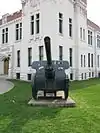 | ||
| Niagara Falls Carnegie Library | 5017 Victoria Avenue, Niagara Falls, ON | 43°06′06″N 79°04′24″W | 9744 | 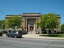 | |||
| Old Imperial Bank | 4190 Bridge Street, Niagara Falls, ON | 43°06′31″N 79°03′42″W | 9782 | 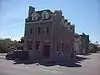 More images | |||
| Old St. John's Anglican | 3394 Portage Road, Niagara Falls, ON | 43°07′25″N 79°05′57″W | 9785 | | |||
| Old St. John's Anglican Church (Stamford) | 3428 Portage Road, Niagara Falls, ON | 43°07′25″N 79°05′57″W | 10543 | [[File: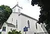 | |||
| Old Stamford Town Hall | 5810 Ferry Street, Niagara Falls, ON | 43°05′22″N 79°05′28″W | 9787 | .JPG.webp) More images | |||
| Orchard Cadham House | 6023 Culp Street, Niagara Falls, ON | 43°05′10″N 79°05′39″W | 9788 | | |||
| Oswald House | 2922 St. Paul Avenue, Niagara Falls, ON | 43°08′42″N 79°06′03″W | 9789 | | |||
| Post Office and Customs House | 4177 Park Street, Niagara Falls, ON | 43°06′28″N 79°03′42″W | 9791 | | |||
| R. Nathaniel Dett British Methodist Episcopal Church National Historic Site of Canada | 5674 Peer Street, Niagara Falls, ON | 43°05′16″N 79°05′19″W | 13333 | 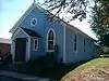 More images | |||
| Russell Cottage | 3174 St. Patrick, Niagara Falls, ON | 43°07′36″N 79°06′05″W | 9790 | | |||
| Toronto Power Generating Station National Historic Site of Canada | Niagara Parkway, Niagara Falls, ON | 43°04′18″N 79°04′26″W | 11954 | 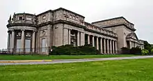 More images | |||
| Via Railway Station | 4267 Bridge Street, Niagara Falls, ON | 43°06′31″N 79°03′46″W | 4624 | 9792 | 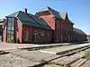 More images | ||
| Whirlpool House | 3011 Portage Road, Niagara Falls, ON | 43°07′48″N 79°05′54″W | 9793 | [[File: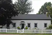 Whirlpool House, Niagara Falls, ON | |||
| Willoughby Township Hall | 11211 Sodom Road, Niagara Falls, ON | 43°00′57″N 79°03′32″W | 9794 | | |||
| Battlefield of Fort George National Historic Site of Canada | Queen Street, Niagara-on-the-Lake, ON | 43°15′18″N 79°06′29″W | 15905 | 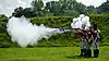 More images | |||
| Fort George National Historic Site of Canada | Queen's Parade Road, Niagara-on-the-Lake, ON | 43°14′55″N 79°03′40″W | 7613 | 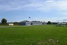 More images | |||
| Blockhouse 1 | Fort George, Niagara-on-the-Lake, ON | 43°14′52″N 79°03′44″W | 4798 | | |||
| Blockhouse 2 | Fort George, Niagara-on-the-Lake, ON | 43°15′03″N 79°03′40″W | 4799 |  More images | |||
| Blockhouse 3 | Fort George, Niagara-on-the-Lake, ON | 43°15′03″N 79°03′41″W | 4800 | 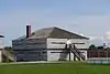 More images | |||
| Brock's Monument | Queenston Heights National Historic Site of Canada, Niagara-on-the-Lake, ON | 43°09′36″N 79°03′11″WBrock's Monument) | 9813 | 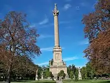 More images | |||
| Butler's Barracks National Historic Site of Canada | Queen's Parade, Niagara-on-the-Lake, ON | 43°14′51″N 79°04′07″W | 7824 | | |||
| Commissariat Storehouse | Queen's Parade, Niagara-on-the-Lake, ON | 43°14′51″N 79°04′10″W | 4814 | | |||
| Eagleson-Buyers House | 433 Regent, Niagara-on-the-Lake, ON | 43°15′01″N 79°04′38″W | 16355 | 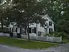 | |||
| Field House | 15284 Niagara River Parkway, Niagara-on-the-Lake, ON | 43°12′07″N 79°03′24″W | 9635 | | |||
| Fort Drummond National Historic Site of Canada | Fort Drummond, Niagara-on-the-Lake, ON | 43°09′35″N 79°03′11″W | 14547 | | |||
| Fort George National Historic Site, Artificer’s and Blacksmith Shop | Fort George, Niagara-on-the-Lake, ON | 43°14′52″N 79°03′44″W | 4803 | | |||
| Fort Mississauga National Historic Site of Canada | 223 Queen Street, Niagara-on-the-Lake, ON | 43°15′39″N 79°04′43″W | 7616 | 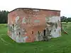 | |||
| Guardhouse / Orderly Room | Fort George, Niagara-on-the-Lake, ON | 43°14′52″N 79°03′44″W | 4810 | | |||
| Gunshed | Queen's Parade, Butler's Barracks, Niagara-on-the-Lake, ON | 43°14′51″N 79°04′10″W | 4815 | | |||
| Junior Commissariat Officer's Quarters | Butler's Barracks, Niagara-on-the-Lake, ON | 43°14′57″N 79°04′25″W | 9950 | | |||
| Lockhart-Moogk House | 289 Simcoe, Niagara-on-the-Lake, ON | 43°15′21″N 79°04′44″W | 15927 | 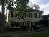 | |||
| McDougal-Harrison House | 165 Queen, Niagara-on-the-Lake, ON | 43°15′27″N 79°04′34″W | 14508 | | |||
| Men's Two-Storey Barracks | Butler's Barracks, Niagara-on-the-Lake, ON | 43°14′52″N 79°04′28″W | 9949 | | |||
| Mississauga Point Lighthouse National Historic Site of Canada | Fort Mississauga, Niagara-on-the-Lake, ON | 43°15′41″N 79°04′37″W | 12012 |  | |||
| Moore-Bishop-Stokes House | 244 King, Niagara-on-the-Lake, ON | 43°15′14″N 79°04′18″W | 15833 | 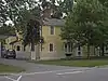 | |||
| Navy Hall | Fort George, Niagara-on-the-Lake, ON | 43°14′52″N 79°03′44″W | 4759 | 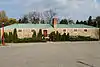 More images | |||
| Niagara Apothecary National Historic Site of Canada | 5 Queen Street, Niagara-on-the-Lake, ON | 43°15′18″N 79°04′16″WNiagara Apothecary National Historic Site of Canada) | 9169 | 10540 | 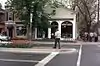 More images | ||
| Niagara District Court House | 26 Queen Street, Niagara-on-the-Lake, ON | 43°15′17″N 79°04′17″W | 10406 | 8181 | 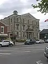 More images | ||
| Niagara Historical Society Museum | 43 Castlereagh Street, Niagara-on-the-Lake, ON | 43°15′07″N 79°04′18″W | 16187 | | |||
| Niagara-on-the-Lake National Historic Site of Canada | District covering 25 city blocks; includes more than 90 residential, commercial, ecclesiastical and institutional buildings constructed between 1815 and 1859, Niagara-on-the-Lake, ON | 43°15′17″N 79°04′15″W | 14623 | 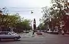 | |||
| Octagonal Blockhouse | Fort George, Niagara-on-the-Lake, ON | 43°14′52″N 79°03′44″W | 4802 | 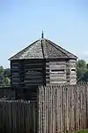 More images | |||
| Officers' Kitchen | Fort George, Niagara-on-the-Lake, ON | 43°14′51″N 79°03′44″W | 4806 | 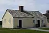 More images | |||
| Officers' Quarters | Fort George, Niagara-on-the-Lake, ON | 43°14′52″N 79°03′44″W | 4808 | | |||
| Powder Magazine | Fort George, Niagara-on-the-Lake, ON | 43°15′03″N 79°03′41″W | 10730 | | |||
| Powder Magazines | Fort Mississauga, Niagara-on-the-Lake, ON | 43°15′41″N 79°04′37″W | 10134 | 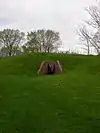 More images | |||
| Powell-Wisch House | 433 King, Niagara-on-the-Lake, ON | 43°15′00″N 79°04′32″W | 16186 | | |||
| Queenston-Chippawa Hydro-Electric Development National Historic Site of Canada | , Niagara-on-the-Lake (Queenston), ON | 43°08′47″N 79°02′41″W | 17706 | 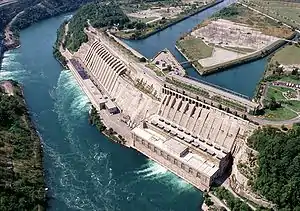 More images | |||
| Queenston Heights National Historic Site of Canada | Niagara Parkway at Portage Road, Niagara-on-the-Lake (Queenston), ON | 43°09′36″N 79°03′10″W | 7677 | 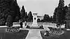 More images | |||
| Secord Mill | 137 Four Mile Creek, Niagara-on-the-Lake, ON | 43°09′09″N 79°06′15″W | 16359 | | |||
| Tower | Fort Mississauga, Niagara-on-the-Lake, ON | 43°15′42″N 79°04′37″W | 9784 | | |||
| Vrooman's Battery National Historic Site of Canada | 14759 and 14767 Niagara Parkway, Niagara-on-the-Lake, ON | 43°09′49″N 79°03′24″W | 17421 | | |||
| Willowbank National Historic Site of Canada | 14487 Niagara Parkway, Niagara-on-the-Lake, ON | 43°10′04″N 79°03′39″W | 6426 | 8674 | 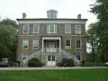 | ||
| Augustine House | 145 Main Street West, Port Colborne, ON | 42°54′03″N 79°15′00″W | 8961 |  | |||
| Humberstone Township Hall | 76 Main Street West, Port Colborne, ON | 42°54′03″N 79°14′52″W | 8964 |  | |||
| Ingleside | 322 King Street, Port Colborne, ON | 42°53′20″N 79°15′06″W | 9661 | | |||
| Ott House | 518 King Street, Port Colborne, ON | 42°54′05″N 79°14′26″W | 8974 | | |||
| Reformed Mennonite Meeting House | 269 Killaly Street West, Port Colborne, ON | 42°53′30″N 79°15′39″W | 8976 |  | |||
| Roselawn | 296 Fielden Street, Port Colborne, ON | 42°53′17″N 79°15′26″W | 12912 | 8977 | .JPG.webp) | ||
| St. James Rectory | 346 Catharine Street, Port Colborne, ON | 42°53′19″N 79°15′11″W | 9858 | | |||
| Sherkwood | 1271 Sherk Road, Port Colborne, ON | 42°53′48″N 79°10′25″W | 9857 |  | |||
| Thomas Euphronius Reeb House | 380 King Street, Port Colborne, ON | 42°53′21″N 79°15′06″W | 13244 | | |||
| Wildwood | 14 Catharine Street, Port Colborne, ON | 42°52′48″N 79°15′11″W | 9860 | | |||
| 160-168 St. Paul Street | 164 St. Paul Street, St. Catharines, ON | 43°08′47″N 79°15′26″W | 13492 | | |||
| Armoury | 81 Lake Street, St. Catharines, ON | 43°09′47″N 79°15′02″W | 10987 | | |||
| Brown-Jouppien House | 1317 Pelham Road, Short Hills Provincial Park, St. Catharines, ON | 43°06′31″N 79°17′11″W | 9640 | [[File: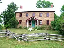 Brown-Jouppien House | |||
| Burgoyne Residence | 15 Trafalgar Street, St. Catharines, ON | 43°09′18″N 79°14′52″W | 13493 | | |||
| Davella Mills Carillon | 480 Queenston Street, St. Catharines, ON | 43°09′39″N 79°12′16″W | 13494 | 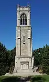 More images | |||
| Former Foghorn Building | Fort Weller lighthouse station, at the northern terminus of the Welland Canal, St. Catharines, ON | 42°28′N 81°16′W | 10477 | | |||
| Former Lighthouse Keeper's Dwelling | Fort Weller lighthouse station, at the northern terminus of the Welland Canal, St. Catharines, ON | 43°14′11″N 79°13′08″W | 10486 | | |||
| Front Range Lighthouse | Lakeside Park, St. Catharines (Port Dalhousie), ON | 43°12′15″N 79°15′58″W | 4743 | 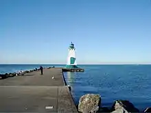 | |||
| Government of Canada Building | 32 Church Street, St. Catharines (Port Dalhousie), ON | 43°09′32″N 79°14′53″W | 10259 | | |||
| Hamilton and Scourge National Historic Site of Canada | at the bottom of Lake Ontario 11 km north of Port Dalhousie, St. Catharines, ON | 43°18′31″N 79°18′35″W | 14941 | | |||
| Keaton Manor | 1590 St. Paul Street, St. Catharines, ON | 43°08′23″N 79°18′08″W | 19850 | | |||
| Phelps-Austin House | 159 Moffatt Street, St. Catharines, ON | 43°08′59″N 79°13′26″W | 19845 | | |||
| Port Dalhousie Heritage Conservation District | Port Dalhousie peninsula, bordered on the north by Lake Ontario, on the south by Martindale Pond and Twelve Mile Creek, and on the east by the Port Dalhousie Harbour, St. Catharines (Port Dalhousie), ON | 43°12′09″N 79°15′59″W | 8348 | 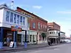 More images | |||
| Rear Range Lighttower | East Pier, St. Catharines (Port Dalhousie), ON | 43°12′15″N 79°15′58″W | 4745 |  | |||
| Robertson Public School | 83 Church Street, St. Catharines, ON | 43°09′41″N 79°14′43″W | 9802 | | |||
| Salem Chapel, British Methodist Episcopal Church National Historic Site of Canada | 92 Geneva Street, St. Catharines, ON | 43°09′54″N 79°14′24″W | 12892 | 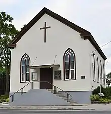 | |||
| Search and Rescue Office | Fort Weller lightstation, St. Catharines, ON | 43°14′12″N 79°13′09″W | 11367 | | |||
| VIA Rail Station | 5 Great Western Avenue, St. Catharines, ON | 43°08′52″N 79°15′22″W | 4625 | | |||
| Wood-Graham-Bacher House | 134 Church Street, St. Catharines, ON | 43°09′48″N 79°14′32″W | 9803 | | |||
| Wray's-Dufferin Block-Helliwell Block | 122 St. Paul Street, St. Catharines, ON | 43°09′24″N 79°14′42″W | 9805 | | |||
| Allanburg United Church | 2364 Centre Street, Thorold, ON | 43°04′38″N 79°12′31″W | 8385 | 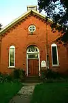 More images | |||
| Allanburg Village Cemetery | Centre Street, Thorold, ON | 43°03′34″N 79°11′57″W | 9856 | 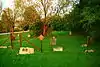 More images | |||
| Battle of Beaver Dams National Historic Site of Canada | Davis Road, Thorold, ON | 43°07′22″N 79°12′06″W | 14602 | 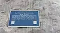 | |||
| The Beatty House | 13 Sullivan Avenue, Thorold, ON | 43°07′23″N 79°12′14″W | 18578 | | |||
| Beaverdams Methodist Church and Burying Ground | Marlatts Road, Thorold, ON | 43°06′18″N 79°13′07″W | 18581 | | |||
| Carr-Millar-McMillan Block | 31 Front Street South, Thorold, ON | 43°07′28″N 79°12′03″W | 11030 | | |||
| Flannery House | 22 Portland Street, Thorold, ON | 43°07′16″N 79°11′47″W | 11025 | | |||
| The Grenville House | 7 Queen Street, Thorold, ON | 43°07′28″N 79°12′18″W | 19839 | | |||
| Macartney Drug Store | 15 Front Street, Thorold, ON | 43°07′28″N 79°12′03″W | 18602 | | |||
| Millar House | 43 Welland Street South, Thorold, ON | 43°07′14″N 79°11′47″W | 8828 | | |||
| Munro House | 5 Ormond Street South, Thorold, ON | 43°07′09″N 79°11′57″W | 14213 | | |||
| St. Andrew's Presbyterian Church | 24 Clairmont Street, Thorold, ON | 43°07′26″N 79°11′56″W | 19797 | | |||
| Thorold's Carnegie Library | 1 Ormond Street, Thorold, ON | 43°07′30″N 79°11′56″W | 18577 | | |||
| Welland Mills | east side Pine Street N, between St. David's Street W and Albert Street, Thorold, ON | 43°07′33″N 79°12′10″W | 1197 | | |||
| Battle of Cook's Mills National Historic Site of Canada | Lyons Creek Road, Welland, ON | 43°00′02″N 79°10′22″W | 12957 | 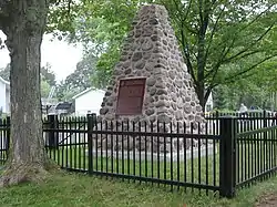 | |||
| Bridgetender's House | 44 Merritt Street, Welland, ON | 42°59′43″N 79°15′27″W | 14842 | | |||
| Brookfield-Cupido House | 271 Division, Welland, ON | 42°59′31″N 79°14′35″W | 14843 | | |||
| Central Fire Hall | 30 Hellems Avenue, Welland, ON | 42°59′30″N 79°14′48″W | 15310 | | |||
| Central United Church (Welland) | 88 King Street, Welland, ON | 42°59′23″N 79°15′03″W | 15311 | | |||
| Chaffey-Fennessy House | 52 Chaffey Street, Welland, ON | 42°58′26″N 79°14′39″W | 15312 | | |||
| Farmer's Market Building | 50 Market Square, Welland, ON | 42°59′27″N 79°14′56″W | 9659 | | |||
| Glasgow-Fortner House | 24 Burgar Street, Welland, ON | 42°59′33″N 79°14′38″W | 15313 | | |||
| Gordon-Marshall House | 155 Hellems Avenue, Welland, ON | 42°59′21″N 79°14′48″W | 15315 | | |||
| King-Hill House | 81 Bald Street, Welland, ON | 42°59′30″N 79°14′48″W | 19857 | | |||
| Lawrence-Singer House | 204 East Main Street, Welland, ON | 42°59′34″N 79°14′42″W | 15344 | | |||
| Lobosco-Foote House | 103 State Street, Welland, ON | 42°59′12″N 79°14′57″W | 15309 | | |||
| Main Street Bridge | Main Street East, Welland, ON | 42°59′30″N 79°15′02″W | 15314 | | |||
| Mizpah Mission/Italian Pentecostal Church | 400 King Street, Welland, ON | 42°59′00″N 79°15′04″W | 15345 | | |||
| Vaughan Seed Company | 111 Victoria Street, Welland, ON | 42°59′10″N 79°14′34″W | 15346 | | |||
| Welland Court House | 102 East Main Street, Welland, ON | 42°59′33″N 79°14′49″W | 15316 | 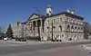 |
See also
| Wikimedia Commons has media related to Cultural heritage monuments in Ontario. |
References
This article is issued from Wikipedia. The text is licensed under Creative Commons - Attribution - Sharealike. Additional terms may apply for the media files.