List of historic places in Golden Horseshoe
This is a list of historic places in Golden Horseshoe, the region of Ontario on the northwestern and western shores of Lake Ontario. It contains heritage sites listed on the Canadian Register of Historic Places (CRHP), all of which are designated as historic places either locally, provincially, territorially, nationally, or by more than one level of government. The following areas have been separated out due to their many listings:
List of historic places in other parts of the region
Regional Municipality of Durham
| Name | Address | Coordinates | IDF | IDP | IDM | Image | |
|---|---|---|---|---|---|---|---|
| Former Bowmanville Boys Training School/Camp 30 National Historic Site of Canada | 2020 Lambs Road, Bowmanville, ON | 43°55′43″N 78°39′59″W | 19684 |  | |||
| Old Stone Church National Historic Site of Canada | 1490 Road 15 (Simcoe Street), Brock (Beaverton), ON | 44°25′35″N 79°06′57″W | 7775 | 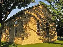 More images | |||
| 19 King Street East | 19 King Street East, Clarington, ON | 43°54′42″N 78°41′19″W | 7577 | | |||
| 210 King Street West | 210 King Street West, Clarington, ON | 43°55′00″N 78°35′34″W | 7592 | | |||
| 62-66 King Street West | 62-66 King Street West, Clarington, ON | 43°54′46″N 78°41′28″W | 7602 | | |||
| Colonel R. S. McLaughlin Armoury | 53 Simcoe Street North, Oshawa, ON | 43°53′57″N 78°51′49″W | 4801 | | |||
| Parkwood National Historic Site of Canada | 270 Simcoe Street North, Oshawa, ON | 43°54′17″N 78°52′03″W | 4300 | 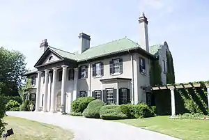 More images | |||
| Art Gallery; Former Brougham School House | 1613 Highway 7, Pickering, ON | 43°55′03″N 79°06′35″W | 13335 |  | |||
| Bentley House | 3590 Brock Road, Pickering (Brougham), ON | 43°55′06″N 79°06′24″W | 9836 |  More images | |||
| Former Atha School House | 555 8th Concession Road, Pickering, ON | 43°56′32″N 79°10′47″W | 13092 | 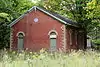 | |||
| Former Commercial Hotel | 1709 Highway 7 Road, Pickering Airport Lands, Pickering (Brougham), ON | 43°55′08″N 79°06′18″W | 12992 | 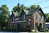 | |||
| Former Miller Residence | 1622 Highway 7 Road, Pickering (Brougham), ON | 43°55′05″N 79°06′38″W | 13041 |  | |||
| Former Mount Pleasant School House | 1503 7th Concession Road, Pickering, ON | 43°56′07″N 79°07′29″W | 13088 |  | |||
| Former Pickering Town Hall | 3545 Brock Road, Pickering, ON | 43°55′04″N 79°06′22″W | 13152 |  | |||
| Thistle Ha' Farm National Historic Site of Canada | Concession and Brock Roads, Pickering, ON | 43°56′35″N 79°06′28″W | 9632 |  More images | |||
| Former Port Perry Town Hall National Historic Site of Canada | 302 Queen Street, Scugog, ON | 44°06′12″N 78°56′50″W | 4211 | 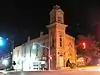 More images | |||
| Leaskdale Manse National Historic Site of Canada | Just north of St. Paul's Presbyterian Church on Durham Regional Rd., Uxbridge, ON | 44°12′11″N 79°09′38″WLeaskdale Manse National Historic Site of Canada) | 7716 |  More images | |||
| Ontario County Court House | 416 Centre Street South, Whitby, ON | 43°52′32″N 78°56′38″W | 10545 |  More images |
Regional Municipality of Halton
| Name | Address | Coordinates | IDF | IDP | IDM | Image | |
|---|---|---|---|---|---|---|---|
| Lighthouse | Burlington Canal, Burlington, ON | 43°17′54″N 79°47′43″W | 4499 | | |||
| Royal Botanical Gardens National Historic Site of Canada | 680 Plains Road West, Burlington, ON | 43°17′26″N 79°52′33″W | 11665 |  More images | |||
| Van Norman-Breckon House | 955 Century Drive, Burlington, ON | 43°23′10″N 79°45′42″W | 8908 | | |||
| VIA Rail/Canadian National Railways Station | 55 Queen Street, Georgetown, ON | 43°39′19″N 79°55′08″W | 4622 | | |||
| Acton Town Hall | 19 Willow Street North, Halton Hills, ON | 43°37′52″N 80°02′28″W | 18639 | 15009 |  | ||
| Beatty House | 98 Church Street East, Halton Hills, ON | 43°37′54″N 80°02′16″W | 15010 | | |||
| Beaumont Knitting Mill | 586 Main, Halton Hills, ON | 43°40′37″N 79°55′45″W | 15011 | | |||
| Boston Presbyterian Church | 9185 Third, Halton Hills, ON | 43°33′13″N 79°54′57″W | 15021 | 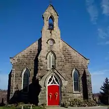 | |||
| Craiglea House | 9722 Third, Halton Hills, ON | 43°33′38″N 79°55′30″W | 15024 | | |||
| Duff House | 9690 Regional Road 25, Halton Hills, ON | 43°33′14″N 79°56′24″W | 15105 | | |||
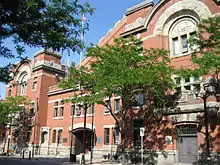
| Georgetown Public Library and Cultural Centre | 9 Church Street, Halton Hills, ON | 43°38′54″N 79°55′34″W | 15124 | 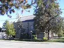 | |||
| Glen Williams Town Hall | 1 Prince, Halton Hills, ON | 43°40′14″N 79°55′33″W | 15106 | | |||
| Lilac Lawns | 475 Guelph, Halton Hills, ON | 43°38′45″N 79°51′55″W | 15131 | | |||
| Syndicate Housing Heritage Conservation District | 69 Bower, Halton Hills, ON | 43°37′57″N 80°02′24″W | 15192 | | |||
| Williams Mill/Georgetown Electric Light Company Power Plant | 515 Main, Halton Hills, ON | 43°40′12″N 79°55′34″W | 15193 | | |||
| 16 Hugh Street | 16 Hugh Street, Milton, ON | 43°30′41″N 79°53′00″W | 15217 | 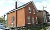 | |||
| 66 Charles Street | 66 Charles Street, Milton, ON | 43°30′45″N 79°52′51″W | 15215 |  | |||
| 151 Robert Street | 151 Robert Street, Milton, ON | 43°30′37″N 79°52′55″W | 16722 | ||||
| Bronte Pioneer Cemetery | Bronte, Milton, ON | 43°30′44″N 79°53′35″W | 15219 |  | |||
| Ebenezer United Church | 12274 Guelph Line, Milton, ON | 43°33′10″N 80°04′34″W | 15127 |  More images | |||
| Elliot House | 8445 Boston Church Road, Milton, ON | 43°32′13″N 79°53′37″W | 16725 | | |||
| John Sproat House | 191 Margaret, Milton, ON | 43°30′54″N 79°53′14″W | 16723 |  | |||
| Mayne Corners Methodist Church | 8560 Tremaine Road, Milton, ON | 43°31′09″N 79°56′10″W | 8179 | | |||
| Milton Court House | 43 Brown Street, Milton, ON | 43°30′38″N 79°53′03″W | 10538 |  | |||
| Nassagaweya Church | 3097 15 Sideroad, Milton, ON | 43°31′32″N 80°02′09″W | 15130 |  More images | |||
| St. David's Presbyterian Church | 132 Main Street North, Milton, ON | 43°29′21″N 79°59′07″W | 15148 | | |||
| Amos Biggar House | 2441 Neyagawa Boulevard, Oakville, ON | 43°27′49″N 79°44′33″W | 8428 | | |||
| Bronte Cemetery | West Street, Oakville, ON | 43°23′11″N 79°42′47″W | 15154 | | |||
| Cox Pioneer Cemetery | Wedgewood Drive, Oakville, ON | 43°27′59″N 79°38′56″W | 17222 | | |||
| Erchless Estate | 8 Navy Street, Oakville, ON | 43°26′30″N 79°40′00″W | 8169 | More images | |||
| First and Second Street Heritage Conservation District | bounded by Allan Street, Second Street, Lakeshore Road East and Lake Ontario, Oakville, ON | 43°26′52″N 79°39′39″W | 15244 | | |||
| Gairloch Gardens | 1306 Lakeshore, Oakville, ON | 43°27′44″N 79°39′02″W | 15245 |  More images | |||
| Henry Gulledge House | 167 Trafalgar, Oakville, ON | 43°26′56″N 79°40′09″W | 15247 |  | |||
| Merton-Mount Pleasant Cemetery | 2411 North Service, Oakville, ON | 43°25′01″N 79°44′01″W | 15266 |  | |||
| Munn's Cemetery | 2 Dundas, Oakville, ON | 43°28′45″N 79°43′45″W | 15268 | | |||
| Old Oakville Heritage Conservation District | bounded by Robinson Street in the south, Lake Ontario in the north, 16 Mile Creek in the east and Allan Street in the west, Oakville, ON | 43°26′37″N 79°40′00″W | 15272 | | |||
| Old Post Office Museum | 144 Front, Oakville, ON | 43°26′34″N 79°39′59″W | 15324 |  | |||
| St Mary's Cemetery | south of the intersection of Lyons Lane and South Service Road, Oakville, ON | 43°27′14″N 79°41′24″W | 15350 | | |||
| Sovereign House | 7 West River, Oakville, ON | 43°23′25″N 79°42′40″W | 15348 | |
Hamilton
| Name | Address | Coordinates | IDF | IDP | IDM | Image | |
|---|---|---|---|---|---|---|---|
| 59-63 King Street West, Dundas | 59 King Street West, Hamilton, ON | 43°15′59″N 79°57′22″W | 8267 |  More images | |||
| Auchmar | 88 Fennell Avenue, Hamilton, ON | 43°14′21″N 79°52′56″W | 8164 | 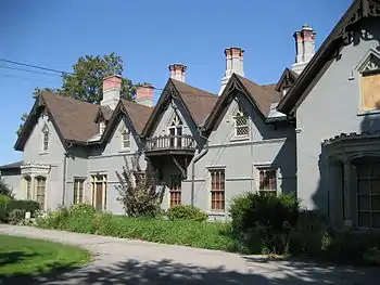 More images | |||
| Bank of Montreal | 1 Main Street West, Hamilton, ON | 43°15′19″N 79°52′12″W | 8330 | | |||
| Battle of Stoney Creek National Historic Site of Canada | 77 King Street West, Hamilton, ON | 43°13′03″N 79°45′58″W | 16143 | 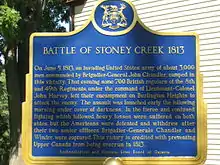 More images | |||
| Battlefield Monument – Stoney Creek Battlefield Park | 77 King St., Hamilton, ON | 43°13′05″N 79°45′59″W | 8165 | 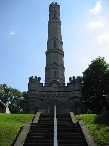 More images | |||
| Building 2 | Catherine Street North, Canadian Forces Reserve Barracks, Hamilton, ON | 43°16′28″N 79°51′17″W | 7523 | | |||
| Burlington Heights National Historic Site of Canada | 610 York Boulevard, Hamilton, ON | 43°16′19″N 79°53′09″W | 1170 |  More images | |||
| Christ's Church Cathedral | 252 James Street, Hamilton, ON | 43°15′48″N 79°51′59″W | 8167 |  More images | |||
| Church of the Ascension | 64 Forest Avenue, Hamilton, ON | 43°14′58″N 79°52′11″W | 8168 |  More images | |||
| Dundas Central School | 73 Melville Street, Hamilton (Dundas), ON | 43°16′09″N 79°57′30″W | 18023 | ||||
| Dundurn Castle National Historic Site of Canada | 610 York Street, Hamilton, ON | 43°16′10″N 79°53′03″W | 12341 |  More images | |||
| Erland Lee (Museum) Home National Historic Site of Canada | 552 Ridge Road, Hamilton, ON | 43°12′24″N 79°43′15″W | 9357 | 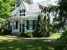 More images | |||
| Former Hamilton Customs House National Historic Site of Canada | 51 Stuart Street, Hamilton, ON | 43°15′59″N 79°52′03″W | 4000 | 10496 | 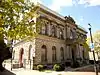 More images | ||
| Former Hamilton Railway Station (Canadian National) National Historic Site of Canada | 360 James Street North, Hamilton, ON | 43°15′57″N 79°51′54″W | 7868 6637 |
8341 | 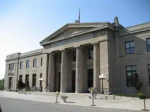 More images | ||
| Gage House – Stoney Creek Battlefield Park | 77 King St., Hamilton, ON | 43°13′05″N 79°45′59″W | 8166 | 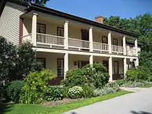 More images | |||
| Griffin House National Historic Site of Canada | 733 Mineral Springs Road, Hamilton, ON | 43°14′06″N 80°00′10″W | 12521 | | |||
| Hamilton Waterworks National Historic Site of Canada | 900 Woodward Avenue, Hamilton, ON | 43°15′24″N 79°46′18″W | 4449 | .jpg.webp) More images | |||
| HMCS Haida National Historic Site of Canada | 658 Catharine Street North, Hamilton, ON | 43°16′31″N 79°51′22″W | 7624 |  | |||
| John Weir Foote Armoury National Historic Site of Canada | 200 James Street North, Hamilton, ON | 43°15′44″N 79°51′59″W | 7626 4303 |
 More images | |||
| McKinlay-McGinty House | 232 Highway 8, Hamilton, ON | 43°16′16″N 80°01′03″W | 10514 | | |||
| McQuesten House / Whitehern National Historic Site of Canada | 41 Jackson Street West, Hamilton, ON | 43°15′17″N 79°52′19″W | 12101 |  More images | |||
| St. Paul's Presbyterian Church / Former St. Andrew's Church National Historic Site of Canada | 56 James Street South, Hamilton, ON | 43°15′17″N 79°52′12″W | 12774 | 19865 | 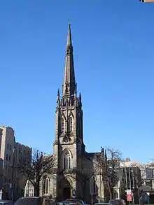 | ||
| Sandyford Place | 35 Duke Street, Hamilton, ON | 43°14′06″N 79°50′14″W | 10706 | 10566 | 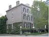 | ||
| Toronto, Hamilton & Buffalo Railway Station, Former | 36 Hunter Street East, Hamilton, ON | 43°15′11″N 79°52′08″W | 6531 |  More images | |||
| Victoria Hall National Historic Site of Canada | 68 King Street East, Hamilton, ON | 43°15′24″N 79°52′10″W | 2210 | 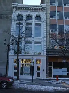 More images | |||
| Waterdown Post Office | 31 Main Street South, Hamilton, ON | 43°19′58″N 79°53′30″W | 8210 |  |
See also
| Wikimedia Commons has media related to Cultural heritage monuments in Ontario. |
References
This article is issued from Wikipedia. The text is licensed under Creative Commons - Attribution - Sharealike. Additional terms may apply for the media files.