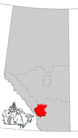
List of historic places in the Calgary Region
This article is a list of historic places in the Calgary Region, in Alberta, which have been entered into the national Register of Historic Places, which includes federal, provincial, and municipal properties. A few are in the national park system.
List
| Name | Address | Coordinates | IDF | IDP | IDM | Image | |
|---|---|---|---|---|---|---|---|
| Beaulieu National Historic Site (Lougheed House) | 707 13th Avenue SW, Calgary, AB | 51°02′25″N 114°04′37″WBeaulieu National Historic Site (Lougheed House)) | 1162 | 5147 | 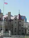 More images | ||
| E.P. Ranch | RR 2, High River, Foothills Municipal District No. 31, AB | 50°24′29″N 114°16′59″W | 1171 |  | |||
| Lougheed Block | 604 - 1 Street SW, Calgary, AB | 51°03′01″N 114°03′54″W | 8984 | 1528 | .JPG.webp) More images | ||
| Victoria Sandstone School | 411 - 11 Avenue SE, Calgary, AB | 51°02′32″N 114°03′14″W | 2100 | 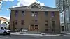 | |||
| Hay Shed | Bar U Ranch, Foothills Municipal District No. 31, AB | 50°25′15″N 114°14′45″W | 2934 | 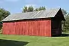 More images | |||
| Implement Shed | Bar U Ranch, Foothills Municipal District No. 31, AB | 50°25′09″N 114°15′05″W | 2935 | 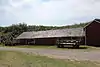 | |||
| Livestock Shed | Bar U Ranch, Foothills Municipal District No. 31, AB | 50°25′25″N 114°14′40″W | 2942 | | |||
| Percheron Box Stalls | Bar U Ranch, Foothills Municipal District No. 31, AB | 50°25′19″N 114°14′58″W | 2944 | 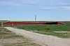 More images | |||
| Piggery | Bar U Ranch, Foothills Municipal District No. 31, AB | 50°25′25″N 114°14′39″W | 2945 | | |||
| Post Office, Building 5 | Bar U Ranch, Foothills Municipal District No. 31, AB | 50°25′10″N 114°14′50″W | 2946 | 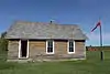 More images | |||
| Poultry Shed, Building 21A | Bar U Ranch, Foothills Municipal District No. 31, AB | 2947 | | ||||
| Poultry Building 21 | Bar U Ranch, Foothills Municipal District No. 31, AB | 50°25′16″N 114°15′14″W | 2948 | | |||
| Privy, Building 28 | Bar U Ranch, Foothills Municipal District No. 31, AB | 50°25′16″N 114°14′52″W | 2949 | .jpg.webp) | |||
| Root Cellar, Building 13 | Bar U Ranch, Foothills Municipal District No. 31, AB | 50°25′08″N 114°14′58″W | 2950 | 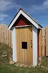 More images | |||
| Saddle Horse Barn, Building 16 | Bar U Ranch, Foothills Municipal District No. 31, AB | 50°25′10″N 114°15′03″W | 2952 | 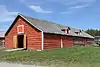 More images | |||
| Self Feeder, former Bunkhouse, Building 30 | Bar U Ranch, Foothills Municipal District No. 31, AB | 50°25′22″N 114°14′40″W | 2955 | | |||
| Abattoir | Bar U Ranch, Foothills Municipal District No. 31, AB | 50°25′17″N 114°14′51″W | 2956 | | |||
| Storage Building 10 | Bar U Ranch, Foothills Municipal District No. 31, AB | 50°25′11″N 114°14′57″W | 2957 | 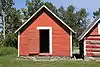 More images | |||
| Storage Building 8 | Bar U Ranch, Foothills Municipal District No. 31, AB | 50°25′11″N 114°14′57″W | 2958 | 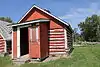 More images | |||
| Coal Shed | Bar U Ranch, Foothills Municipal District No. 31, AB | 50°25′09″N 114°14′58″W | 3097 | 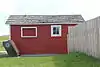 | |||
| Dairy Barn | Bar U Ranch, Foothills Municipal District No. 31, AB | 50°25′13″N 114°15′01″W | 3107 | 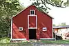 More images | |||
| Feed Mill | Bar U Ranch, Foothills Municipal District No. 31, AB | 50°25′12″N 114°14′45″W | 3116 | 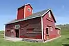 More images | |||
| Pearson's House | Bar U Ranch, Foothills Municipal District No. 31, AB | 50°25′12″N 114°15′17″W | 3117 | | |||
| Foreman's House | Bar U Ranch, Foothills Municipal District No. 31, AB | 3118 | 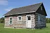 More images | ||||
| Harness Shop | Bar U Ranch, Foothills Municipal District No. 31, AB | 50°25′10″N 114°14′51″W | 3119 | 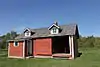 More images | |||
| Blacksmith Shop | Bar U Ranch, Foothills Municipal District No. 31, AB | 50°25′09″N 114°15′00″W | 3120 | 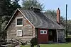 More images | |||
| Bunkhouse and Cookhouse | Bar U Ranch, Foothills Municipal District No. 31, AB | 50°25′10″N 114°14′58″W | 3121 |  More images | |||
| Storage Building 9 | Bar U Ranch, Foothills Municipal District No. 31, AB | 50°25′11″N 114°14′57″W | 3123 |  More images | |||
| Stud Horse Barn, Building 1 | Bar U Ranch, Foothills Municipal District No. 31, AB | 50°25′14″N 114°14′45″W | 3125 |  More images | |||
| Tractor Garage, Building 7 | Bar U Ranch, Foothills Municipal District No. 31, AB | 50°25′09″N 114°14′52″W | 3127 |  More images | |||
| Vehicle Garage, Building 35 | Bar U Ranch, Foothills Municipal District No. 31, AB | 3128 | | ||||
| Vehicle Garage, Building 24 | Bar U Ranch, Foothills Municipal District No. 31, AB | 3129 | | ||||
| Work Horse Barn, Building 17 | Bar U Ranch, Foothills Municipal District No. 31, AB | 50°25′10″N 114°15′05″W | 3130 | 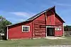 More images | |||
| Calgary Milling Company Building | 119 - 8 Avenue SW, Calgary, AB | 51°02′44″N 114°03′50″W | 3193 | 9279 | 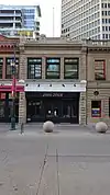 | ||
| Dr. Crawford Residence | 636 Elbow Drive SW, Calgary, AB | 51°01′44″N 114°04′34″W | 3441 | | |||
| National Hotel | 1043 - 10 Avenue SE, Calgary, AB | 51°02′29″N 114°02′13″W | 3637 |  | |||
| Alequiers | west of Longview, Foothills Municipal District No. 31, AB | 50°30′49″N 114°23′38″W | 4995 | | |||
| Anderson Apartments | 804 - 18 Avenue SW, Calgary, AB | 51°02′14″N 114°04′37″W | 5098 | 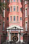 More images | |||
| Burns Building | 237 - 8 Avenue SE, Calgary, AB | 51°02′44″N 114°03′29″WBurns Building) | 5101 | 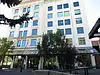 More images | |||
| Haultain School | 225 - 13 Avenue SW, Calgary, AB | 51°02′25″N 114°04′05″W | 5104 |  More images | |||
| North-West Travellers Building | 515 - 1 Street SE, Calgary, AB | 51°02′52″N 114°03′36″W | 5108 | | |||
| St. Patrick's Roman Catholic Church | 14608 Macleod Trail, Calgary, AB | 50°55′20″N 114°04′16″W | 5149 |  | |||
| Hillhurst Cottage School | 455 - 12 Avenue NW, Calgary, AB | 51°03′22″N 114°05′31″W | 5181 |  | |||
| John Snow Residence and Studio | 915 - 18 Avenue SW, Calgary, AB | 51°02′12″N 114°04′59″W | 5182 |  More images | |||
| Knox United Church | 506 - 4 Street SW, Calgary, AB | 51°02′51″N 114°04′16″WKnox United Church) | 5183 | 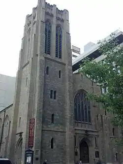 More images | |||
| William Roper Hull Ranche House | 15979 Bow Bottom Trail SE, Calgary, AB | 50°54′36″N 114°01′16″W | 5111 | 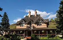 More images | |||
| A.E. Cross House | 1240 - 8 Avenue SE, Calgary, AB | 51°02′32″N 114°02′02″W | 5133 | 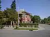 More images | |||
| Bank of Nova Scotia | 125 - 8 Avenue SW, Calgary, AB | 51°02′42″N 114°03′54″W | 5134 | .JPG.webp) More images | |||
| Colonel James Walker House | Inglewood Bird Sanctuary, Calgary, AB | 51°01′35″N 114°00′36″W | 5137 | | |||
| Hunt House (H.B.C. Log Cabin) | 806 - 9 Avenue SE,, Calgary, AB | 51°02′43″N 114°02′35″W | 5140 | _2012-09-30_11-12-31.jpg.webp) More images | |||
| Major John Stewart House | 26 New Street SE, Calgary, AB | 51°02′30″N 114°01′44″W | 5141 | | |||
| Nellie McClung House | 803 - 15 Avenue SW, Calgary, AB | 51°02′19″N 114°04′44″W | 5144 | 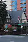 More images | |||
| Old Y.W.C.A. Building | 223 - 12 Avenue SW, Calgary, AB | 51°02′29″N 114°04′05″W | 5145 | 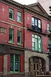 More images | |||
| Royal Canadian Legion Calgary (Alberta No. 1) Branch | 116 - 7 Avenue SE, Calgary, AB | 51°02′47″N 114°03′43″W | 5146 | _Branch.jpg.webp) More images | |||
| Thomson Brothers Block | 112 - 8 Avenue SE, Calgary, AB | 51°02′48″N 114°03′47″W | 5150 | 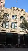 More images | |||
| Devenish Apartments | 904 to 908 - 17 Avenue SW, Calgary, AB | 51°02′19″N 114°04′44″W | 5179 | | |||
| Lacombe House | 14502 Macleod Trail South, Calgary, AB | 50°55′23″N 114°04′01″W | 5256 | | |||
| Battalion Numbers | , Calgary, AB | 51°01′17″N 114°04′16″W | 5724 | | |||
| Rutledge Hangar | 731 - 13 Avenue NE, Calgary, AB | 51°03′49″N 114°02′53″W | 5725 | | |||
| Canada Life Assurance Building | 301 - 8 Avenue SW, Calgary, AB | 51°02′44″N 114°04′05″W | 5741 |  More images | |||
| Clark Residence, The | 725 Macleod Trail, High River, AB | 50°34′36″N 113°52′59″W | 6563 | 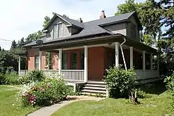 | |||
| Museum of the Highwood | 401 - 1 Street West, High River, AB | 50°34′45″N 113°52′19″W | 6564 | 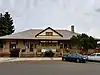 | |||
| Calgary City Hall | 700 Macleod Trail SE, Calgary, AB | 51°02′46″N 114°03′29″W | 7562 | 8981 | 9289 | .JPG.webp) More images | |
| Turner Valley Gas Plant National Historic Site | Sunset Boulevard SE, Turner Valley, AB | 50°40′22″N 114°16′52″W | 7749 | 15532 | 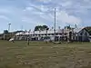 | ||
| Stephen Avenue National Historic Site | 8th Avenue, Calgary, AB | 51°02′44″N 114°03′50″W | 7774 | .JPG.webp) More images | |||
| Reader Rock Garden National Historic Site | Macleod Trail South and 25 Avenue SE, Calgary, AB | 51°01′48″N 114°03′18″W | 7915 | 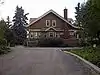 More images | |||
| Cathedral Church of the Redeemer | 210 - 7 Avenue SE, Calgary, AB | 51°02′48″N 114°03′40″W | 8039 |  | |||
| Palace Theatre | 219 - 8 Avenue SW, Calgary, AB | 51°02′45″N 114°03′58″W | 14221 | 8040 | .jpg.webp) | ||
| Imperial Bank of Canada | 102 - 8 Avenue SE, Calgary, AB | 51°02′45″N 114°03′47″W | 8081 | 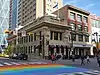 | |||
| Calgary Cattle Company Building | 117 - 8 Avenue SW, Calgary, AB | 51°02′45″N 114°03′50″W | 8082 | 9282 | 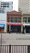 | ||
| Bank of Montreal Building | 140 - 8 Avenue SW, Calgary, AB | 51°02′44″N 114°03′50″W | 8354 | 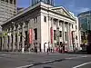 More images | |||
| Customs Examining Warehouse | 134 - 11 Avenue SE, Calgary, AB | 51°02′32″N 114°03′40″W | 8403 | 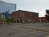 More images | |||
| Lorraine Block | 620 - 12 Avenue SW, Calgary, AB | 51°02′30″N 114°04′26″W | 8408 | 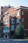 More images | |||
| Reverend George McDougall Memorial | , Calgary, AB | 51°10′15″N 114°05′35″W | 8444 | | |||
| Fort Calgary National Historic Site | 750 - 9 Ave SE, Calgary, AB | 51°02′42″N 114°02′38″W | 12522 | 8807 |  More images | ||
| Molson's (Toronto Dominion) Bank | 114 - 8 Avenue SW, Calgary, AB | 51°02′45″N 114°03′50″W | 8814 | .JPG.webp) More images | |||
| Odd Fellows Temple / Calgary Chamber of Commerce | 106 - 6 Avenue SW, Calgary, AB | 51°02′51″N 114°03′48″W | 8815 | | |||
| Dominion (Toronto Dominion) Bank | 200 - 8 Avenue SE, Calgary, AB | 51°02′44″N 114°03′40″W | 8975 |  More images | |||
| Dafoe Terrace | 1204 - 3 Street SE, Calgary, AB | 51°02′29″N 114°03′22″W | 8992 | | |||
| Fairey Terrace | 1111 - 3 Street SE, Calgary, AB | 51°02′29″N 114°03′22″W | 8993 | | |||
| Perrenoud Homestead | near Cochrane, Rocky View County, AB | 51°16′24″N 114°30′36″W | 8997 | | |||
| Glenwood Manor | 904 and 908 Memorial Drive NW, Calgary, AB | 51°03′17″N 114°04′48″W | 9000 | | |||
| St. Mary's Parish Hall | 141 - 18 Avenue SW, Calgary, AB | 51°02′13″N 114°03′58″W | 9012 |  | |||
| Treend Residence | 1933 - 5 Street SW, Calgary, AB | 51°02′06″N 114°04′30″W | 9019 |  More images | |||
| Heritage Hall of the Southern Alberta Institute of Technology | 1301 - 16 Avenue NW, Calgary, AB | 51°03′51″N 114°05′20″W | 12666 | 9080 | 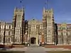 More images | ||
| Calgary Courthouse No. 2 | 530 - 7 Avenue SW, Calgary, AB | 51°02′48″N 114°04′23″W | 9082 | 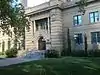 More images | |||
| Memorial Park Library | 1221 - 2 Street SW, Calgary, AB | 51°02′28″N 114°04′12″W | 9157 | 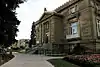 More images | |||
| McDougall School | 412 - 7 Street SW, Calgary, AB | 51°02′57″N 114°04′38″W | 9203 | 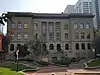 | |||
| Centre Street Bridge | , Calgary, AB | 51°03′10″N 114°03′43″WCentre Street Bridge) | 9275 |  More images | |||
| Merchants Bank Building | 121 - 8 Avenue SW, Calgary, AB | 51°04′34″N 114°06′25″W | 9276 |  | |||
| Glenmore Water Treatment Plant | 1668 - 56 Avenue SW, Calgary, AB | 51°02′45″N 114°03′50″W | 9277 |  | |||
| Tribune Block | 118 - 8 Avenue SW, Calgary, AB | 51°02′45″N 114°03′50″W | 9283 |  | |||
| Fire Hall No. 4 | 104 - 6A Street NE, Calgary, AB | 51°03′09″N 114°02′49″W | 9284 | | |||
| Calgary Public Building | 201 - 8 Avenue SE, Calgary, AB | 51°03′01″N 114°03′54″W | 9286 | 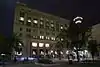 More images | |||
| Bow River Pumphouse No. 2 (Pumphouse Theatre) | 2140 Pumphouse Avenue SW, Calgary, AB | 51°02′25″N 114°06′36″W | 9287 |  More images | |||
| Balzac Archaeological Site | , Calgary, AB | 51°11′00″N 114°00′39″W | 10860 | | |||
| Currie Barracks | (Former) Canadian Forces Base Calgary, Calgary, AB | 51°01′07″N 114°07′12″WCurrie Barracks) | 11075 | | |||
| Mewata Armoury | , Calgary, AB | 51°02′46″N 114°05′20″WMewata Armoury) | 11239 | 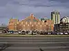 More images | |||
| Women's Buffalo Jump | northwest of Cayley, Foothills Municipal District No. 31, AB | 11515 |  More images | ||||
| Cochrane Ranche | , Cochrane, AB | 51°11′48″N 114°28′12″W | 11541 | | |||
| Wood's Douglas Fir Tree Sanctuary | , Calgary, AB | 51°05′39″N 114°13′30″W | 11610 |  More images | |||
| Bar U Ranch National Historic Site | Bar U Ranch, Foothills Municipal District No. 31, AB | 50°25′10″N 114°14′37″W | 11640 | Q4857972 | 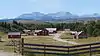 More images | ||
| Calgary Fire Hall No. 1 | 140 - 6 Avenue SE, Calgary, AB | 51°02′51″N 114°03′40″W | 11820 | .jpg.webp) More images | |||
| Zephyr Creek Pictographs | near Longview, Foothills Municipal District No. 31, AB | 11910 | | ||||
| Canadian Pacific Railway Station | 406 1st Street SW, High River, AB | 50°34′45″N 113°52′20″W | 8189 | | |||
| Inglewood Telephone Building | 1311 - 9 Avenue SE, Calgary, AB | 51°02′27″N 114°02′02″W | 12409 | 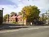 More images | |||
| Mewata Drill Hall / Calgary Drill Hall National Historic Site | 801 11th St. SW, Calgary, AB | 51°02′44″N 114°05′20″W | 12607 | 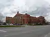 | |||
| Leighton House and Art Centre | near Okotoks, Foothills Municipal District No. 31, AB | 50°47′44″N 114°12′43″W | 15486 | | |||
| Turner Valley Gas Works | , Turner Valley, AB | 50°40′15″N 114°16′08″W | 15532 | 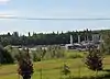 More images | |||
| St. Paul's Anglican Church | 146 Avenue and Macleod Trail (Midnapore), Calgary, AB | 50°55′18″N 114°04′16″W | 17906 | 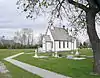 More images | |||
| Irricana United Church | Junction of Township Road 272 (Highway 567) and Range Road 274, approximately 10 km west of Irricana, Irricana, AB | 51°17′58″N 113°45′22″W | 19036 | | |||
| Leighton House and Art Centre | Range Road 23, about 30km sw of Calgary, Okotoks, AB | 50°47′47″N 114°12′35″W | 15486 | |
See also
| Wikimedia Commons has media related to Cultural heritage monuments in Calgary. |
This article is issued from Wikipedia. The text is licensed under Creative Commons - Attribution - Sharealike. Additional terms may apply for the media files.