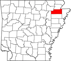
List of lakes of Craighead County, Arkansas
Lakes
According to the United States Geological Survey, there are no named lakes in Craighead County.
Reservoirs
- Big Creek Site Four Reservoir, 35°57′48″N 090°42′24″W, el. 407 feet (124 m) [1]
- Big Creek Site Five Reservoir, 35°58′24″N 090°44′00″W, el. 413 feet (126 m) [2]
- Big Creek Site Six Reservoir, 35°55′54″N 090°43′52″W, el. 367 feet (112 m) [3]
- Big Creek Site Seven Reservoir, 35°55′02″N 090°44′01″W, el. 331 feet (101 m) [4]
- Big Creek Site Eight Reservoir, 35°54′14″N 090°44′40″W, el. 338 feet (103 m) [5]
- Big Creek Site Nine Reservoir, 35°53′12″N 090°44′30″W, el. 315 feet (96 m) [6]
- Big Creek Site 10 Reservoir, 35°53′20″N 090°46′33″W, el. 328 feet (100 m) [7]
- Big Creek Site 11 Reservoir, 35°52′12″N 090°47′18″W, el. 308 feet (94 m) [8]
- Big Creek Site 13 Reservoir, 35°49′03″N 090°46′15″W, el. 308 feet (94 m) [9]
- Big Creek Site 14 Reservoir, 35°49′24″N 090°45′12″W, el. 361 feet (110 m) [10]
- Big Creek Site 15 Reservoir, 35°58′07″N 090°40′12″W, el. 371 feet (113 m) [11]
- Big Creek Site 16 Reservoir, 35°58′00″N 090°39′00″W, el. 440 feet (130 m) [12]
- Big Creek Site 17 Reservoir, 35°55′54″N 090°41′00″W, el. 364 feet (111 m) [13]
- Big Creek Site 18 Reservoir, 35°55′24″N 090°39′00″W, el. 361 feet (110 m) [14]
- Big Creek Site 19 Reservoir, 35°53′00″N 090°40′36″W, el. 328 feet (100 m) [15]
- Big Creek Site 20 Reservoir, 35°53′00″N 090°41′54″W, el. 361 feet (110 m) [16]
- Big Creek Site 21 Reservoir, 35°47′48″N 090°45′30″W, el. 364 feet (111 m) [17]
- Big Creek Site 22 Reservoir, 35°47′48″N 090°45′36″W, el. 381 feet (116 m) [18]
- Big Pond, 35°50′36″N 090°39′18″W, el. 331 feet (101 m) [19]
- Cole Pond, 35°50′30″N 090°49′42″W, el. 302 feet (92 m) [20]
- Craighead Forest Lake, 35°46′43″N 090°42′17″W, el. 354 feet (108 m) [21]
- Farmers Lake, 35°44′14″N 090°47′59″W, el. 249 feet (76 m) [22]
- Guy Parden Pond, 35°54′42″N 090°45′30″W, el. 410 feet (120 m) [23]
- J L Craft Pond, 35°55′24″N 090°46′12″W, el. 390 feet (120 m) [24]
- Mary Simpson Pond, 35°47′01″N 090°44′01″W, el. 325 feet (99 m) [25]
- Poinsett Watershed Site 20 Reservoir, 35°47′18″N 090°41′18″W, el. 295 feet (90 m) [26]
- Ralph Cox Pond, 35°52′54″N 090°46′42″W, el. 312 feet (95 m) [27]
See also
- List of lakes in Arkansas
Notes
- "Big Creek Site Four Reservoir". Geographic Names Information System. United States Geological Survey.
- "Big Creek Site Five Reservoir". Geographic Names Information System. United States Geological Survey.
- "Big Creek Site Six Reservoir". Geographic Names Information System. United States Geological Survey.
- "Big Creek Site Seven Reservoir". Geographic Names Information System. United States Geological Survey.
- "Big Creek Site Eight Reservoir". Geographic Names Information System. United States Geological Survey.
- "Big Creek Site Nine Reservoir". Geographic Names Information System. United States Geological Survey.
- "Big Creek Site 10 Reservoir". Geographic Names Information System. United States Geological Survey.
- "Big Creek Site 11 Reservoir". Geographic Names Information System. United States Geological Survey.
- "Big Creek Site 13 Reservoir". Geographic Names Information System. United States Geological Survey.
- "Big Creek Site 14 Reservoir". Geographic Names Information System. United States Geological Survey.
- "Big Creek Site 15 Reservoir". Geographic Names Information System. United States Geological Survey.
- "Big Creek Site 16 Reservoir". Geographic Names Information System. United States Geological Survey.
- "Big Creek Site 17 Reservoir". Geographic Names Information System. United States Geological Survey.
- "Big Creek Site 18 Reservoir". Geographic Names Information System. United States Geological Survey.
- "Big Creek Site 19 Reservoir". Geographic Names Information System. United States Geological Survey.
- "Big Creek Site 20 Reservoir". Geographic Names Information System. United States Geological Survey.
- "Big Creek Site 21 Reservoir". Geographic Names Information System. United States Geological Survey.
- "Big Creek Site 22 Reservoir". Geographic Names Information System. United States Geological Survey.
- "Big Pond". Geographic Names Information System. United States Geological Survey.
- "Cole Pond". Geographic Names Information System. United States Geological Survey.
- "Craighead Forest Lake". Geographic Names Information System. United States Geological Survey.
- "Farmers Lake". Geographic Names Information System. United States Geological Survey.
- "Guy Parden Pond". Geographic Names Information System. United States Geological Survey.
- "J L Craft Pond". Geographic Names Information System. United States Geological Survey.
- "Mary Simpson Pond". Geographic Names Information System. United States Geological Survey.
- "Poinsett Watershed Site 20 Reservoir". Geographic Names Information System. United States Geological Survey.
- "Ralph Cox Pond". Geographic Names Information System. United States Geological Survey.
This article is issued from Wikipedia. The text is licensed under Creative Commons - Attribution - Sharealike. Additional terms may apply for the media files.
