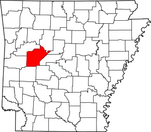
List of lakes of Yell County, Arkansas
Lakes
- Buckman Lake, 35°04′33″N 093°28′14″W, el. 338 feet (103 m) [1]
- Cowger Lake, 35°03′09″N 093°24′36″W, el. 325 feet (99 m) [2]
- Gibson Lake, 35°07′48″N 093°07′34″W, el. 295 feet (90 m) [3]
- Horseshoe Lake, 35°03′38″N 093°27′04″W, el. 325 feet (99 m) [4]
- Keeland Lake, 35°02′48″N 093°12′15″W, el. 292 feet (89 m) [5]
- Luther Lake, 35°07′51″N 093°05′28″W, el. 285 feet (87 m) [6]
- Mason Lake, 35°03′56″N 093°27′23″W, el. 325 feet (99 m) [7]
- Open Slough, 35°08′50″N 093°07′15″W, el. 302 feet (92 m) [8]
- Peeler Lake, 35°04′09″N 093°19′51″W, el. 312 feet (95 m) [9]
- Peter George Lake, 35°06′14″N 093°18′14″W, el. 322 feet (98 m) [10]
- Rose Lake, 35°03′45″N 093°05′12″W, el. 299 feet (91 m) [11]
- Surrounded Ridges Lake, 35°05′20″N 093°18′21″W, el. 308 feet (94 m) [12]
Reservoirs
- Bailey Branch Lake, 35°02′12″N 093°26′57″W, el. 344 feet (105 m) [13]
- Blue Mountain Lake, 35°05′59″N 093°42′02″W, el. 384 feet (117 m) [14]
- Bogs Lake, 35°08′01″N 093°17′47″W, el. 338 feet (103 m) [15]
- Cedar-Piney Lake, 35°06′50″N 093°29′11″W, el. 387 feet (118 m) [16]
- Chambers Lake, 35°02′37″N 093°27′49″W, el. 427 feet (130 m) [17]
- Harris Fish Farm Reservoir, 35°06′07″N 093°21′22″W, el. 351 feet (107 m) [18]
- Kingfisher Lake, 35°05′44″N 093°06′20″W, el. 315 feet (96 m) [19]
- Lake Ola, 35°01′54″N 092°14′01″W, el. 361 feet (110 m) [20]
- Lake Ola-dale, 35°01′48″N 093°14′10″W, el. 390 feet (120 m) [21]
- Mockingbird Hill Lake, 35°06′27″N 093°13′05″W, el. 354 feet (108 m) [22]
- Nimrod Lake, 34°57′03″N 093°14′37″W, el. 341 feet (104 m) [23]
- Pullen Pond, 35°05′12″N 093°08′06″W, el. 302 feet (92 m) [24]
- Schoonover Lake, 35°05′15″N 093°12′12″W, el. 348 feet (106 m) [25]
- Spring Lake, 35°09′14″N 093°25′39″W, el. 512 feet (156 m) [26]
See also
- List of lakes in Arkansas
Notes
- "Buckman Lake". Geographic Names Information System. United States Geological Survey.
- "Cowger Lake". Geographic Names Information System. United States Geological Survey.
- "Gibson Lake". Geographic Names Information System. United States Geological Survey.
- "Horseshoe Lake". Geographic Names Information System. United States Geological Survey.
- "Keeland Lake". Geographic Names Information System. United States Geological Survey.
- "Luther Lake". Geographic Names Information System. United States Geological Survey.
- "Mason Lake". Geographic Names Information System. United States Geological Survey.
- "Open Slough". Geographic Names Information System. United States Geological Survey.
- "Peeler Lake". Geographic Names Information System. United States Geological Survey.
- "Peter George Lake". Geographic Names Information System. United States Geological Survey.
- "Rose Lake". Geographic Names Information System. United States Geological Survey.
- "Surrounded Ridges Lake". Geographic Names Information System. United States Geological Survey.
- "Bailey Branch Lake". Geographic Names Information System. United States Geological Survey.
- "Blue Mountain Lake". Geographic Names Information System. United States Geological Survey.
- "Bogs Lake". Geographic Names Information System. United States Geological Survey.
- "Cedar-Piney Lake". Geographic Names Information System. United States Geological Survey.
- "Chambers Lake". Geographic Names Information System. United States Geological Survey.
- "Harris Fish Farm Reservoir". Geographic Names Information System. United States Geological Survey.
- "Kingfisher Lake". Geographic Names Information System. United States Geological Survey.
- "Lake Ola". Geographic Names Information System. United States Geological Survey.
- "Lake Ola-dale". Geographic Names Information System. United States Geological Survey.
- "Mockingbird Hill Lake". Geographic Names Information System. United States Geological Survey.
- "Nimrod Lake". Geographic Names Information System. United States Geological Survey.
- "Pullen Pond". Geographic Names Information System. United States Geological Survey.
- "Schoonover Lake". Geographic Names Information System. United States Geological Survey.
- "Spring Lake". Geographic Names Information System. United States Geological Survey.
This article is issued from Wikipedia. The text is licensed under Creative Commons - Attribution - Sharealike. Additional terms may apply for the media files.

