List of lighthouses in the British Virgin Islands
Light beacons
| Name | Image | Year built | Coordinates | Class of Light [2] | Focal height[2] | NGA number[2] | Admiralty number[2] | Range nml[2] |
|---|---|---|---|---|---|---|---|---|
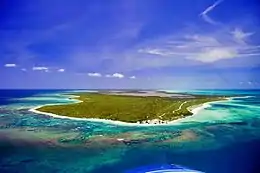
| Anegada West End Light beacon |  | N/A | Anegada 18°44′28.6″N 64°24′57.1″W | Fl W 10s. | 6 metres (20 ft) | 14702 | J5632.5 | 10 |
| Bellamy Cay Light beacon | N/A | Bellamy Cay 18°26′53.4″N 64°31′57.5″W | F W | N/A | 14699 | J5636.5 | N/A | |
| Ginger Island Light beacon | N/A | Ginger Island 18°23′34.1″N 64°28′14.7″W | Fl W 5s. | 4 metres (13 ft) | 14704 | J5637 | 14 | |
| Pajaros Point Light beacon | N/A | Virgin Gorda 18°30′13.1″N 64°19′17.7″W | Fl (3) W 15s. | N/A | 14700 | J5637 | 16 | |
| Roadtown Range Front Light beacon | 1900s. est. | Road Town 18°25′07.6″N 64°37′04.5″W | F R | 2 metres (6.6 ft) | 14696 | J5635 | 3 | |
| Salt Island Light beacon | N/A | Salt Island 18°22′18.4″N 64°32′03.4″W | Fl W 10s. | N/A | 14708 | J5636 | 14 | |
See also
- Lists of lighthouses and lightvessels
References
- British Virgin Islands The Lighthouse Directory. University of North Carolina at Chapel Hill. Retrieved 28 August 2016
- List of Lights, Pub. 110: Greenland, The East Coasts of North and South America (Excluding Continental U.S.A. Except the East Coast of Florida) and the West Indies (PDF). List of Lights. United States National Geospatial-Intelligence Agency. 2016.
External links
- Rowlett, Russ. "The Lighthouse Directory". University of North Carolina at Chapel Hill.
This article is issued from Wikipedia. The text is licensed under Creative Commons - Attribution - Sharealike. Additional terms may apply for the media files.
_-_cropped.jpg.webp)