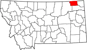
List of mountains in Daniels County, Montana
There are at least 11 named mountains in Daniels County, Montana.
- Dighans Hill, 48°48′41″N 105°51′46″W, el. 3,005 feet (916 m)[1]
- Four Buttes, 48°49′37″N 105°38′02″W, el. 2,595 feet (791 m)[2]
- Gregerson Hill, 48°51′11″N 105°53′27″W, el. 2,979 feet (908 m)[3]
- Haugens Hill, 48°35′13″N 105°53′24″W, el. 2,949 feet (899 m)[4]
- Jones Hill, 48°51′09″N 105°49′37″W, el. 2,884 feet (879 m)[5]
- Long Butte, 48°57′03″N 105°13′27″W, el. 2,897 feet (883 m)[6]
- Richland Hill, 48°49′22″N 106°00′06″W, el. 2,861 feet (872 m)[7]
- Slaughter Hill, 48°51′58″N 105°51′17″W, el. 2,766 feet (843 m)[8]
- Square Butte, 48°55′47″N 105°15′02″W, el. 2,897 feet (883 m)[9]
- Sundby Hill, 48°47′40″N 105°51′25″W, el. 2,907 feet (886 m)[10]
- Wild Horse Butte, 48°51′44″N 105°51′37″W, el. 2,894 feet (882 m)[11]
Notes
- "Dighans Hill". Geographic Names Information System. United States Geological Survey.
- "Four Buttes". Geographic Names Information System. United States Geological Survey.
- "Gregerson Hill". Geographic Names Information System. United States Geological Survey.
- "Haugens Hill". Geographic Names Information System. United States Geological Survey.
- "Jones Hill". Geographic Names Information System. United States Geological Survey.
- "Long Butte". Geographic Names Information System. United States Geological Survey.
- "Richland Hill". Geographic Names Information System. United States Geological Survey.
- "Slaughter Hill". Geographic Names Information System. United States Geological Survey.
- "Square Butte". Geographic Names Information System. United States Geological Survey.
- "Sundby Hill". Geographic Names Information System. United States Geological Survey.
- "Wild Horse Butte". Geographic Names Information System. United States Geological Survey.
This article is issued from Wikipedia. The text is licensed under Creative Commons - Attribution - Sharealike. Additional terms may apply for the media files.
