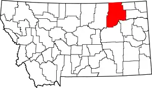
List of mountains in Valley County, Montana
There are at least 20 named mountains in Valley County, Montana.
- Castle Butte, 47°49′31″N 107°23′18″W, el. 2,917 feet (889 m)[1]
- Coal Mine Hill, 48°52′55″N 106°30′45″W, el. 3,304 feet (1,007 m)[2]
- Dead Mans Hill, 48°12′52″N 107°16′43″W, el. 2,395 feet (730 m)[3]
- Glass Hill, 48°52′57″N 106°15′47″W, el. 3,150 feet (960 m)[4]
- Graveyard Hill, 47°46′54″N 106°52′22″W, el. 2,726 feet (831 m)[5]
- Johnnys Hill, 48°44′17″N 106°05′12″W, el. 3,051 feet (930 m)[6]
- Kaminski Hill, 48°56′54″N 106°11′38″W, el. 3,107 feet (947 m)[7]
- Landre Hills, 48°33′37″N 106°56′07″W, el. 2,595 feet (791 m)[8]
- Laundry Hill, 48°32′18″N 106°49′45″W, el. 2,963 feet (903 m)[9]
- Lighthouse Hill, 48°53′03″N 106°49′02″W, el. 2,746 feet (837 m)[10]
- Lookout, 48°29′28″N 106°24′07″W, el. 2,986 feet (910 m)[11]
- Murray Hill, 47°48′37″N 107°02′39″W, el. 2,877 feet (877 m)[12]
- Round Butte, 48°53′39″N 106°21′52″W, el. 3,159 feet (963 m)[13]
- Round Butte, 48°53′44″N 106°35′22″W, el. 2,946 feet (898 m)[14]
- Seventh Point Buttes, 47°49′54″N 106°41′39″W, el. 2,651 feet (808 m)[15]
- Spencer Point, 48°15′53″N 107°16′08″W, el. 2,411 feet (735 m)[16]
- Three Buttes, 48°08′33″N 105°55′33″W, el. 2,300 feet (700 m)[17]
- Tiger Butte, 48°07′31″N 106°31′56″W, el. 2,339 feet (713 m)[18]
- Two Buttes, 47°58′23″N 106°46′40″W, el. 2,244 feet (684 m)[19]
- White Highland Hills, 48°44′56″N 106°06′18″W, el. 3,094 feet (943 m)[20]
Notes
- "Castle Butte". Geographic Names Information System. United States Geological Survey.
- "Coal Mine Hill". Geographic Names Information System. United States Geological Survey.
- "Dead Mans Hill". Geographic Names Information System. United States Geological Survey.
- "Glass Hill". Geographic Names Information System. United States Geological Survey.
- "Graveyard Hill". Geographic Names Information System. United States Geological Survey.
- "Johnnys Hill". Geographic Names Information System. United States Geological Survey.
- "Kaminski Hill". Geographic Names Information System. United States Geological Survey.
- "Landre Hills". Geographic Names Information System. United States Geological Survey.
- "Laundry Hill". Geographic Names Information System. United States Geological Survey.
- "Lighthouse Hill". Geographic Names Information System. United States Geological Survey.
- "Lookout". Geographic Names Information System. United States Geological Survey.
- "Murray Hill". Geographic Names Information System. United States Geological Survey.
- "Round Butte". Geographic Names Information System. United States Geological Survey.
- "Round Butte". Geographic Names Information System. United States Geological Survey.
- "Seventh Point Buttes". Geographic Names Information System. United States Geological Survey.
- "Spencer Point". Geographic Names Information System. United States Geological Survey.
- "Three Buttes". Geographic Names Information System. United States Geological Survey.
- "Tiger Butte". Geographic Names Information System. United States Geological Survey.
- "Two Buttes". Geographic Names Information System. United States Geological Survey.
- "White Highland Hills". Geographic Names Information System. United States Geological Survey.
This article is issued from Wikipedia. The text is licensed under Creative Commons - Attribution - Sharealike. Additional terms may apply for the media files.
