List of waterfalls of Canada
The following list of waterfalls of Canada include all waterfalls of superlative significance.
Tallest waterfalls
By overall height
As of 2020, there are 18 confirmed waterfalls with an overall height of at least 400 m (1,300 ft).[1]
| Waterfall | Image | Height | Province | Coordinates | |
|---|---|---|---|---|---|
| m | ft | ||||
| James Bruce Falls | .jpg.webp) | 840 | 2,760 | British Columbia | 50°13′08″N 123°46′57″W |
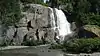
| Madden Falls | 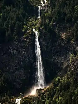 | 579 | 1,900 | British Columbia | 49°53′20″N 123°19′01″W |
| Swiftcurrent Falls | 537 | 1,762 | British Columbia | 53°07′49″N 119°19′03″W | |
| Kingcome Valley Falls | 520 | 1,710 | British Columbia | 51°16′10″N 126°12′46″W | |
| Schwartzenbach Falls | 520 | 1,710 | Nunavut | 66°30′30″N 65°31′30″W | |
| Francis Falls | 518 | 1,699 | British Columbia | 50°39′33″N 124°11′47″W | |
| Storey Peak Falls | 480 | 1,570 | British Columbia | 50°00′17″N 123°21′53″W | |
| Cerberus Falls | 475 | 1,558 | British Columbia | 51°53′39″N 117°04′19″W | |
| Kiwi Falls | 475 | 1,558 | British Columbia | 50°09′18″N 126°12′44″W | |
| Bush Mountain Falls | 466 | 1,529 | British Columbia | 51°49′22″N 117°08′01″W | |
| Unnamed waterfall | 460 | 1,510 | British Columbia | 51°17′56″N 125°44′16″W | |
| Bedard Falls | 457 | 1,499 | British Columbia | 49°58′53″N 123°20′49″W | |
| Unnamed waterfall | 457 | 1,499 | British Columbia | 50°18′45″N 123°56′09″W | |
| Harmony Falls | 444 | 1,457 | British Columbia | 49°51′23″N 123°59′55″W | |
| Michael Falls | 442 | 1,450 | British Columbia | 51°28′25″N 116°31′07″W | |
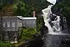
| Della Falls | 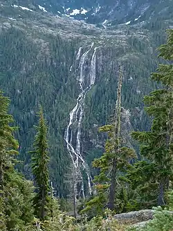 | 440 | 1,440 | British Columbia | 49°27′16″N 125°32′11″W |
| South Phillips Glacier Falls | 427 | 1,401 | British Columbia | 53°07′24″N 119°13′23″W | |
| Bishop Falls | 410 | 1,350 | British Columbia | 58°40′31″N 133°27′12″W | |
By tallest single drop
As of 2020, there are 14 confirmed waterfalls have a single unbroken drop with a height of at least 150 m (490 ft).[2]
| Waterfall | Image | Height | Province | Coordinates | |
|---|---|---|---|---|---|
| m | ft | ||||
| Cerberus Falls | 475 | 1,558 | British Columbia | 51°53′39″N 117°04′19″W | |
| Odegaard Falls | 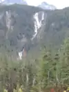 | 271 | 889 | British Columbia | 52°14′29″N 126°17′33″W |
| Hunlen Falls | 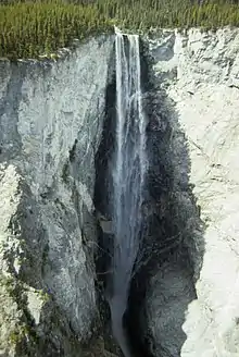 | 260 | 850 | British Columbia | 52°16′36″N 125°46′21″W |
| Takakkaw Falls | 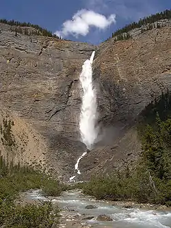 | 260 | 850 | British Columbia | 51°30′00″N 116°28′23″W |
| Hamill Creek Falls | 255 | 837 | British Columbia | 50°14′24″N 116°35′06″W | |
| Pissing Mare Falls | 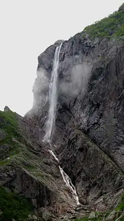 | 255 | 837 | Newfoundland and Labrador | 49°42′37″N 57°39′39″W |
| Francis Falls | 244 | 801 | British Columbia | 50°39′33″N 124°11′47″W | |
| South Phillips Glacier Falls | 244 | 801 | British Columbia | 53°07′24″N 119°13′23″W | |
| Middle Cummins Falls | 220 | 720 | British Columbia | 52°10′00″N 117°59′25″W | |
| Schwartzenbach Falls | 200 | 660 | Nunavut | 66°30′30″N 65°31′30″W | |
| Michael Falls | 158 | 518 | British Columbia | 51°28′25″N 116°31′07″W | |
| Bow Glacier Falls |  | 154 | 505 | Alberta | 51°39′12″N 116°29′57″W |
| Lady Wilsons Falls | 152 | 499 | Alberta | 52°01′37″N 116°49′00″W | |
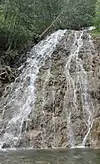
| Madden Falls | | 152 | 499 | British Columbia | 49°53′20″N 123°19′01″W |
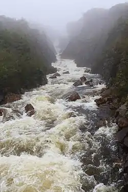
Waterfalls by average flow rate
As of 2021, there are 25 confirmed waterfalls with an average flow rate or discharge of at least 100 m3/s (3,500 cu ft/s).[3][4][5]
.jpg.webp)
.jpg.webp)
.jpeg.webp)
Notable waterfalls by province
Alberta
| Waterfall | Image | Watercourse | Drop | Width | Type | Coordinates | Ref |
|---|---|---|---|---|---|---|---|
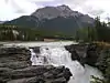
| Athabasca Falls | 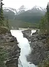 | Athabasca River | 24 m (79 ft) | 18 m (59 ft) | Segmented Horsetail | 52°39′51″N 117°53′01″W | [6] |
| Bow Falls | 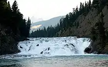 | Bow River | 9 m (30 ft) | 37 m (121 ft) | Cascade | 51°9′57″N 115°33′35″W | [7] |
| Bow Glacier Falls | 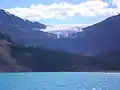 | Bow River | 120 m (390 ft) | 57 m (187 ft) | Horsetail | 51°39′11″N 116°29′57″W | [8] |
| Bridal Veil Falls (Banff) | 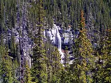 | An unnamed stream | 86 m (282 ft) | 5 m (16 ft) | Tiered Plunges | 52°11′01″N 117°03′07″W | [9] |
| Crescent Falls | 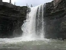 | Bighorn River | Tiered | 52°23′14″N 116°21′15″W | [10] | ||
| Crypt Falls | 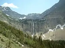 | Hellroaring Creek | 175 m (574 ft) | 15 m (49 ft) | Horsetail | 49°0′18″N 113°50′35″W | [11] |
| Elbow Falls |  | Elbow River | Cascade | 50°51′31″N 114°47′32″W | [12] | ||
| Fossil Falls | Foch Creek | 150 m (490 ft) | 23 m (75 ft) | Tiered Horsetails | 50°35′28″N 115°11′56″W | [13] | |
| Geraldine Falls | Geraldine Creek | 152 m (499 ft) | 15 m (49 ft) | Tiered Horsetails | 52°36′01″N 117°56′20″W | [14] | |
| Kerkeslin Falls | An unnamed stream | Tiered Horsetails | disputed[nb 1] | [15] | |||
| Kitchener Creek Falls | Kitchener Creek | 122 m (400 ft) | 122 m (400 ft) | 5 m (16 ft) | 52°15′31″N 117°18′11″W | [17] | |
| Lineham Falls | Lineham Creek | 125 m (410 ft) | 49°04′40″N 114°03′21″W | [18] | |||
| Lower Sunwapta Falls | 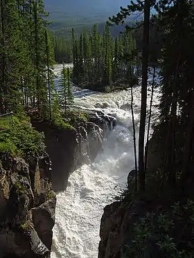 | Sunwapta River | 17 m (56 ft), 26 m (85 ft) | 8 m (26 ft), 8 m (26 ft) | Tiered Horsetails, Tiered Plunges | 52°31′57″N 117°38′42″W | [19], [20] |
| Maligne Canyon Falls | Maligne Canyon | [21] | |||||
| Murchison Falls | An unnamed stream | 180 m (590 ft) | 30 m (98 ft) | Segmented Plunges | 51°55′09″N 116°41′15″W | [22] | |
| O'Shaughnessy Falls | [21] | ||||||
| Panther Falls | 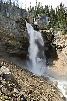 | Nigel Creek | 66 m (217 ft) | 12 m (39 ft) | Plunge | 52°10′54″N 117°3′29″W | [23] |
| Sideways Falls (Big Bend Falls) | An unnamed stream | 106 m (348 ft) | 15 m (49 ft) | Tiered Horsetails | 52°09′46″N 117°04′01″W | [24] | |
| Siffleur Falls | 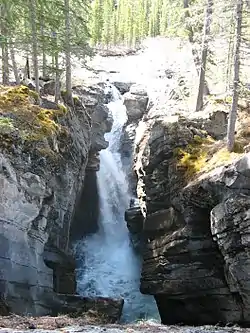 | Siffleur River | 52°1′14″N 116°21′58″W | [25] | |||
| Snake Indian Falls | Snake Indian River | [21] | |||||
| Tangle Falls | [21] |
Manitoba
| Image | Waterfall | Watercourse | Drop | Width | Type | Coordinates | Ref |
|---|---|---|---|---|---|---|---|
| Kwasitchewan Falls |  | Grass River | 14 m (46 ft) | 55°15′55″N 98°17′22″W | [26] | ||
| Muhigan Falls | Muhigan River | 19 m (62 ft) | 54°41′17″N 98°35′31″W | [27] | |||
| Pisew Falls |  | Grass River | 13 m (43 ft) | 47 m (154 ft) | 55°11′50″N 98°23′51″W | [28] |
New Brunswick
| Waterfall | Image | Watercourse | Drop | Width | Type | Coordinates | Ref |
|---|---|---|---|---|---|---|---|
| Grand Falls |  | Saint Croix River | 45°16′30″N 67°28′43″W | [29] | |||
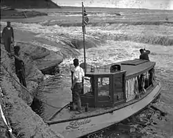
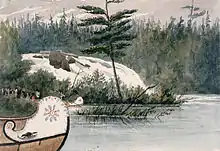
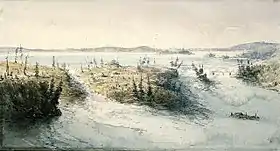
| Nepisiguit (Grand) Falls | "Grand Falls, Nepisiguit River, before 1874" | Nepisiguit River | 75 m (246 ft) | Segmented Block | 47°24′19″N 65°47′29″W |
Newfoundland & Labrador
| Waterfall | Image | Watercourse | Drop | Width | Type | Coordinates | Ref |
|---|---|---|---|---|---|---|---|
| Aviron Bay Falls | 213 m (699 ft) | 12 m (39 ft) | Tiered | [30] | |||
| Churchill Falls |  | Churchill River | 75 m (246 ft) | segmented Block | 53°36′00″N 64°18′57″W | [31][32] | |
| Grand Falls | Exploits River | 43 m (141 ft) | [33] | ||||
| Grand Falls | Hamilton River | 92 m (302 ft) | 46 m (151 ft) | Slide, Plunge | [34] | ||
| Muskrat Falls | Churchill River | 15 m (49 ft) | 53°14′44″N 60°46′17″W | ||||
| Pissing Mare Falls | | Burnt Woods Brook | 350 m (1,150 ft) | Plunge, Cascade | [35][36][37] | ||
| Rattling Brook Falls | 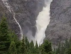 | Rattling Brook | 140 m (460 ft) | Tiered | [38] | ||
| Sandy Pond Falls | 220 m (720 ft) | Plunge, Cascades | [39] | ||||
| Scott Falls | Unknown River | 27 m (89 ft) | [33] | ||||
| Thomas Falls | Unknown River | 31 m (102 ft) | [33] | ||||
| Twin Falls | Unknown River | 53 m (174 ft) | [40] |
Northwest Territories
| Waterfall | Image | Watercourse | Drop | Width | Type | Coordinates | Ref |
|---|---|---|---|---|---|---|---|
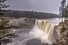
| Alexandra Falls | 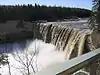 | Hay River | 33 m (108 ft) | 117 m (384 ft) | Vertical Block | 60°30′02″N 116°16′48″W | [41] |
| Cameron Falls | .jpg.webp) | Cameron River | 17 m (56 ft) | Steep cascade | 62°31′14″N 113°41′16″W | [42] | |
| Lady Evelyn Falls | Kakisa River | 17 m (56 ft) | 116 m (381 ft) | Vertical Block | 60°57′53″N 117°19′46″W | [43] | |
| Louise Falls |  | Hay River | 15 m (49 ft) | 183 m (600 ft) | Vertical Block | 60°30′10″N 116°14′34″W | [44] |
| Marengo Falls | Marengo Creek | 30 m (98 ft) | ? | Veiling Horsetail | 61°35′39″N 125°48′08″W | [45] | |
| Virginia Falls |  | South Nahanni River | 90 m (300 ft) | 305 m (1,001 ft) | Segmented Horsetails | 61°36′27″N 125°44′20″W | [46] |
Nunavut
| Waterfall | Image | Watercourse | Drop | Width | Type | Coordinates | Ref |
|---|---|---|---|---|---|---|---|
| Barrow Falls | Barrow River | 27 m (89 ft) | 67°19′17″N 81°22′30″W | [47] | |||
| Kattimannap Qurlua | 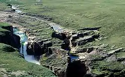 | Hood River | 49 m (161 ft) | ? | Segmented Plunges | 67°05′43″N 108°47′51″W | [48] |
| Kazan Falls | 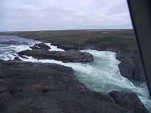 | Kazan River | 25 m (82 ft) | 63°42′51″N 95°50′48″W | [49] | ||
| Kingaunmiut Falls | Hood River | 25 m (82 ft) | Steep cascade | 66°51′26″N 110°44′30″W | [50] |
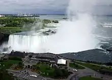
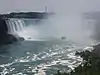
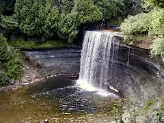
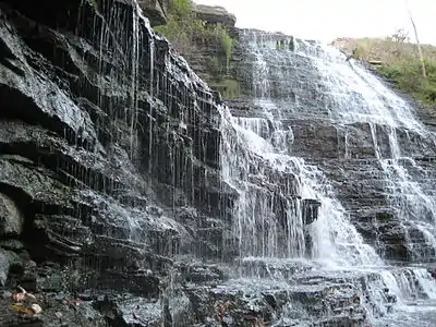
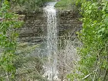
Ontario
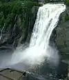
Quebec
.jpg.webp)


Saskatchewan
| Waterfall | Image | Watercourse | Height | Width | Type | Coordinates | Ref |
|---|---|---|---|---|---|---|---|
| Elizabeth Falls | Fond du Lac River | 34 m (112 ft) | 59°10′48″N 105°33′24″W | [85] | |||
| Kettle Falls | Churchill River | 5 m (16 ft) | 134 m (440 ft) | 55°32′54″N 103°14′26″W | [86] | ||
| Nistowiak Falls | 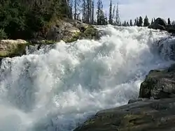 | Rapid River | 10 m (33 ft) | Segmented | 55°23′46″N 104°21′59″W | [87] | |
| Spruce Falls | Swan River | 55°37′N 102°27′W | [88] |
Yukon
| Waterfall | Image | Watercourse | Height | Width | Type | Coordinates | Ref |
|---|---|---|---|---|---|---|---|
| Otter Falls |  | Aishihik River | 61°04′54″N 136°59′42″W | [89] | |||
| Rancheria Falls | Rancheria River | 8 m (26 ft) | Cascade | 60°04′40″N 130°49′43″W | [90] |
See also
Notes
References
- "Waterfalls in Canada - World Waterfall Database". www.worldwaterfalldatabase.com. Retrieved 2020-10-31.
- "Tallest and Largest Waterfalls at the World Waterfall Database". www.worldwaterfalldatabase.com. Retrieved 2020-11-01.
- "Waterfalls in Canada - World Waterfall Database". www.worldwaterfalldatabase.com. Retrieved 2020-11-01.
- "Graphique des données à une station hydrométrique Montmorency". www.cehq.gouv.qc.ca. Retrieved 2020-11-02.
- "Graphique des données à une station hydrométrique Chaudière". www.cehq.gouv.qc.ca. Retrieved 2020-11-04.
- "Athabasca Falls, Alberta, Canada". World Waterfall Database. Retrieved 2017-06-17.
- "Bow Falls, Alberta, Canada". World Waterfall Database. Retrieved 2017-06-17.
- "Bow Glacier Falls, Alberta, Canada". World Waterfall Database. Retrieved 2017-06-17.
- "Bridal Veil Falls, Alberta, Canada". World Waterfall Database. Retrieved 2017-06-17.
- "Upper Crescent Falls, Alberta, Canada". World Waterfall Database. Retrieved 2017-06-17.
- "Crypt Falls, Alberta, Canada". World Waterfall Database. Retrieved 2017-06-17.
- "Elbow Falls, Alberta, Canada". World Waterfall Database. Retrieved 2017-06-17.
- "Fossil Falls, Alberta, Canada". World Waterfall Database. Retrieved 2017-06-18.
- "Geraldine Falls, Alberta, Canada". World Waterfall Database. Retrieved 2017-06-18.
- "Kerkeslin Falls, Alberta, Canada". World Waterfall Database. Retrieved 2017-06-18.
- "Kerkeslin Falls, II, WI 3 : Climbing, Hiking & Mountaineering". www.summitpost.org. Retrieved 2017-06-18.
- "Kitchener Creek Falls, Alberta, Canada". World Waterfall Database. Retrieved 2017-06-18.
- "Lineham Falls, Alberta, Canada". World Waterfall Database. Retrieved 2017-06-18.
- "Sunwapta Falls, Alberta, Canada". World Waterfall Database. Retrieved 2017-06-17.
- "Lower Sunwapta Falls, Alberta, Canada". World Waterfall Database. Retrieved 2017-06-17.
- "Waterfalls Alberta". Mat Quigley. Retrieved 2013-02-06.
- "Murchison Falls, Alberta, Canada - World Waterfall Database". www.worldwaterfalldatabase.com. Retrieved 2020-12-03.
- "Panther Falls, Alberta, Canada". World Waterfall Database. Retrieved 2017-06-17.
- "Sideways Falls, Alberta, Canada". World Waterfall Database. Retrieved 2017-06-18.
- "Siffleur Falls, Alberta, Canada". World Waterfall Database. Retrieved 2017-06-17.
- "Kwasitchewan Falls, Manitoba, Canada - World Waterfall Database". www.worldwaterfalldatabase.com. Retrieved 2020-12-03.
- "Muhigan Falls, Manitoba, Canada - World Waterfall Database". www.worldwaterfalldatabase.com. Retrieved 2020-12-03.
- "Pisew Falls, Manitoba, Canada - World Waterfall Database". www.worldwaterfalldatabase.com. Retrieved 2020-12-03.
- "Grand Falls, Maine, United States - World Waterfall Database". www.worldwaterfalldatabase.com. Retrieved 2020-11-30.
- "British Columbia – Canada". World Waterfalls. Bryan Swan & Dean Goss. 1985–2008. Retrieved 2008-11-07.
- "Churchill Falls - History". Reprinted Courtesy of Churchill Falls (Labrador) Corporation Compiled by Peter Green - IEEE. Retrieved 2008-11-09.
- "Query Record Details: Churchill Falls". Natural Resources Canada. Government of Canada. Archived from the original on 2011-08-17. Retrieved 2008-11-09.
- "Niagara Falls". World Waterfalls. Bryan Swan & Dean Goss. 1985–2008. Archived from the original on 2008-12-18. Retrieved 2008-11-07.Rated as 15th tallest waterfall in the world
- Encyclopedia of Newfoundland and Labrador, ISBN 0-9693422-1-7.
- "Newfoundland Gros Morne National Park". 2008-11-09. Archived from the original on 2008-12-07. Retrieved 2008-11-09.Photo of the Pissing Mare Falls
- "Pissing Mare Falls – British Columbia – Canada". World Waterfalls. Bryan Swan & Dean Goss. 1985–2008. Retrieved 2008-11-07.
- "Rattling Brook Falls – Newfoundland – Canada". World Waterfalls. Bryan Swan & Dean Goss. 1985–2008. Retrieved 2008-11-07.
- "Sandy Pond Falls – Newfoundland – Canada". World Waterfalls. Bryan Swan & Dean Goss. 1985–2008. Retrieved 2008-11-07.
- "Twin Falls NL - Satellite photo". Google Maps. Retrieved 2008-11-09.
- "Alexandra Falls – Northwest Territories, Canada". World Waterfall Database. Retrieved 2020-03-17.
- "Cameron Falls, Northwest Territories, Canada - World Waterfall Database". www.worldwaterfalldatabase.com. Retrieved 2020-12-04.
- "Lady Evelyn Falls, Northwest Territories, Canada - World Waterfall Database". www.worldwaterfalldatabase.com. Retrieved 2020-11-09.
- "Louise Falls, Northwest Territories, Canada - World Waterfall Database". www.worldwaterfalldatabase.com. Retrieved 2020-11-09.
- "Marengo Falls, Northwest Territories, Canada - World Waterfall Database". www.worldwaterfalldatabase.com. Retrieved 2020-11-09.
- "Virginia Falls, Northwest Territories, Canada - World Waterfall Database". www.worldwaterfalldatabase.com. Retrieved 2020-11-09.
- "Barrow Falls, Nunavut, Canada - World Waterfall Database". www.worldwaterfalldatabase.com. Retrieved 2020-12-04.
- "Wilberforce Falls, Nunavut, Canada - World Waterfall Database". www.worldwaterfalldatabase.com. Retrieved 2020-11-09.
- "Kazan Falls, Nunavut, Canada - World Waterfall Database". www.worldwaterfalldatabase.com. Retrieved 2020-12-04.
- "Kingaunmiut Falls, Nunavut, Canada - World Waterfall Database". www.worldwaterfalldatabase.com. Retrieved 2020-12-04.
- "City Profile for Niagara Falls, Ontario". Retrieved 2008-10-06.
- "Niagara Falls". World Waterfalls. Bryan Swan & Dean Goss. 1985–2008. Archived from the original on 2008-12-18. Retrieved 2008-11-07.Rated as 10th largest in the world
- Harris, Mark (September 2, 2003). "Waterfalls of Ontario—Bridal Veil Falls (Kagawong)". Waterfalls of Ontario.ca/. Archived from the original on 2009-03-10. Retrieved 2008-11-07.
- "Bridal Veil Falls". Great Lakes Waterfalls and Beyond. 25 Mar 2008. Retrieved 2008-11-07.
- Harris, Mark (September 2, 2003). "Waterfalls of Ontario—Ottawa Valley Index". Archived from the original on 2008-07-23. Retrieved 2008-11-07.
- Corbet, Ron (July 30, 2005). "Chaudiere Falls at the heart of Ottawa's history". The Ottawa Citizen. Canwest Digital Media, Canwest Publishing Inc. Archived from the original on 2012-11-05. Retrieved 2008-11-07.
- Harris, Mark (September 2, 2003). "Waterfalls of Ontario—Fenelon Falls". Archived from the original on 2009-03-22. Retrieved 2008-11-07.
- "Fourth Falls". Natural Resources Canada. October 6, 2016.
- Harris, Mark (September 2, 2003). "Waterfalls of Ontario—Northeast Waterfall Region". Archived from the original on 2009-03-10. Retrieved 2008-11-07.
- "GeoNames Query—Helen Falls : Query Record Details". Natural Resources Canada. Government of Canada. 2008-11-09. Archived from the original on 2011-06-08. Retrieved 2008-11-09.
- "Nomination of the Rideau Canal for Inscription in the World Heritage List". Parks Canada. Government of Canada. 2008-11-09. Archived from the original on 2013-01-01. Retrieved 2008-11-09.Also called Hogs Back Falls
- "Inglis Falls". day trips canada. 4 June 2008. Retrieved 2008-11-09.
- "Waterfalls of Ontario—Kakabeka Falls". Archived from the original on 2007-07-04. Retrieved 2007-09-21.
- "GeoNames Query—Rideau Falls : Query Record Details". Natural Resources Canada. Government of Canada. 2008-11-09. Archived from the original on 2011-06-08. Retrieved 2008-11-09.
- "GeoNames Query—Rideau Chutes] : Query Record Details". Natural Resources Canada. Government of Canada. 2008-11-09. Archived from the original on 2011-06-08. Retrieved 2008-11-09.
- "Hamilton- Waterfall Capital of the World". (www.cityofwaterfalls.ca). Retrieved 2008-07-09.
- "Hamilton Naturalist's Club: Protecting Nature since 1919". (www.hamiltonnature.org/). Retrieved 2008-08-06.
- "Borer's Falls Ontario, Canada". EXPLORE Magazine. Archived from the original on 2008-10-12. Retrieved 2008-07-25.
- "Hamilton Waterfalls: Boundary Falls". (www.hamiltonnature.org). Archived from the original on 2008-10-14. Retrieved 2008-07-29.
- https://www.cityofwaterfalls.ca/websters-falls/
- "BLANC-SABLON (BRADOR) - Cote-Nord Tourism". tourismecote-nord.com. Retrieved 2020-12-30.
- "Chats Falls, Ontario, Canada - World Waterfall Database". www.worldwaterfalldatabase.com. Retrieved 2020-11-29.
- "Parc des Chutes-de-la-Chaudière". Visitez Lévis. Retrieved 30 November 2016.
- "GeoNames Query—Chutes-de-la-Chaudière in the Lèvis region: Query Record Details". Natural Resources Canada. Government of Canada. 2008-11-09. Archived from the original on 2011-06-08. Retrieved 2008-11-09.
- "GeoNames Query—Chute Kabir Kouba in the Lèvis region: Query Record Details". Natural Resources Canada. Government of Canada. 2008-11-09. Archived from the original on 2011-06-08. Retrieved 2008-11-09.
- "Kabir Kouba". Conception et réalisation: Bleu Outremer en collaboration avec le CLD de Québec. Archived from the original on 2008-08-25. Retrieved 2008-11-09.
- "TRAILS". Restigouche South-East Municipality. Archived from the original on 2011-08-28. Retrieved 15 August 2011.
- "Calcaire, Chute du, Quebec, Canada - World Waterfall Database". www.worldwaterfalldatabase.com. Retrieved 2020-12-28.
- parcdeschutesetd. "Parc Régional des Chutes Monte-à-Peine-et-des-Dalles" (in French). Retrieved 2020-11-30.
- Steven Dutch (19 January 2007). "Montmorency Falls, Quebec". Virtual Field Trips. Archived from the original on 28 May 2009. Retrieved 2008-11-09. highest in the province of Quebec
- Depeyre, Michèle; Gauthier, Michel (2005). Guide des chutes du Québec. Québec: Les Éditions Tricycle. p. 40. ISBN 2-922072-30-4.
- "M.R.C. d'Avignon - Saint-André-de-Restigouche". www.gaspesie-les-iles.org. Retrieved 2020-11-30.
- Behrens, David. "Canyon Sainte Anne Falls". Canadian Waterfalls. Retrieved 2008-11-09.
- "Parc national d'Anticosti". Sépaq. 2020. Retrieved 2020-11-30.
- "Elizabeth Falls, Saskatchewan, Canada - World Waterfall Database". www.worldwaterfalldatabase.com. Retrieved 2020-11-03.
- "Kettle Falls, Saskatchewan, Canada - World Waterfall Database". www.worldwaterfalldatabase.com. Retrieved 2020-12-02.
- Lac La Ronge Provincial Park website Archived 2006-08-27 at the Wayback Machine the highest in the province of Saskatchewan
- Davis, R.W. and Huffaker, M.F. Island Falls Power Development on the Churchill River, a paper presented at the annual general meeting of the Canadian Institute of Mining and Metallurgy, Winnipeg, MB, March, 1935.
- "Otter Falls, Yukon, Canada - World Waterfall Database". www.worldwaterfalldatabase.com. Retrieved 2020-12-04.
- "Rancheria Falls, Yukon, Canada - World Waterfall Database". www.worldwaterfalldatabase.com. Retrieved 2020-12-04.
This article is issued from Wikipedia. The text is licensed under Creative Commons - Attribution - Sharealike. Additional terms may apply for the media files.