Litz (Austria)
The Litz has a length of about 22 km (14 mi). It originates from a 7-fold spring near the Alpe Fresch (alpine pasture Fresch) on approximately 1,800 m (5,900 ft) above sea level. Another part of the water comes from the lake Langsee,[1] which seeps subterraneously into the Litz.
| Litz | |
|---|---|
_02.jpg.webp) The Litz in its lower reaches near Silbertal | |
| Location | |
| Country | Austria |
| State | Vorarlberg |
| Physical characteristics | |
| Source | |
| • location | Alpe Fresch |
| • elevation | 1,800 m (5,900 ft) |
| Mouth | |
• location | Ill |
• coordinates | 47.0792°N 9.9027°E |
| Length | 22 km (14 mi) |
| Basin features | |
| Progression | Ill→ Rhine→ North Sea |

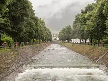
The Litz in Schruns
The Litz is a river of Vorarlberg, Austria.
In the course of time the Litz created the valley Silbertal in a slightly bellied river course. The Gaflunerbach (length: 6.5 km (4.0 mi)) comes from the valley Gaflunertal and discharges into the Litz from the right. The Litz passes Silbertal, traverses the area of Bartholomäberg and of Schruns, where it finally discharges into the Ill.[2]
References
- Google (8 February 2020). "Langsee" (Map). Google Maps. Google. Retrieved 8 February 2020.
- Google (8 February 2020). "Litz mouth" (Map). Google Maps. Google. Retrieved 8 February 2020.
This article is issued from Wikipedia. The text is licensed under Creative Commons - Attribution - Sharealike. Additional terms may apply for the media files.
