Livingstone County, New South Wales

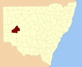
Livingstone County is one of the 141 Cadastral divisions of New South Wales. The Darling River is the western and north-western boundary, near Menindee.

Livingstone
New South Wales
Location in New South Wales
Lands administrative divisions around Livingstone:
Tandora Young Werunda
Menindee Livingstone Woore
Windeyer Perry Manara

Livingstone County was named in honour after the African missionary and explorer David Livingstone (1813-1873).[1]

Parishes within this county

A full list of parishes found within this county; their current LGA and mapping coordinates to the approximate centre of each location is as follows:

ParishLGACoordinates
AlbemarleCentral Darling Shire32°19′13″S 142°39′40″E
ArlingtonCentral Darling Shire32°27′30″S 143°45′32″E
AshbourneCentral Darling Shire32°19′46″S 143°23′35″E
BerangabahCentral Darling Shire32°29′45″S 143°31′58″E
BillitongCentral Darling Shire32°08′26″S 143°10′52″E
BindiCentral Darling Shire32°27′48″S 143°12′01″E
BlenalbenCentral Darling Shire32°22′43″S 143°49′06″E
BlenheimCentral Darling Shire32°21′22″S 142°31′28″E
BolivaCentral Darling Shire32°38′00″S 142°51′31″E
BoolaboolkaCentral Darling Shire32°36′04″S 143°12′44″E
BoomeryCentral Darling Shire32°16′03″S 143°13′47″E
BoondittiCentral Darling Shire32°21′29″S 142°56′52″E
BoonoonaCentral Darling Shire32°38′47″S 143°01′52″E
BoothingallaCentral Darling Shire32°11′41″S 143°02′23″E
BrainerdCentral Darling Shire31°59′37″S 143°10′19″E
BrunkerCentral Darling Shire31°56′48″S 143°04′41″E
BurndooCentral Darling Shire32°09′35″S 143°41′52″E
CliffordCentral Darling Shire31°52′13″S 143°10′58″E
ConnulpieCentral Darling Shire32°39′58″S 143°22′18″E
ConollyCentral Darling Shire32°36′22″S 142°36′31″E
CoveneyCentral Darling Shire32°04′06″S 143°19′15″E
CowaryCentral Darling Shireunknown
CulpaulinCentral Darling Shireunknown
DromoreCentral Darling Shire32°23′21″S 143°34′20″E
GeminiCentral Darling Shire32°24′40″S 142°40′21″E
GordonCentral Darling Shire32°25′40″S 142°50′09″E
HaribelCentral Darling Shire32°00′24″S 143°20′00″E
HucoCentral Darling Shire32°35′03″S 143°02′22″E
HudsonCentral Darling Shire32°17′53″S 143°44′48″E
LiddellCentral Darling Shire32°12′38″S 142°43′30″E
MakingahCentral Darling Shire32°32′52″S 142°37′02″E
MandyCentral Darling Shire32°41′50″S 142°45′01″E
MarlboroughCentral Darling Shire31°48′33″S 143°16′31″E
MarleCentral Darling Shire32°02′18″S 143°32′31″E
MindenCentral Darling Shire32°09′47″S 143°22′24″E
MourteCentral Darling Shire32°31′02″S 142°46′30″E
MundyCentral Darling Shire32°17′01″S 142°51′56″E
NewcomeCentral Darling Shire32°11′14″S 142°51′16″E
PysantCentral Darling Shire32°18′14″S 143°03′13″E
ReptonCentral Darling Shire32°01′13″S 143°01′40″E
SadlierCentral Darling Shire32°23′27″S 143°03′42″E
SteelCentral Darling Shire32°25′11″S 142°30′49″E
SurbitonCentral Darling Shire32°08′45″S 142°53′14″E
TalyawalkaCentral Darling Shire32°28′57″S 142°27′25″E
TeryawinyaCentral Darling Shire32°28′07″S 143°22′21″E
TintinalogyCentral Darling Shire32°09′12″S 143°02′11″E
ToorincacaCentral Darling Shire32°32′21″S 142°52′20″E
UndeathiCentral Darling Shire32°31′18″S 142°27′11″E
VictoriaCentral Darling Shire32°36′24″S 143°24′08″E
WambahCentral Darling Shire32°24′38″S 142°25′22″E
WanallaCentral Darling Shire32°15′34″S 143°33′20″E
WeatherlyCentral Darling Shire32°04′56″S 143°09′24″E
WidgeraCentral Darling Shire32°21′48″S 143°12′55″E
YendaCentral Darling Shireunknown

References

  1. "Livingstone County". Geographical Names Register (GNR) of NSW. Geographical Names Board of New South Wales.
This article is issued from Wikipedia. The text is licensed under Creative Commons - Attribution - Sharealike. Additional terms may apply for the media files.