Loch Garry
Loch Garry, (Scottish Gaelic: Loch Garraidh), is a freshwater Loch 25 km north of Fort William, Lochaber, Scotland.[2][1][3] Loch Garry is 11 km long and 50 m deep. It is fed by waters from Loch Quoich 10 km upstream on the River Garry, and drains into Loch Oich in the Great Glen just 5 km downstream. Loch Garry is much photographed from the A87 for its romantic setting and also because a quirk of perspective makes it appear like a map of Scotland.
| Loch Garry | |
|---|---|
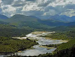 Looking west from the lookout on the A87 | |
 Loch Garry | |
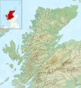
| Location | Scotland |
| Coordinates | 57°05′N 4°55′W |
| Primary inflows | River Garry |
| Basin countries | United Kingdom |
| Max. length | 4 km (2.5 mi) |
| Max. width | 0.25 km (0.16 mi) |
| Surface area | 686 ha (1,700 acres)[1] |
| Average depth | 11.25 ft (3.43 m)[2] |
| Max. depth | 50 ft (15 m)[2] |
| Water volume | 846,000,000 cu ft (24,000,000 m3)[2] |
| Shore length1 | 30.7 km (19.1 mi) [1] |
| Surface elevation | 83 m (272 ft) |
| Max. temperature | 57 °F (14 °C) |
| Min. temperature | 46 °F (8 °C) |
| Islands | 7 |
| 1 Shore length is not a well-defined measure. | |
Both lochs have been dammed for hydro-electric, the dam on Loch Quoich being the largest rockfill dam in Scotland at 320 m long and 38 m high. Water is fed by tunnel to the two power stations each producing 20MW, and the scheme was completed in 1962.
The Glen used to be home of the Clan MacDonell of Glengarry, but since the Highland Clearances the population has been reduced to a handful of estates. The main activities are deerstalking and forestry, with little tourism apart from munro-baggers seeking some spectacularly remote mountains at the head of the glen. The lonely road along the north side of Loch Garry continues past Loch Quoich to Kinlochhourn from where a footpath continues to Knoydart.
There is another Loch Garry in Glengarry County, Ontario, Canada. This loch is named by Clan MacDonell of Glengarry, after their previous home loch, Loch Garry in Scotland, after their emigration to the county from Scotland in result of the Highland Clearances
There are two Loch Garrys in Scotland, the data used above (length, depth, area etc) are all wrong, they are for the Perthshire Loch Garry. The maximum depth for this Loch Garry is approx 220 feet and the length is 8km, or 10km if the new flooded part of the loch is included, known as Inchlaggan, created by the hydroelectric dam.
See also
- List of reservoirs and dams in the United Kingdom
References
- "Loch Garry". British Lakes. Retrieved 13 September 2018.
- John, Murray; Lawrence, Pullar (1910). Bathymetrical Survey of the Fresh-Water Lochs of Scotland, 1897-1909 Lochs of the Tay Basin Volume II - Loch of Butterstone. National Library of Scotland: National Challenger Officer. p. 102. Retrieved 13 September 2018.
 This article incorporates text from this source, which is in the public domain.
 - Ordnance Survey: Landranger map sheet 34 Fort Augustus Glen Albyn & Glen Roy (Map). Ordnance Survey. 2012. ISBN 9780319231012.
