Londa, Tuscany
Londa is a municipality in the Metropolitan City of Florence in the central Italian region Tuscany.
Londa | |
|---|---|
| Comune di Londa | |
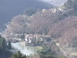 Panorama of Londa | |
 Coat of arms | |
Location of Londa 
| |
 Londa Location of Londa in Italy 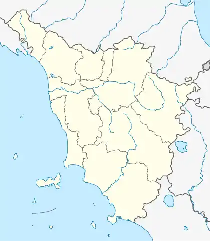 Londa Londa (Tuscany) | |
| Coordinates: 43°51′46″N 11°34′12″E | |
| Country | Italy |
| Region | Tuscany |
| Metropolitan city | Florence (FI) |
| Frazioni | Caiano, Fornace, Rincine, Rata, Vierle, Petroio, Bucigna, Sambucheta, San Leolino. |
| Government | |
| • Mayor | Aleandro Murras |
| Area | |
| • Total | 59.4 km2 (22.9 sq mi) |
| Elevation | 226 m (741 ft) |
| Population (31 August 2007)[2] | |
| • Total | 1,840 |
| • Density | 31/km2 (80/sq mi) |
| Demonym(s) | Londesi |
| Time zone | UTC+1 (CET) |
| • Summer (DST) | UTC+2 (CEST) |
| Postal code | 50060 |
| Dialing code | 055 |
| Patron saint | Immaculate Conception |
| Saint day | 8 December |
| Website | Official website |
Geography
The neighbouring communes are Dicomano, Pratovecchio, Rufina, San Godenzo and Stia.
The toponym is first recorded in a document of 1028 as Unda, meaning "wave" and alluding to the torrent on which it is situated. The wave appears in the communal coat of arms.
| Wikimedia Commons has media related to Londa. |

| Authority control |
|
|---|
- "Superficie di Comuni Province e Regioni italiane al 9 ottobre 2011". Istat. Retrieved 16 March 2019.
- "Popolazione Residente al 1° Gennaio 2018". Istat. Retrieved 16 March 2019.
This article is issued from Wikipedia. The text is licensed under Creative Commons - Attribution - Sharealike. Additional terms may apply for the media files.