London Outer Orbital Path
The London Outer Orbital Path — more usually the "London LOOP" — is a 150-mile (242 km) signed walk along public footpaths,[1] and through parks, woods and fields around the edge of Outer London, England, described as "the M25 for walkers". The walk begins at Erith on the south bank of the River Thames and passes clockwise through Crayford, Petts Wood, Coulsdon, Banstead, Ewell, Kingston upon Thames, Uxbridge, Elstree, Cockfosters, Chingford, Chigwell, Grange Hill and Upminster Bridge before ending at Purfleet, almost directly across the Thames from its starting point. Between these settlements the route passes through green buffers and some of the highest points in Greater London.
| London Outer Orbital Path | |
|---|---|
 The London LOOP's logo, a flying kestrel, can be seen on the signs marking the route | |
| Length | 150 mi (242 km)[1] |
| Location | London, England |
| Trailheads | Circular |
| Use | Hiking |
| Hiking details | |
| Season | All year |
History
The walk was first proposed at a meeting between The Ramblers and the Countryside Commission in 1990. It was given an official launch at the House of Lords in 1993. The first section was opened on 3 May 1996, with a ceremony on Farthing Downs, Coulsdon. Other sections followed at the rate of two or three per year as signs were installed and leaflets for individual sections published, the route becoming fully walkable in 2001. Following the election of Ken Livingstone as Mayor of London, the London Loop became one of his key routes, along with its sister route, the Capital Ring.
Route
The route is divided into 24 sections in three groups: the "blue" group in South London, the "green" group in north-west London, and the "yellow" group in north-east London. Each of the 24 sections links public transport nodes, though they vary greatly in length,[1] from 3.8 miles (6.1 km) section 14 to 10 miles (16 km) section 16. The guidebook by David Sharp adds together some of the shorter walks among the 24 to give 15 approximately equal stages, designed to be day walks. The table below shows the correspondence between the official sections and Sharp's sometimes longer walks.[2]
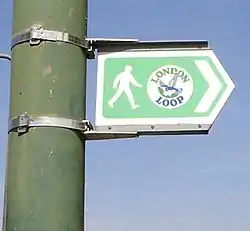
Signposts, waymarks and information boards direct the walker along the route. In countryside locations the waymarks consist mostly of a simple white disc mounted on a wooden post, with a directional arrow and flying kestrel logo in blue and text in green. However, local authorities are responsible for funding these signs, so the quality varies from one borough to the next, with some sections not signed at all. The 54-mile blue route from Erith to Kingston is maintained by the Downlands Countryside Management Project, a joint initiative by several councils, and is complete with signs and information boards, in addition to maps available from Tourist Information Centres.
There is no way to cross the river between Purfleet and Erith to complete the loop, although there was once a ferry to Erith which was mainly used by pilgrims on their way to Canterbury. In 2011 a proposal for a ferry to link the ends, and to link to riverbuses upstream at Woolwich, was shortlisted in the RIBA Forgotten Spaces competition.[3]
Further reading
References
- "London LOOP". Transport for London. Retrieved 14 August 2018.
- Sharp, David (2010). The London Loop, 3rd ed. Aurum Press. ISBN 978-1-84513-521-8.
- "Pilgrim Ferry". Forgotten Spaces shortlist 2011. RIBA. Archived from the original on 19 January 2012.
External links
| Wikimedia Commons has media related to London Outer Orbital Path. |