Long Draw Fire
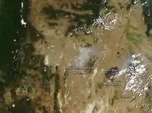
The Long Draw Fire was a wildfire started by a lightning strike on July 8, 2012 that burned 557,648 acres (2,257 km2) acres in southeastern Oregon, in the Western United States.[1][2] It was Oregon's largest wildfire since the 1865 Silverton Fire which burned over 1 million acres.[3]
| Long Draw Fire | |
|---|---|
 | |
| Location | Oregon |
| Coordinates | 42.5°N 117.67°W |
| Statistics[1] | |
| Date(s) | July 8, 2012 - July 17, 2012 |
| Burned area | 557,648 acres (2,257 km2) |
| Cause | Lightning |
| Map | |
 Location of fire in Oregon | |
Events
The Long Draw Fire was reported on July 8, 2012, at 6:04 PM. It was located north of McDermitt, Nevada. The source of the fire was a lightning strike.[1]
By July 13, the fire had spread to Owyhee Canyon.[4] The next day, July 14, firefighters reported that cattle had died in the fire. Highway 95 was reopened, too.[5] The fire was 100% contained by July 15.[1]
References
- "InciWeb the Incident Information System: Long Draw". InciWeb. Retrieved August 12, 2012.
- "Long Draw fire in Oregon's southeast corner biggest in nearly 150 years". The Oregonian. Retrieved July 15, 2012.
- "Large Fires & Fatalities". U.S. Department of the Interior. Retrieved July 15, 2012.
- "Long Draw Fire evening update, Friday, July 13, 2012". inciweb.nwcg.gov. Retrieved 5 September 2017.
- "Long Draw Fire Update July 14, 2012 9:00am P T". inciweb.nwcg.gov. Retrieved 5 September 2017.
This article is issued from Wikipedia. The text is licensed under Creative Commons - Attribution - Sharealike. Additional terms may apply for the media files.