Lowry City, Missouri
Lowry City is a city in St. Clair County, Missouri, United States. The population was 640 at the 2010 census. Lowry City is the city where the Ozark Mountains meet the Great Plains.
Lowry City, Missouri | |
|---|---|
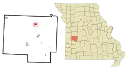 Location of Lowry City, Missouri | |
| Coordinates: 38°8′24″N 93°43′38″W | |
| Country | United States |
| State | Missouri |
| County | St. Clair |
| Area | |
| • Total | 1.04 sq mi (2.70 km2) |
| • Land | 1.03 sq mi (2.66 km2) |
| • Water | 0.02 sq mi (0.04 km2) |
| Elevation | 873 ft (266 m) |
| Population | |
| • Total | 640 |
| • Estimate (2019)[3] | 613 |
| • Density | 597.47/sq mi (230.74/km2) |
| Time zone | UTC-6 (Central (CST)) |
| • Summer (DST) | UTC-5 (CDT) |
| ZIP code | 64763 |
| FIPS code | 29-44282[4] |
| GNIS feature ID | 0756332[5] |
History
Lowry City was platted in 1871.[6] The community was named after one Mr. Lowry, the business associate of a first settler.[7] A post office called Lowry City has been in operation since 1871.[8]
Geography
Lowry City is located at 38°8′24″N 93°43′38″W (38.139980, -93.727205).[9]
According to the United States Census Bureau, the city has a total area of 1.04 square miles (2.69 km2), of which 1.02 square miles (2.64 km2) is land and 0.02 square miles (0.05 km2) is water.[10]
Demographics
| Historical population | |||
|---|---|---|---|
| Census | Pop. | %± | |
| 1880 | 58 | — | |
| 1890 | 368 | 534.5% | |
| 1900 | 467 | 26.9% | |
| 1910 | 462 | −1.1% | |
| 1920 | 509 | 10.2% | |
| 1930 | 549 | 7.9% | |
| 1940 | 488 | −11.1% | |
| 1950 | 493 | 1.0% | |
| 1960 | 437 | −11.4% | |
| 1970 | 520 | 19.0% | |
| 1980 | 676 | 30.0% | |
| 1990 | 723 | 7.0% | |
| 2000 | 728 | 0.7% | |
| 2010 | 640 | −12.1% | |
| 2019 (est.) | 613 | [3] | −4.2% |
| U.S. Decennial Census[11] | |||
2010 census
At the 2010 census,[2] there were 640 people, 262 households and 146 families living in the city. The population density was 627.5 inhabitants per square mile (242.3/km2). There were 326 housing units at an average density of 319.6 per square mile (123.4/km2). The racial makeup of the city was 97.7% White, 0.2% African American, 0.9% Native American, and 1.3% from two or more races. Hispanic or Latino of any race were 1.9% of the population.
There were 262 households, of which 24.4% had children under the age of 18 living with them, 38.2% were married couples living together, 11.1% had a female householder with no husband present, 6.5% had a male householder with no wife present, and 44.3% were non-families. 38.9% of all households were made up of individuals, and 19% had someone living alone who was 65 years of age or older. The average household size was 2.21 and the average family size was 2.92.
The median age in the city was 47.9 years. 21.1% of residents were under the age of 18; 5.7% were between the ages of 18 and 24; 20.1% were from 25 to 44; 23% were from 45 to 64; and 30.2% were 65 years of age or older. The gender makeup of the city was 48.8% male and 51.3% female.
2000 census
At the 2000 census,[4] there were 728 people, 301 households and 168 families living in the city. The population density was 712.6 per square mile (275.6/km2). There were 356 housing units at an average density of 348.5 per square mile (134.8/km2). The racial makeup of the city was 98.63% White, 0.14% African American, 0.41% Native American, 0.14% Asian, 0.14% from other races, and 0.55% from two or more races. Hispanic or Latino of any race were 2.34% of the population.
There were 301 households, of which 25.9% had children under the age of 18 living with them, 41.9% were married couples living together, 9.6% had a female householder with no husband present, and 43.9% were non-families. 38.5% of all households were made up of individuals, and 21.9% had someone living alone who was 65 years of age or older. The average household size was 2.20 and the average family size was 2.89.
22.1% of the population were under the age of 18, 6.5% from 18 to 24, 22.4% from 25 to 44, 19.5% from 45 to 64, and 29.5% who were 65 years of age or older. The median age was 44 years. For every 100 females there were 84.8 males. For every 100 females age 18 and over, there were 80.6 males.
The median household income was $19,438 and the median family income was $28,854. Males had a median income of $23,125 and females $17,135. The per capita income for the city was $10,968. About 15.5% of families and 22.1% of the population were below the poverty line, including 18.5% of those under age 18 and 24.7% of those age 65 or over.
Notable people
- Catherine Kidwell, novelist
- Delbert Lee Scott, politician, college president
- Teea Goans, country singer
References
- "2019 U.S. Gazetteer Files". United States Census Bureau. Retrieved July 26, 2020.
- "U.S. Census website". United States Census Bureau. Retrieved July 8, 2012.
- "Population and Housing Unit Estimates". United States Census Bureau. May 24, 2020. Retrieved May 27, 2020.
- "U.S. Census website". United States Census Bureau. Retrieved 2008-01-31.
- "US Board on Geographic Names". United States Geological Survey. 2007-10-25. Retrieved 2008-01-31.
- Eaton, David Wolfe (1918). How Missouri Counties, Towns and Streams Were Named. The State Historical Society of Missouri. p. 357.
- "St. Clair County Place Names, 1928–1945". The State Historical Society of Missouri. Archived from the original on June 24, 2016. Retrieved November 27, 2016.
- "Post Offices". Jim Forte Postal History. Retrieved 27 November 2016.
- "US Gazetteer files: 2010, 2000, and 1990". United States Census Bureau. 2011-02-12. Retrieved 2011-04-23.
- "US Gazetteer files 2010". United States Census Bureau. Archived from the original on 2012-07-02. Retrieved 2012-07-08.
- "Census of Population and Housing". Census.gov. Retrieved June 4, 2015.
External links
- Historic maps of Lowry City in the Sanborn Maps of Missouri Collection at the University of Missouri
Municipalities and communities of St. Clair County, Missouri, United States | ||
|---|---|---|
| Cities |  Map of Missouri highlighting Saint Clair County | |
| Villages | ||
| Townships | ||
| Unincorporated communities | ||
| Ghost towns | ||
| ||
| Authority control |
|---|