Lue Amnat District
Lue Amnat (Thai: ลืออำนาจ, pronounced [lɯ̄ː ʔām.nâːt]) is a district (amphoe) in the southern part of Amnat Charoen Province, northeastern Thailand.
Lue Amnat
ลืออำนาจ | |
|---|---|
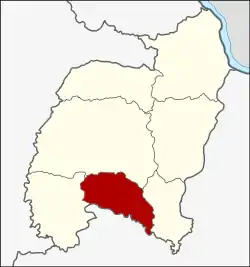 District location in Amnat Charoen Province | |
| Coordinates: 15°42′6″N 104°38′42″E | |
| Country | Thailand |
| Province | Amnat Charoen |
| Seat | Amnat |
| Area | |
| • Total | 191.8 km2 (74.1 sq mi) |
| Population (2005) | |
| • Total | 36,878 |
| • Density | 192.3/km2 (498/sq mi) |
| Time zone | UTC+7 (ICT) |
| Postal code | 37120 |
| Geocode | 3707 |
Geography
Neighboring districts are (from the west clockwise): Hua Taphan, Mueang Amnat Charoen, Phana of Amnat Charoen Province, and Muang Sam Sip of Ubon Ratchathani Province.
History
The minor district (king amphoe) was created on 1 April 1991, when six tambons were split off from Mueang Amnat Charoen District.[1] In 1993 it was one of the districts which formed the newly created Amnat Charoen Province. The minor district was upgraded to a full district on 5 December 1996.[2]
Administration
The district is divided into seven sub-districts (tambons), which are further subdivided into 79 villages (mubans). Amnat is a township (thesaban tambon) which covers parts of tambon Amnat. There are a further seven tambon administrative organizations (TAO).
| No. | Name | Thai name | Villages | Pop. | |
|---|---|---|---|---|---|
| 1. | Amnat | อำนาจ | 11 | 4,911 | |
| 2. | Dong Mayang | ดงมะยาง | 7 | 3,964 | |
| 3. | Pueai | เปือย | 13 | 7,396 | |
| 4. | Dong Bang | ดงบัง | 16 | 6,463 | |
| 5. | Rai Khi | ไร่ขี | 10 | 4,600 | |
| 6. | Maet | แมด | 11 | 4,461 | |
| 7. | Khok Klang | โคกกลาง | 11 | 5,083 |
References
- ประกาศกระทรวงมหาดไทย เรื่อง แบ่งเขตท้องที่อำเภออำนาจเจริญ จังหวัดอุบลราชธานี ตั้งเป็นกิ่งอำเภอลืออำนาจ (PDF). Royal Gazette (in Thai). 108 (15 ง): 1070. January 31, 1991.
- พระราชกฤษฎีกาตั้งอำเภอเหนือคลอง อำเภอนายายอาม อำเภอท่าตะเกียบ อำเภอขุนตาล อำเภอแม่ฟ้าหลวง อำเภอแม่ลาว อำเภอรัษฎา อำเภอพุทธมณฑล อำเภอวังน้ำเขียว อำเภอเจาะไอร้อง อำเภอชำนิ อำเภอโนนดินแดง อำเภอปางมะผ้า อำเภอสนธิ อำเภอหนองม่วง อำเภอเบญจลักษ์ อำเภอโพนนาแก้ว อำเภอบุ่งคล้า อำเภอดอนมดแดง และอำเภอลืออำนาจ พ.ศ. ๒๕๓๙ (PDF). Royal Gazette (in Thai). 113 (62 ก): 5–8. November 20, 1996.