Lund, Nevada
Lund is a small town and census-designated place in White Pine County, Nevada, United States. The population of Lund as of 2010 was 282.[1]
Lund, Nevada | |
|---|---|
Census-designated place | |
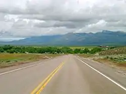 Lund from northbound Nevada State Route 318 | |
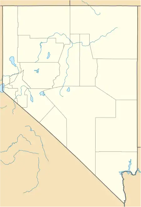 Lund Location within the state of Nevada and within the USA  Lund Lund (the United States) | |
| Coordinates: 38°51′22″N 115°0′22″W | |
| Country | United States |
| State | |
| County | White Pine |
| Area | |
| • Total | 1.7 sq mi (4.4 km2) |
| • Land | 1.7 sq mi (4.4 km2) |
| • Water | 0 sq mi (0 km2) |
| Elevation | 5,580 ft (1,700 m) |
| Population (2010) | |
| • Total | 282 |
| • Density | 170/sq mi (64/km2) |
| Time zone | UTC-8 (Pacific (PST)) |
| • Summer (DST) | UTC-7 (PDT) |
| ZIP codes | 89317 |
| Area code(s) | 775 |
| FIPS code | 32-43400 |
| GNIS feature ID | 0845548 |
Etymology
Lund was named for Anthon H. Lund.[2]
History
Lund was settled in 1898 on land that the United States government had given The Church of Jesus Christ of Latter-day Saints (Mormons) in lieu of land that had been confiscated under the Edmunds–Tucker Act. The first settlers were Mormons,[3] and the LDS Church still has a ward in Lund.
On June 24, 2020, the Brown Fire threatened Lund, resulting in residents on the south side to be evacuated from their homes. Residents were allowed to return that evening. The Brown Fire burned over 8,000 acres (3,237 ha).[4][5]
Transportation
Lund is served by Nevada State Route 318 which passes through the town.
Education
Lund has a high school, Lund High School, and is part of the White Pine County School District. The town also had a primary school, Lund Grade School, which was built in 1915 and operated for 90 years until 2005. The school was added the National Register of Historic Places in 2018 after being nominated by residents of Lund.[6]
Climate
| Climate data for Lund, Nevada (Elevation 5,580ft) | |||||||||||||
|---|---|---|---|---|---|---|---|---|---|---|---|---|---|
| Month | Jan | Feb | Mar | Apr | May | Jun | Jul | Aug | Sep | Oct | Nov | Dec | Year |
| Record high °F (°C) | 68 (20) |
75 (24) |
81 (27) |
83 (28) |
94 (34) |
99 (37) |
104 (40) |
101 (38) |
95 (35) |
90 (32) |
78 (26) |
69 (21) |
104 (40) |
| Average high °F (°C) | 43.0 (6.1) |
47.1 (8.4) |
53.9 (12.2) |
61.4 (16.3) |
71.1 (21.7) |
81.3 (27.4) |
88.9 (31.6) |
86.9 (30.5) |
79.3 (26.3) |
67.7 (19.8) |
53.2 (11.8) |
44.3 (6.8) |
64.8 (18.2) |
| Average low °F (°C) | 14.6 (−9.7) |
19.2 (−7.1) |
23.7 (−4.6) |
28.9 (−1.7) |
36.5 (2.5) |
43.7 (6.5) |
50.3 (10.2) |
48.7 (9.3) |
40.9 (4.9) |
31.7 (−0.2) |
21.9 (−5.6) |
15.0 (−9.4) |
31.2 (−0.4) |
| Record low °F (°C) | −20 (−29) |
−12 (−24) |
−2 (−19) |
−3 (−19) |
13 (−11) |
23 (−5) |
33 (1) |
32 (0) |
19 (−7) |
5 (−15) |
−11 (−24) |
−18 (−28) |
−20 (−29) |
| Average precipitation inches (mm) | 0.78 (20) |
0.85 (22) |
1.00 (25) |
0.98 (25) |
0.95 (24) |
0.82 (21) |
0.69 (18) |
0.87 (22) |
0.77 (20) |
0.92 (23) |
0.69 (18) |
0.73 (19) |
10.04 (255) |
| Average snowfall inches (cm) | 3.6 (9.1) |
4.2 (11) |
3.8 (9.7) |
2.2 (5.6) |
0.5 (1.3) |
0 (0) |
0 (0) |
0 (0) |
0 (0) |
0.1 (0.25) |
1.6 (4.1) |
3.9 (9.9) |
19.9 (51) |
| Source: The Western Regional Climate Center[7] | |||||||||||||
See also
References
- "Geographic Identifiers: 2010 Demographic Profile Data (G001): Lund CDP, Nevada". U.S. Census Bureau, American Factfinder. Archived from the original on February 12, 2020. Retrieved January 28, 2013.
- Jenson, Andrew. Encyclopedic History of the Church of Jesus Christ of Latter-day Saints. (Salt Lake City: Deseret News Press, 1941) p. 452
- Hall, Shawn (1994). Romancing Nevada's Past: Ghost Towns and Historic Sites of Eureka, Lander, and White Pine Counties. Reno NV: University of Nevada Press. p. 160. ISBN 9780874172287. Retrieved 30 September 2014.
- "Brown Fire Information - InciWeb the Incident Information System". InciWeb. Retrieved 27 June 2020.
- "Brown fire causes evacuation in Lund; Monarch fire still growing". North Las Vegas News. 8 News Now. Retrieved 27 June 2020.
- "Lund Grade School designated historic site". The Ely Times. December 22, 2018.
- "Seasonal Temperature and Precipitation Information". Western Regional Climate Center. Retrieved April 6, 2013.
External links
| Wikimedia Commons has media related to Lund, Nevada. |
Municipalities and communities of White Pine County, Nevada, United States | ||
|---|---|---|
| City | 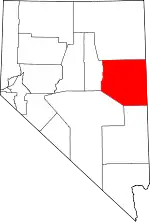 White Pine County map | |
| CDPs | ||
| Other unincorporated communities | ||
| Indian reservations | ||
| Ghost towns | ||
| Footnotes | ‡This populated place also has portions in an adjacent county or counties | |
| ||
| Authority control |
|
|---|