Mümling
The Mümling is a river of Hesse and Bavaria, Germany. It is 49.7 kilometres (30.9 mi) long and lends its name to the Mümlingtal (Mümling valley) in Odenwald. In Bavaria it is sometimes called Mömling in official documents. It is a left tributary of the Main.
| Mümling | |
|---|---|
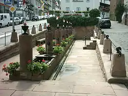 Mümling source, Beerfelden | |
| Location | |
| Country | Germany |
| States | Hesse and Bavaria |
| Reference no. | DE: 2474 |
| Physical characteristics | |
| Source | |
| • location | Zwölf-Röhrenbrunnen in Beerfelden, Odenwald |
| • coordinates | 49°34′06″N 8°58′31″E |
| • elevation | 400 m above sea level (NN) [1] |
| Mouth | |
• location | Obernburg |
• coordinates | 49°49′54″N 9°08′38″E |
• elevation | 117 m above sea level (NN) [1] |
| Length | 49.2 km (30.6 mi) [2] |
| Basin size | 377.35 km² [3] |
| Discharge | |
| • location | [4] (at the border to Bavaria) |
| • average | 3.7205 m³/s |
| • minimum | Average low: 1.3394 m³/s |
| Basin features | |
| Progression | Main→ Rhine→ North Sea |
 Mümling | |
Etymology
The Romans named this river Nemaninga, and after it the Numerus Brittonum et exploratorum Nemaningensium unit in Obernburg. In the 9th century, this river was first mentioned with the name Mimininga. The name Mümling probably belongs to the so-called "pra-european hydronyms" as a twin-form of Neman River.
Cities near Mümling
- Beerfelden
- Erbach
- Michelstadt
- Zell im Odenwald
- Bad König
- Mümling-Grumbach
- Höchst im Odenwald
- Breuberg
- Mömlingen
- Eisenbach (Unterfranken)
- Obernburg
References
- Topographische Karte 1:25.000
- Complete table of the Bavarian Waterbody Register by the Bavarian State Office for the Environment (xls, 10.3 MB)
- Hessisches Landesamt für Umwelt und Geologie: Retentionskataster Flußgebiet Mümling PDF-File (7.09 MB)
- Kartenservice zur Umsetzung der Wasserrahmenrichtlinie in Hessen
External links
| Wikimedia Commons has media related to Mümling. |
- Cycling trail "R1" Mümlingtal
- Water level at Michelstadt, water level at Hainstadt, HND Bayern
- Upper course and tributaries of the Mümling, Natura 2000 Hessen
This article is issued from Wikipedia. The text is licensed under Creative Commons - Attribution - Sharealike. Additional terms may apply for the media files.
