Mže
The Mže (Czech pronunciation: [mʒɛ]; German: Mies) is a 105 km long river in the Czech Republic. Its source is situated in the Griesbach Forest (726 metres), Germany, near the village of Asch, in the municipality of Mähring, Tirschenreuth district. It forms the state boundary for a short distance of 3 kilometers and then finally enters Czech territory. It passes through the towns of Tachov and Stříbro. At the confluence with the Radbuza, it forms the Berounka in Pilsen. Its major left affluent is Hamerský potok and the right affluent is Úhlava. There are two water dams on the Mže, Lučina and Hracholusky, both in the Tachov district. The basin area of the Mže is 1,828.6 km²,[1] of which 1,792 km² in the Czech Republic.[2]
| Mže Mies | |
|---|---|
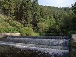 Mže near Pavlovice | |
| Location | |
| Countries | |
| Physical characteristics | |
| Source | Mies |
| • location | Griesbacher Wald, Germany |
| • coordinates | 49°51′10″N 12°28′00″E |
| • elevation | 726 m (2,382 ft) |
| Mouth | Berounka River |
• location | Plzeň City |
• coordinates | 49°45′12″N 13°23′24″E |
| Length | 105.2 km (65.4 mi)[1] |
| Basin size | 1,829 km2 (706 sq mi)[1] |
| Discharge | |
| • average | 8.5 m3/s (300 cu ft/s) |
| Basin features | |
| Progression | Berounka→ Vltava→ Elbe→ North Sea |
References
- Complete table of the Bavarian Waterbody Register by the Bavarian State Office for the Environment (xls, 10.3 MB)
- "Charakteristiky toků a povodí ČR - Mže" (in Czech). VÚV TGM. Retrieved 2018-05-08.
This article is issued from Wikipedia. The text is licensed under Creative Commons - Attribution - Sharealike. Additional terms may apply for the media files.
